Overview
Binn idir an Daingin (Irish for peak between the two hollows) stands at 702 m (2 303 ft), making it the highest point in the Maumturk Mountains and the third‑highest summit in County Galway. Its rugged, quartzite‑studded ridge dominates the central spine of Connemara National Park, offering panoramic outlooks over the Maam and Inagh valleys, the glacial corrie lake Lough Maumahoge, and distant Atlantic‑kissed hills. The mountain’s prominence of 629 m qualifies it as a P600 and a Marilyn, underscoring its dominance in the Irish landscape.
History & Naming
The name derives from the two glacial corries that flank the summit ridge – a north‑western corrie that houses a lake and a larger south‑eastern hollow. Early maps recorded an anglicised form, Benadolug, but the Irish name has endured in placename databases. The surrounding townland of Barrslievenaroy is sometimes mistakenly applied to the peak itself. Historically the ridge has formed part of the Western Way, an ancient pilgrim route that includes a stone altar set into the rock face at the sacred pass of Maumahoge.
What to See & Do
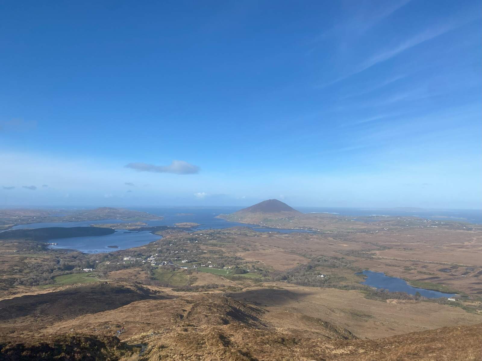
Summit Experience
Reaching the cairned summit rewards walkers with unobstructed 360° views: the jagged silhouettes of Binn Chaonaigh to the south, the shimmering surface of Lough Maumahoge to the north‑west, and the rolling Connemara coastline on clear days. Photographers prize the contrast of dark quartzite outcrops against the green valleys below.
Hill‑walking Routes
| Route | Distance | Elevation Gain | Approx. Time | Difficulty |
|---|---|---|---|---|
| Maumahoge Pass (direct) | 6 km | 600 m | 3 h | Hard walk |
| Maumeen Loop (classic) | 13 km | 1 000 m | 5–6 h | Hard walk |
| Maamturks Challenge (full) | 25 km | 7 600 ft (≈ 2 300 m) | 10–12 h | Extreme grade |
| The direct 6 km route follows the well‑marked Western Way to the pass of Maumahoge before a steep ascent to the summit. The 13 km loop starts at the Maumeen road parking, climbs Binn Chaonaig (633 m), traverses the ridge to Binn Idir an Daingin, then descends via Lough Maumahoge. This loop is popular for day‑trippers seeking a full ridge experience without committing to the full challenge. |
Rock Climbing
While the Maumturks are not a primary climbing destination, a crag just west of Lough Maumahoge offers 90–190 m routes graded S to HVS. These routes cling to the same quartzite faces that define the summit ridge, providing an exposed yet rewarding climb for experienced alpinists.
Cultural Highlights
The ancient altar at Maumahoge pass hints at the mountain’s spiritual past, and the cairn on the summit marks centuries of pilgrim and mountaineer passage. The area is also a key checkpoint for the University College Galway Mountaineering Club’s Maamturks Challenge Walk, with the summit representing 54 % of the total ascent.
Getting There
The most common approach is from the Maumeen road, which branches off the N59 near Maam Cross (also known as An Mám). A small, free car park sits at the start of the Western Way; from there walkers follow sign‑posted tracks to the oratory before ascending the ridge.
Public transport: Bus services run from Galway city to Maam, but schedules vary seasonally. [Needs human verification] – confirm the latest bus routes and stops.
Safety & Seasonal Tips
Weather in Connemara can change rapidly; even in summer, mist, rain and strong winds are common at summit level. Carry a waterproof jacket, map, compass and a fully‑charged GPS device. The final descent involves loose quartzite scree and steep grass slopes – take care on the western side, which can become slippery after rain. Early morning walks often offer clearer views, while late afternoon may bring cloud cover over the valleys.
Nearby Attractions
- Benbaun – the highest peak of the Twelve Bens, about 15 km south‑west, offers another classic Connemara mountain experience.
- Benbrack – a striking quartzite summit within Connemara National Park, reachable via the popular Benbaun‑Benbrack ridge walk.
Practical Information
Binn idir an Daingin lies within Connemara National Park, but the mountain itself has no formal opening hours or admission fee – access is free. The route is well‑marked on OSi50 sheet 037, and GPS coordinates for the summit are 53.4972 N, ‑9.6866 W.
Climbers should consult the University College Galway Mountaineering Club for current route conditions and any seasonal restrictions on the crag near Lough Maumahoge. The club’s website provides a downloadable route card for the Maamturks Challenge.
For detailed topographic maps and additional route descriptions, see the MountainViews entry for Binn Idir an Daingin and the Wikiloc ridge‑walk guide.
Further Reading
- MountainViews summit page: https://mountainviews.ie/summit/108/
- Wikiloc ridge‑walk guide (search “Binn idir an Daingin ridge walk”)
Binn idir an Daingin offers a blend of rugged mountain adventure, historic intrigue and some of the most striking scenery in western Ireland. Whether you’re tackling the full Maamturks Challenge or a shorter loop, the peak promises an unforgettable Connemara experience.