Overview
The Burren Way is a long‑distance, way‑marked walking trail that cuts across the heart of County Clare’s famous karst landscape – the Burren. Covering 118.8 km (about 74 mi) and typically completed in five days, the route begins on the Atlantic‑facing beach at Lahinch and finishes in the inland village of Corofin. The trail is a mixture of quiet tarmac roads, ancient cattle‑droving tracks, forest paths and a few short, steep climbs, with an overall ascent of 540 m. Roughly 85 % of the way follows local roads, making it accessible for walkers of moderate fitness while still offering plenty of off‑road, limestone‑field experiences.
| Trail attribute | Detail |
|---|---|
| Length | 118.8 km |
| Typical time | 5 days |
| Grade | Moderate |
| Waymarking | Yellow arrow on black background |
| Dogs | Not allowed (farmland and livestock protection) |
| Best season | Late spring to early autumn (peak visitor numbers at the Cliffs of Moher) |
History & Background
Designated as a National Waymarked Trail by the Irish Sports Council, the Burren Way is managed by the Burren Way Committee. The trail follows historic routes that have linked coastal settlements for centuries – from the early droving roads used by cattle herders to the ancient stone forts that dot the limestone plateau. Early maps show the trail originally climbing above the Cliffs of Moher from Hag’s Head, but many modern walkers now start at Ballyvaughan to avoid the heavily trafficked southern sections. A 2010 review highlighted the trail’s strong potential to become a National Long Distance Trail, recommending a reduction in road‑walking sections to improve the walking experience.
What to See & Do
Coastal Highlights
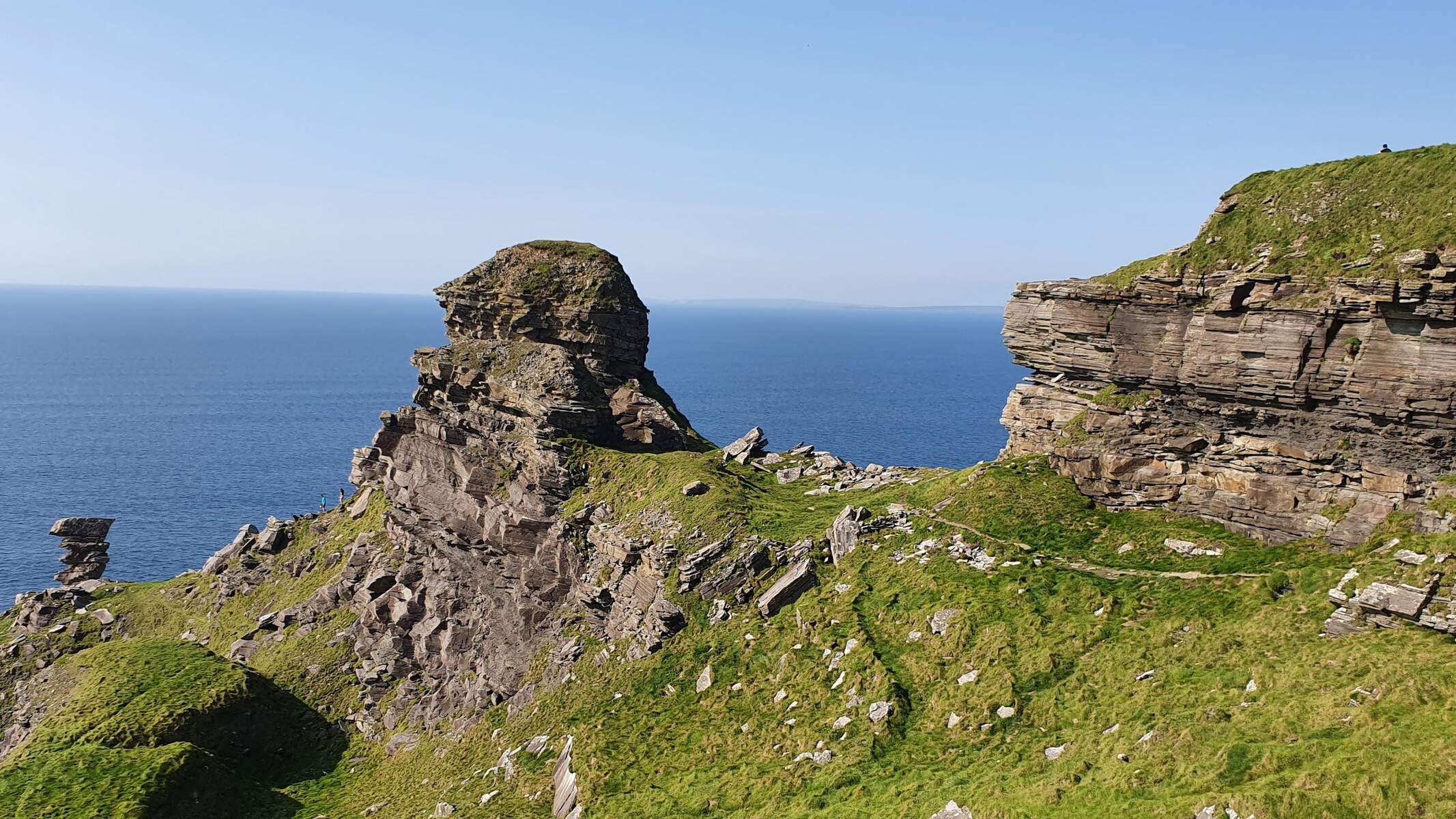
- Cliffs of Moher – The world‑renowned sea cliffs rise more than 200 m above the Atlantic. A short, 1.5 km discovery path offers spectacular viewpoints and a visitor centre (note that a 5 km section from Hag’s Head to just south of the centre is temporarily closed for safety works until further notice).
- Lahinch Beach – A blue‑flag surf beach with surf schools and a lively promenade.
- Doolin – A traditional music hub where you can enjoy live sessions in pubs such as O’Connor’s Bar.
Inland Landscapes
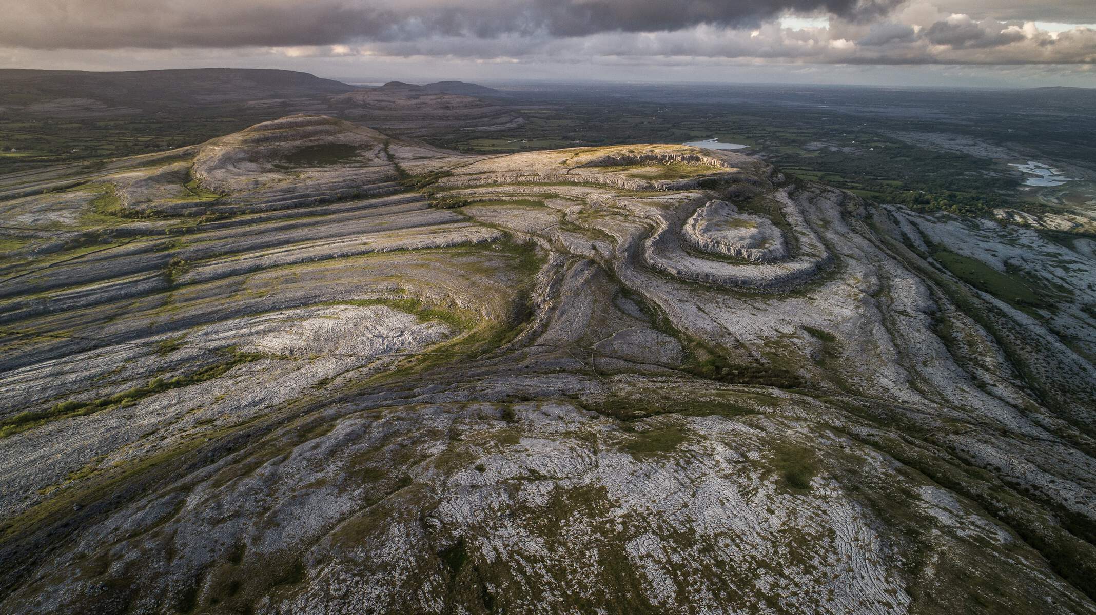
- Slieve Elva – The highest hill in the Burren (344 m) provides panoramic views over Galway Bay and the Aran Islands.
- Caher Valley – A deep limestone valley flanked by ancient stone walls and wild‑flower‑rich terraces.
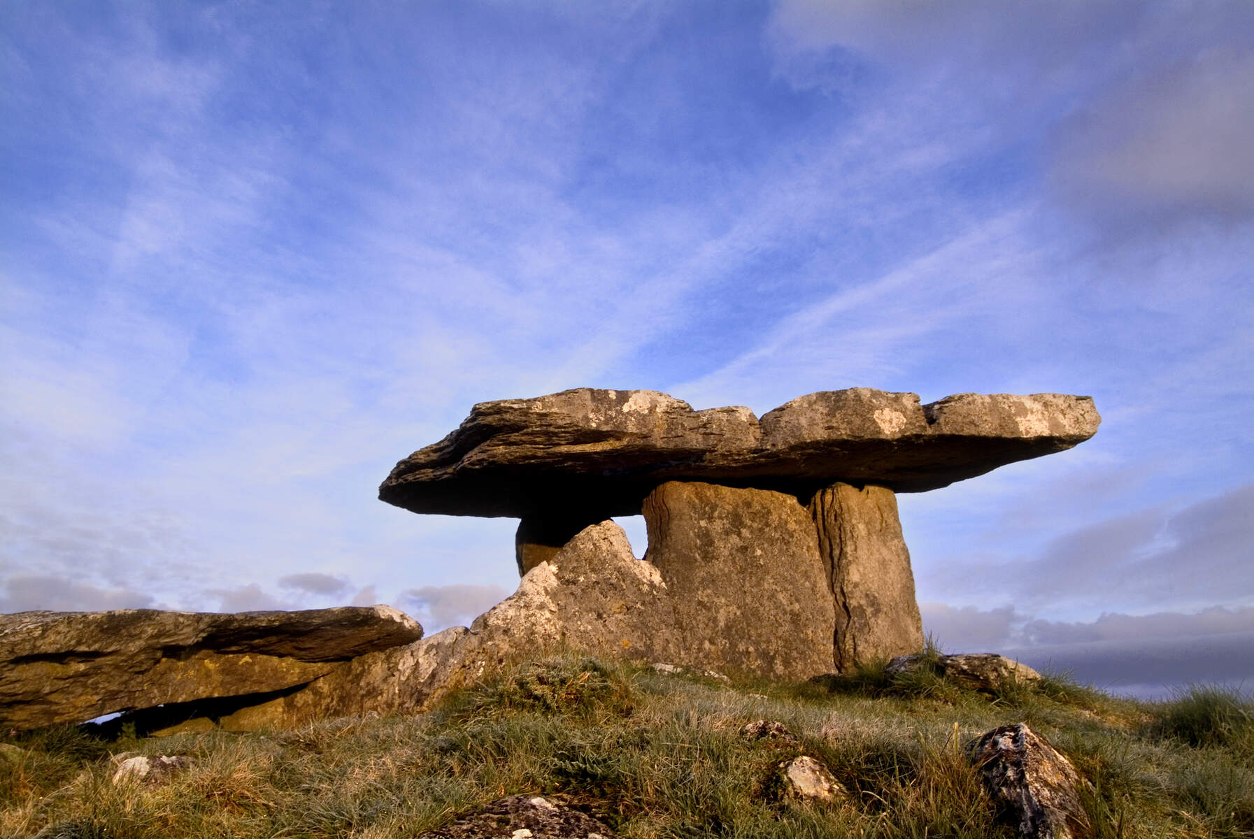
- Poulnabrone Dolmen – A classic portal tomb dating to the Neolithic period, located near Carran.
- Ballinalacken Castle and Newtown Castle – Ruined stone forts that illustrate the region’s medieval heritage.
- Cahercommaun Ring Fort and Parknabinnia Wedge Tomb – Further archaeological gems on the final stretch to Corofin.
Wildlife & Flora
The Burren’s unique karst soil supports an extraordinary mix of Arctic, Mediterranean and Alpine plant species, with over 70 % of Ireland’s native flora found here. Keep an eye out for Peregrine Falcons, Choughs, Irish hares and the occasional pine marten.
Practical Information
Access & Transport
- Start point: Lahinch (limited bus service to Fanore, Doolin and Lisdoonvarna – check Bus Éireann for schedules). A limited winter bus runs from Lahinch to Galway.
- Finish point: Corofin (bus connections to Galway and Ennis). The trail is linear; most walkers arrange transport back to the start via public bus or private hire.
- Parking: Free roadside parking is available in most villages (Lahinch, Doolin, Ballyvaughan, Carran). Some villages have designated car parks near the trailhead.
Trail Management & Safety
- The trail is way‑marked with distinctive black‑and‑yellow posts. In sections where way‑marks are missing, the official route notes (available from the Burren Way Committee) provide detailed navigation.
- Temporary closures: From 22 August 2024, a 5 km stretch from Hag’s Head to 1 km south of the Cliffs of Moher Visitor Centre, and a 500 m section 1 km north of the centre, are closed to the public for safety works. Alternative routes and a Cliffs of Moher Discovery Day (including a short transfer to the visitor centre and a cruise from Doolin) are offered by local operators.
- Dog policy: Dogs are not allowed on the trail, primarily to protect livestock and farmland.
- Accommodation: A wide range of options exists – from hotels and guesthouses in Lahinch, Doolin and Ballyvaughan, to B&Bs, hostels, campsites and Airbnb properties. Most villages have at least two nightly options, and bookings are recommended in the summer months.
- Supplies: Shops and grocery stores are located in the larger villages (Lahinch, Doolin, Lisdoonvarna, Ballyvaughan). It is advisable to carry water and snacks between settlements, especially on the longer inland stages.
- Maps & Guides: Detailed PDF maps are available from Sport Ireland (Map 1 – 10) and the Burren Way Brochure (https://www.burrengeopark.ie/wp-content/uploads/2013/09/Burren-Way.pdf). Ordnance Survey Discovery Series sheets 51, 52 and 57 also cover the area.
- Mountain‑bike option: Guided mountain‑bike tours operate on parallel tracks, offering novice to intermediate routes such as the “Lord of the Rings” tour and the popular “Over the Hills” ride.
Sample Itinerary (Moderate, 5 days)
- Day 1 – Lahinch → Doolin (coastal walk, Cliffs of Moher views). Approx. 18 km.
- Day 2 – Doolin → Fanore (inland plateau, Slieve Elva summit). Approx. 18 km.
- Day 3 – Fanore → Ballyvaughan (Black Head Loop, stone forts). Approx. 21 km.
- Day 4 – Ballyvaughan → Carran (Poulnabrone Dolmen, stone‑walled fields). Approx. 23 km.
- Day 5 – Carran → Corofin (Cahercommaun Ring Fort, lake scenery). Approx. 18 km.
Each day ends in a village with ample lodging, dining and the chance to enjoy traditional Irish music, especially in Doolin and Ballyvaughan.
Essential Contacts
- Trail manager: Eoin Hogan, Rural Recreation Officer, Clare Local Development Company, 1 Westgate Business Park, Kilrush Road, Ennis, Co Clare – Tel: 065‑6866800 – Email: ehogan@cldc.ie.
- Official trail page: https://www.sportireland.ie/outdoors/walking/trails/burren-way
The Burren Way offers a rare blend of dramatic coastal scenery, ancient stone monuments and the quiet, otherworldly beauty of Ireland’s largest karst landscape. Whether you’re a seasoned walker, a history enthusiast, or simply seeking a peaceful escape into nature, the trail provides a memorable Irish adventure.