Overview
Béal Átha an Ghaorthaidh translates to “the mouth of the ford of the wooded valley through which flows a river”. The name refers to the River Lee, which rises just a few kilometres to the west at Gougane Barra before threading its way toward Cork city. Situated 19 km west of Macroom on the R584, the village is the cultural and linguistic centre of the Muskerry Gaeltacht. According to the 2022 census, 89% of residents aged three and over speak Irish, making it one of the most active Irish-speaking communities in the country. Daily life here operates naturally in Gaeilge, from street signage and shop windows to casual conversation in the local pubs.
Language & Cultural Life
The village’s commitment to the Irish language is anchored by Coláiste na Mumhan, founded in 1904 as Ireland’s first Irish-language college. The institution attracted early 20th-century figures such as Thomas MacDonagh, Terence McSweeney, and writer Frank O’Connor. Today, the college runs intensive summer immersion courses that draw students from across Europe. While applications for 2026 are closed, the college’s presence sustains a year-round cultural rhythm. Visitors can explore the campus grounds, attend local workshops, or experience the annual agricultural and horticultural show, which celebrates regional produce, crafts, and livestock.
Literary history runs deep in the area. Writer Eric Cross based his celebrated novel The Tailor and Ansty on characters who lived between Ballingeary and Gougane Barra. Local poet Máire Bhuí Uí Laoghaire also immortalised the valley in verse, most notably in Cath Céim an Fhia, a narrative poem recounting the 1822 Battle of Keimaneigh.
History & Heritage Walks
The village centre is built around Ireland’s longest clapper bridge. Restored in recent years, the structure is made from massive, interlocking stone slabs and remains in active use by locals and visitors. Directly beside it stands a historic Famine Pot, preserved by the Ballingeary Cumann Staire (Historical Society), which was used to feed parishioners during the Great Hunger.
For a structured look at the area’s past, the self-guided Village Historical Walk follows 21 informational plaques detailing everything from early monastic connections to the bridge’s engineering. The shorter Stepping-Stones Walk is a gentle 1 km loop that crosses the clapper bridge and offers clear views across the valley. Beyond the village, the surrounding landscape holds a dense concentration of ancient monuments, including megalithic tombs, stone forts, a 1,500-year-old crannóg (lake dwelling), and the tallest standing stone (gallaun) in Ireland – known locally as Gallán a’ Mhacaire (Gallaunamaghera), it rises prominently from the pastureland. Just outside the village toward Kealkil lies the Pass of Keimaneigh (Céim an Fhia), a deep glacial valley with a monument commemorating the 1822 skirmish between local Whiteboys and Crown forces described in Máire Bhuí Uí Laoghaire’s poem Cath Céim an Fhia. The nearby Kealkil Stone Circle – a five-stone alignment with two large standing stones and a radial cairn – overlooks Bantry Bay.
Outdoor Trails & Cycling
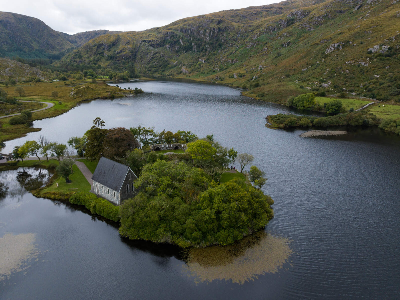
Ballingeary serves as a practical launchpoint for hillwalking and cycling in West Cork. The local tourism network lists seven marked walking routes on Bealach Trails, ranging from easy village loops to more demanding mountain paths. Just outside the village, Gougane Barra Forest Park offers 10 km of hill walks and 5 km of motor trails through dense woodland and open mountain terrain. At its heart, St Finbarr’s Oratory sits on a small island in the lake, accessible via a footbridge; Saint Finbarr is said to have founded a monastery here in the 6th century. The chapel retains a striking pink interior and stained-glass windows, and is surrounded by nine ancient stone prayer recesses and a large wooden cross. Birdlife in the forest park includes crossbills and goldcrest, and the understorey has ancient yew and juniper.
Cyclists can follow a marked route along the Lee Valley from Cork city to Gougane Barra, passing through Ballingeary on a relatively quiet road. The route provides steady elevation changes, river views, and easy access to forest park trails, making it suitable for both casual riders and experienced cyclists.
Water Activities & Fishing
The River Lee and nearby Lough Allua (Locha Lua) drive much of the area’s outdoor recreation. Anglers target brown trout in the upper reaches of the Lee, while pike and coarse fishing are popular on the six-mile stretch of Lough Allua between Ballingeary and Inchigeela. A valid fishing licence is required for the River Lee and can be purchased locally.
For those preferring to stay on the water, the Outdoor Discovery Adventure Company operates out of Lough Allua, offering boat hire, kayaking, and guided fishing trips. Equipment is available for beginners and experienced paddlers alike, and advance booking is recommended during the summer months.
Practical Information
- Getting there: 19 km west of Macroom on the R584. A daily bus service connects to Cork City; check current timetables locally.
- Parking: Free on-street and car park spaces are available near the village centre and clapper bridge. Gougane Barra Forest Park charges a €5 parking fee (coins are recommended).
- Walks & trails: Self-guided historical and stepping-stone routes start in the village centre. Detailed maps for all seven local trails are available at bealathatrails.ie.
- Water sports: Boat hire and kayaking are arranged through the Outdoor Discovery Adventure Company. Fishing licences for the River Lee are sold at local tackle shops.
- Food & drink: Shortens Bar and Ard Na Laoi provide casual refreshments and local conversation. Cronins Bar & Café near Gougane Barra is popular for homemade cakes and coffee. Self-catering apartments, such as The Loft on Radharc na Laoi, offer mountain views and easy trail access; the seasonal Gougane Barra Hotel overlooks the lake and provides bikes, fishing gear, and rowing boats for hire.
- Nearby visits: Baile Bhuirne lies a short drive away, offering additional Gaeltacht walking routes and St Gobnait’s Well. The Shehy Mountains provide further hillwalking and mountain-biking terrain.
Check trail conditions and weather forecasts before heading into the forest park or upper valley routes, and carry a physical map or downloaded GPS tracks as mobile signal can drop in the deeper gorges.