Overview
Carrigan is a modest townland of 104 statute acres in the parish of Tomregan, Barony of Loughtee Lower, County Cavan. Its name comes from the Irish cairrig‑ín – “a little rock or rocky surface” – an apt description for the drumlin hill that rises above the surrounding lowlands. The landscape is dotted with the tranquil waters of Lough Rud, the meandering Rag River and a patchwork of fields that have been cultivated for wheat, oats, barley and potatoes since the early‑19th century. Though only a handful of houses lie within the townland, Carrigan sits at the gateway to a cluster of attractions that showcase the best of Ulster’s natural beauty and ancient heritage.
History
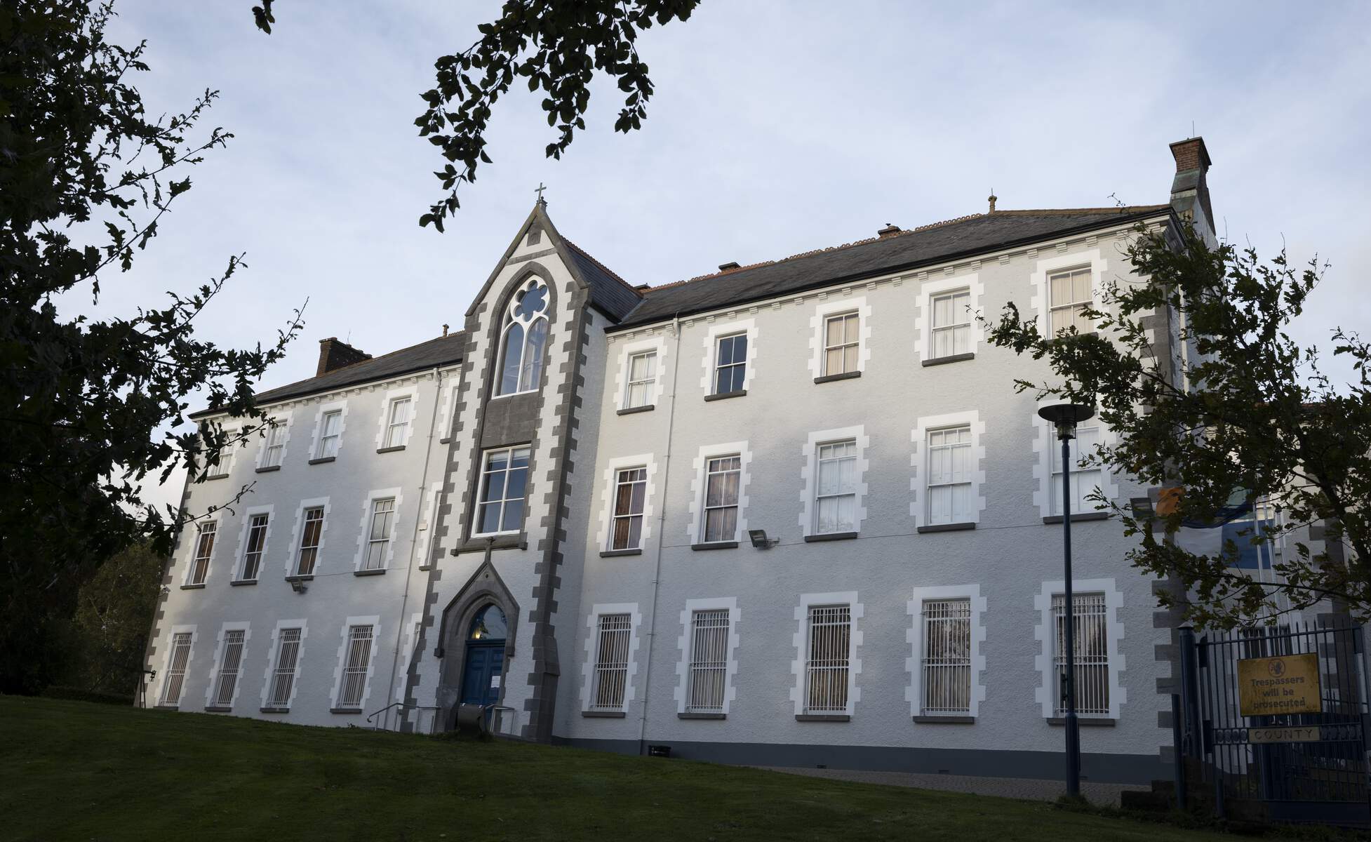
The lands that make up Carrigan were originally termon lands belonging to the Roman Catholic Church of Tomregan. After the 1610 Plantation of Ulster the Protestant Bishop of Kilmore received the area, and a series of leases passed the property to notable families such as the Lambarts, the Moores of Mellifont and later the Jones family, who held the lease into the 19th century. 19th‑century records describe the townland’s houses as stone‑built and its tenants as modest farmers. Census returns show a small, fluctuating population – never more than a dozen families – reflecting the rural, agrarian character that still defines Carrigan today.
Genealogy
Carrigan features in several 19th‑century genealogical records. Notably, the O’Rourke family, whose ancestors are traced back to Carrigan in the early 1800s, appear in parish registers and census returns. Researchers can find references to Carrigan in the 1901 and 1911 Irish censuses, as well as in land valuation records, making the townland a point of interest for those tracing roots in the Tomregan area.
What to See & Do
Cuilcagh Boardwalk Trail (Stairway to Heaven)
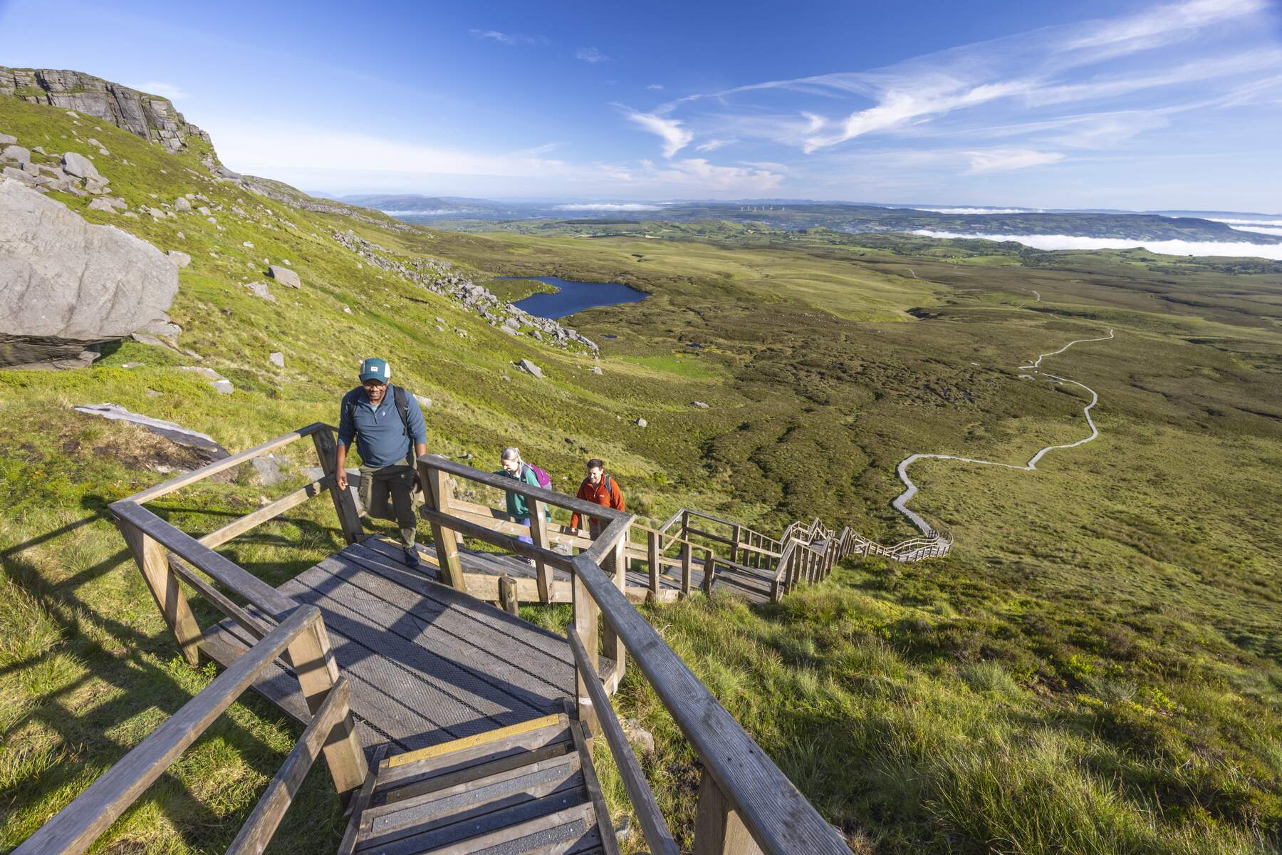
A short drive north of Carrigan, the Cuilcagh Boardwalk – affectionately called the Stairway to Heaven – offers an 11 km round‑trip hike across blanket bogs and up 450 wooden steps to a viewing platform on the summit of Cuilcagh Mountain. The boardwalk protects the delicate peat while providing a relatively dry surface, making the trek accessible to a wide range of walkers. From the summit you can glimpse counties Cavan, Leitrim and Donegal on a clear day.
Cuilcagh Mountain Summit
For those who prefer a more direct ascent, the Cuilcagh Mountain Summit is a challenging climb with continuous ups and downs. The reward is a panoramic vista over the lowlands, the surrounding drumlins and the distant Sperrin Mountains.
Florence Court Estate
A short drive east lies Florence Court, an 18th‑century National Trust house set in lush parkland at the foothills of Cuilcagh. The estate boasts over 10 miles of walking and cycling trails, a water‑powered sawmill, a blacksmith’s forge and spectacular views of Benaughlin Mountain. The house is open daily; opening times and ticket prices are available on the National Trust website.
Florence Court – National Trust
Giant’s Grave & Giant’s Cave
Within the nearby Burren Forest Park, the Giant’s Grave & Giant’s Cave are Bronze‑Age megalithic tombs steeped in local legend. According to folklore, two giants vied for a lady’s affection and leapt across a chasm, leaving the burial mound as a reminder of their daring.
Carrigan Forest Loop Walk
For a forest‑based experience, the Carrigan Forest Loop Walk traverses Carrigan Forest Park, part of the Marble Arch Caves Global Geopark. The moderate 11 km loop takes roughly 3.5 hours and climbs to the summit of Mormal More (307 m), offering sweeping countryside views. The route passes the serene Lough Formal and winds through well‑maintained forest paths.
Other Natural Highlights
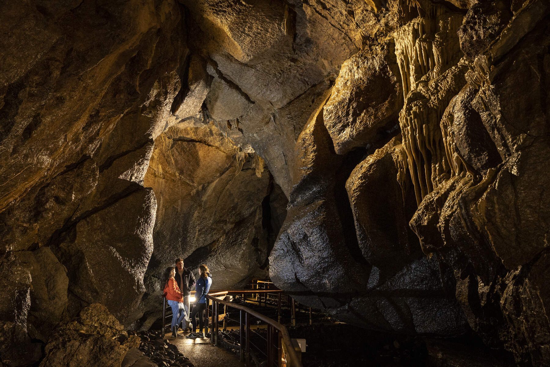
- Pollnagollum Cave and Waterfall – a dramatic limestone cavern with a cascading waterfall.
- Roogagh Waterfall – a picturesque cascade with picnic benches, ideal for a family stop.
- Cliffs of Magho – dramatic limestone cliffs overlooking Lough Erne.
Nearby Natural Attractions
Shannon Pot (Source of the River Shannon)
A short 10‑km drive east of Carrigan lies the Shannon Pot, the legendary source of Ireland’s longest river. The spring is set in a limestone karst landscape and is a popular stop for walkers on the Cavan Way. A modest viewing platform and interpretive panel explain the geology and folklore surrounding the pot.
Wildlife & Nature
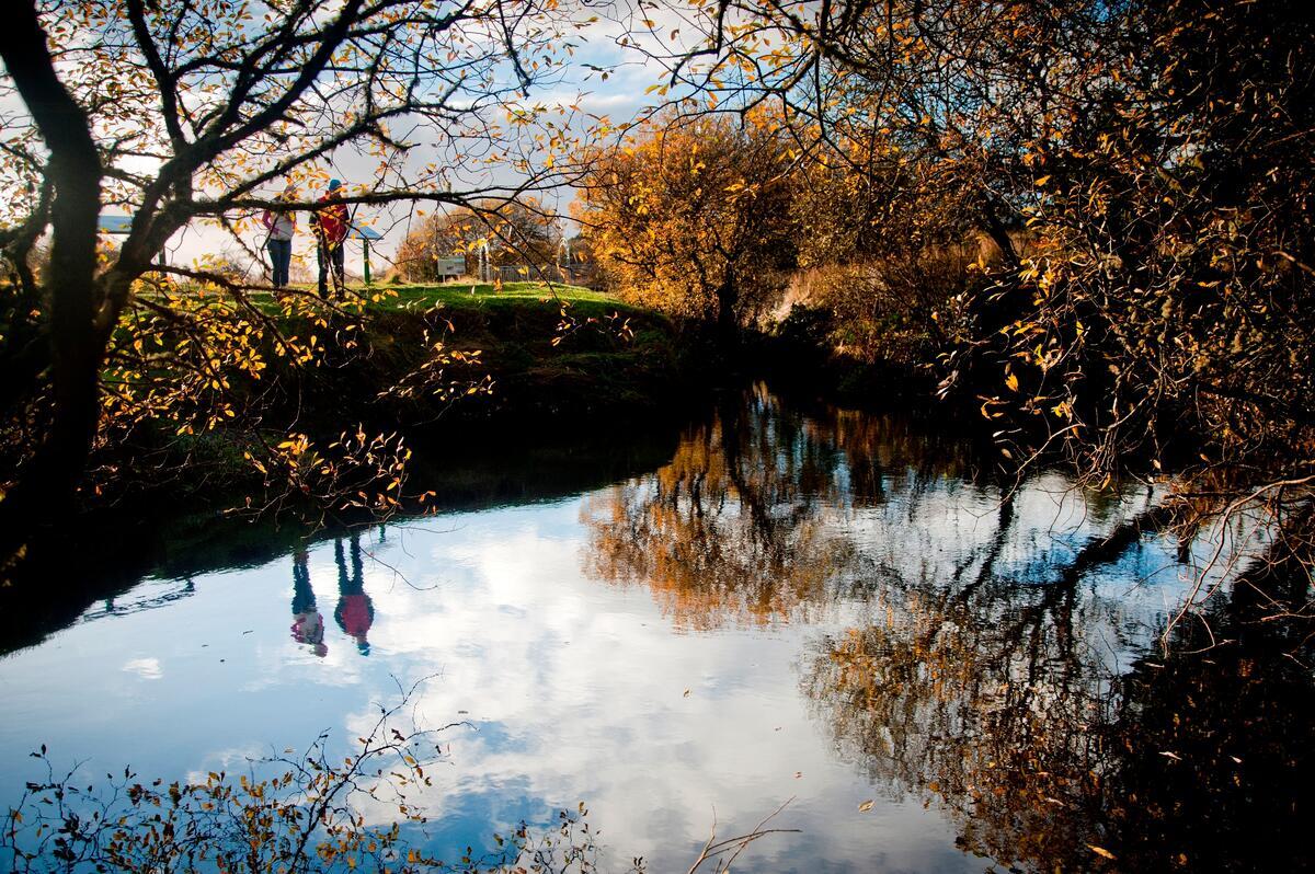
The drumlin landscape around Carrigan supports a mix of farmland birds such as skylarks and meadow pipits, while the boggy plateau of Cuilcagh is a haven for heather, bog cotton and occasional sightings of the rare Irish hare. Anglers can try their luck on the Rag River, which holds brown trout throughout the year.
Nearby Attractions
- Cavan Burren Park – a geopark with a dolmen trail and wedge tombs (Cavan Burren Park).
- Annagh Lake – popular for swimming, angling and exploring a crannóg (Annagh Lake).
- Ballyconnell Bridge and Canal Walk – historic route along the Shannon–Erne Waterway (Ballyconnell Bridge).
- Cavan Town – offers museums, shops and dining options (Cavan Town).
Practical Information
| Facility | Details |
|---|---|
| Cuilcagh Mountain Park Car Park | Limited spaces (approximately 3 car spaces, plus a few larger‑vehicle bays). Cash fee of 5 GBP / 6 EUR payable to the on‑site steward. |
| Carrigan Forest Loop Parking | Free parking at designated forest entry points; spaces for cars and motorbikes. |
| Public transport | No regular bus service to Carrigan; a private car or hire vehicle is recommended. |
| Nearest towns | Cavan (≈ 20 km) and Enniskillen (≈ 30 km). |
| Amenities | Café and basic supplies in Ballyconnell; wider range of restaurants and accommodation in Cavan town. |
Getting there – Carrigan is accessed via the Slievebrickan lane, which joins the regional road network around Ballyconnell (about 2 mi south of the townland). The nearest major towns are Cavan and Enniskillen. Because public transport is limited, a private car or hire vehicle provides the most flexibility.
Trail conditions – The boardwalk is maintained year‑round, but the surrounding bog can be wet after rain. The forest loop is well‑marked, though sections become steep near Mormal More. Check the ActiveME or Komoot apps for up‑to‑date GPS tracks.
Accessibility – The boardwalk offers a stable surface suitable for walkers with limited mobility, though the final ascent to the summit involves many steps and may be challenging. The forest loop comprises uneven forest paths and is best suited to able‑bodied walkers.
Safety – Mobile reception can be patchy on the plateau. Carry a fully charged phone, a paper map, and let someone know your intended route. In winter, snow and ice may make the boardwalk slippery; sturdy footwear is advisable.
Seasonality – Spring and summer provide the most reliable footing and vibrant flora. Autumn brings striking foliage, especially around Florence Court and the forest trails. Winter can be harsh on the bog, with occasional closures for safety.
Further Resources
- Komoot Guides – detailed route maps for hiking, mountain biking, road cycling and running around Carrigan.
- ActiveME – GPS‑enabled walking guide for the Carrigan Forest Loop Walk.
- National Trust – visitor information for Florence Court.