Overview
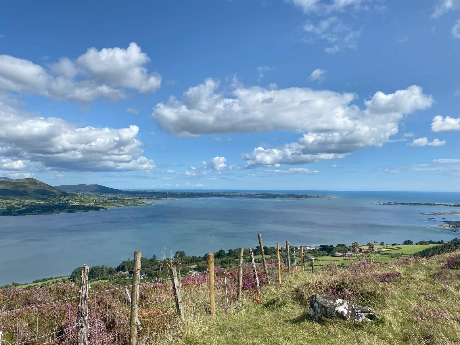
The Cooley Mountains dominate the eastern horizon of County Louth, their jagged peaks stretching from Carlingford Bay to the border with County Down. At the heart of the range sits Slieve Foy (Sliabh Feá), the highest summit at 589 m, offering unrivalled 360‑degree panoramas that sweep across the Mourne Mountains, the Irish Sea and the rolling countryside below. The mountain’s lower slopes are cloaked in the Coillte‑managed Slieve Foye Woods, a mixed‑species forest that provides easy access, picnic facilities and a series of well‑signposted walking routes.
The area is steeped in myth. According to legend, the great hero Fionn Mac Cumhaill hurled the massive Cloghmore boulder from the slopes of Slieve Foy during a fierce contest with a rival giant from the Mournes. The story adds a touch of the supernatural to the already dramatic landscape, inviting visitors to imagine ancient battles as they trek the trails.
History & Legend
While the Cooley Mountains have been a natural barrier for centuries, they also feature prominently in Irish folklore and early literature. The famed Táin Bó Cúailnge (Cattle Raid of Cooley) is set in this very region, describing heroic deeds and epic confrontations that echo across the hills. The name “Cooley” itself derives from the Irish Cúile, meaning “nook” or “corner”, reflecting the peninsula’s tucked‑in geography.
The forest that now blankets Slieve Foye’s lower slopes was planted in the mid‑20th century as part of a national re‑forestation programme. Today, Coillte’s stewardship ensures a sustainable environment for wildlife, recreation and education, while preserving the ancient spirit of the land.
What to See & Do
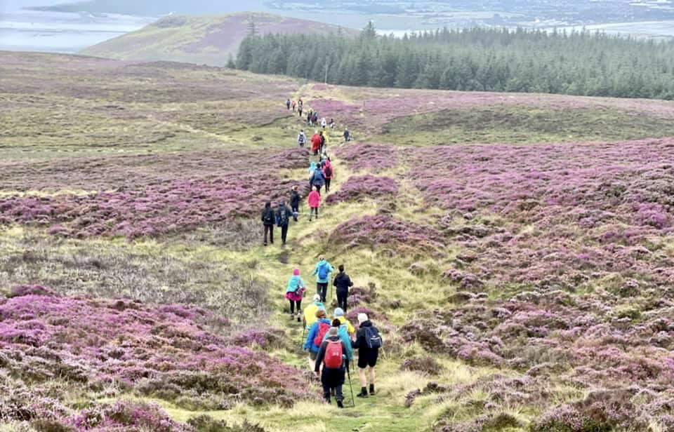
Walking Trails
The forest trail follows the Táin Way, a national long‑distance route that threads through the Cooley Mountains for roughly 4 km within the woods. From this backbone, three colour‑coded loop walks radiate outward:
| Loop | Length | Marker Colour |
|---|---|---|
| Commons Loop | 3 km | Green |
| Slieve Foye Loop | 8 km | Blue |
| Barnavave Loop | 12.5 km | Red |
Each loop is clearly sign‑posted and varies from gentle woodland strolls to more demanding hill‑top treks. The Slieve Foye Loop is particularly popular, guiding walkers up to the summit where the view over Carlingford Lough and the Mournes is simply breathtaking. For those seeking a longer challenge, the Barnavave Loop weaves through higher terrain and offers a deeper immersion in the mountain’s rugged character.
Scenic Drive
If you prefer to stay in the car, the surrounding roads are celebrated as some of Ireland’s most picturesque driving routes. The R173, which runs from Carlingford to Omeath and on towards Newry, hugs the coastline and provides frequent pull‑outs for photo‑ops of the sea, cliffs and distant peaks.
Picnic & Relaxation
Two free car parks sit at the forest’s entrance, each equipped with picnic tables and ample space for families or groups. The sites are strategically placed to give visitors immediate access to the trailheads while also offering sweeping views of the surrounding landscape.
Map & Resources
A downloadable PDF trail map is available from Coillte, detailing the loops, way‑markers and points of interest. You can access it here: Slieve Foye Trail Map (PDF).
Practical Information
- Access: The forest entrance lies 3.5 km north‑east of Carlingford. From Carlingford, follow the R173 north‑east; the turn‑off appears on the left after about 3.5 km.
- Parking: Both car parks are free of charge and operate on a first‑come, first‑served basis. During peak summer weekends, early arrival can help secure a spot.
- Admission: Entry to the woods and all walking routes is free.
- Facilities: Picnic tables, car‑park spaces and clearly marked trailheads are provided. No permanent visitor centre exists on site.
- Navigation: For GPS users, the coordinates of the main entrance are 54.06674, ‑6.22083. A Google Maps link is available here: Get Directions.
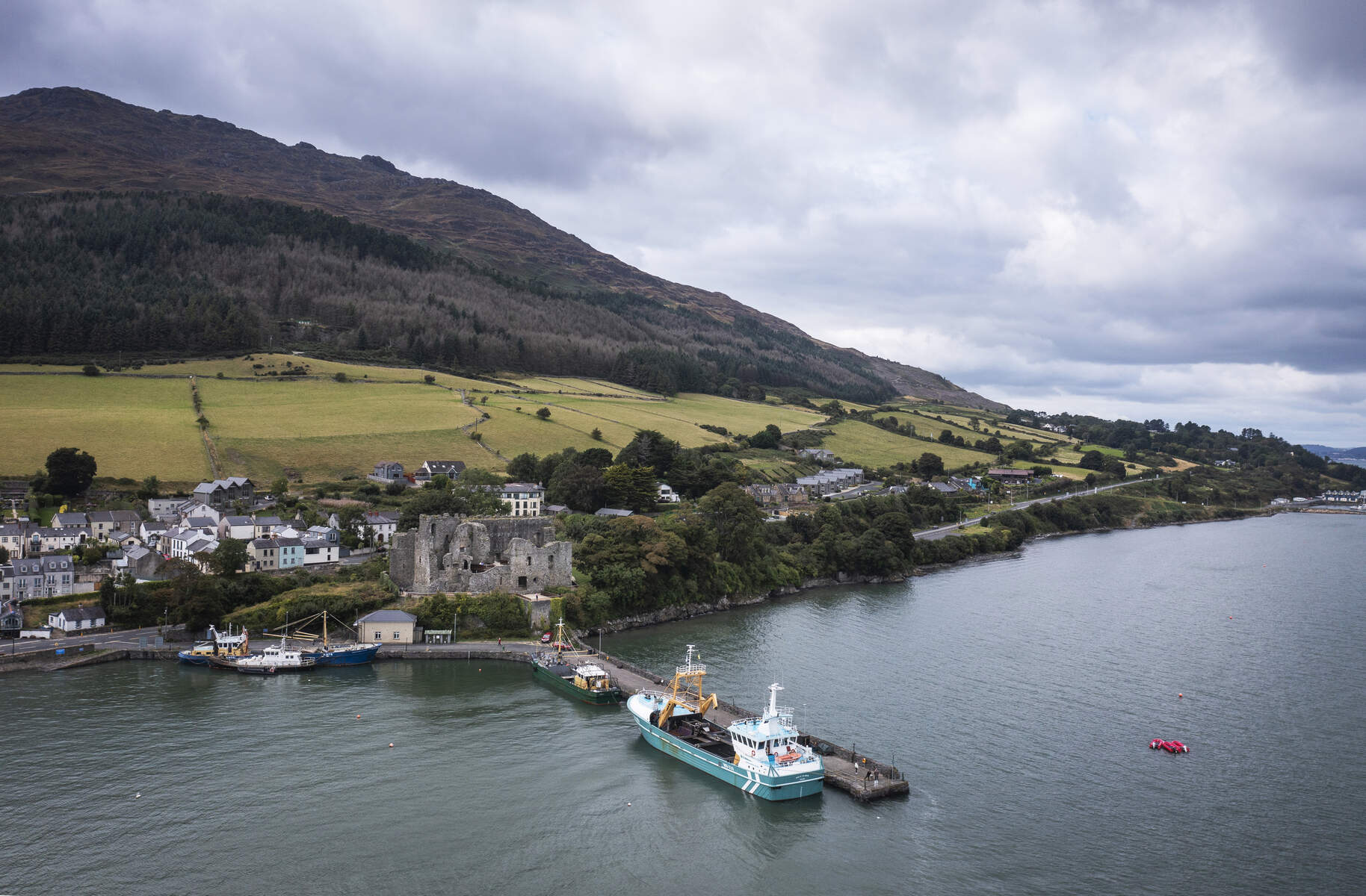
- Nearby Amenities: The historic towns of Carlingford and Omeath lie just a short drive away, offering cafés, restaurants and additional cultural attractions.
- Seasonality: The trails are open year‑round. While the forest floor can be damp after rain, the well‑maintained paths remain usable for most of the year.
For further information on the wider Louth region, visit the official tourism portals: Louth Tourism and Discover Ireland.
Whether you are chasing the legend of Fionn Mac Cumhaill, seeking a family‑friendly walk, or simply yearning for a dramatic vista over the Irish Sea, the Cooley Mountains and Slieve Foy deliver an unforgettable outdoor experience.