Overview
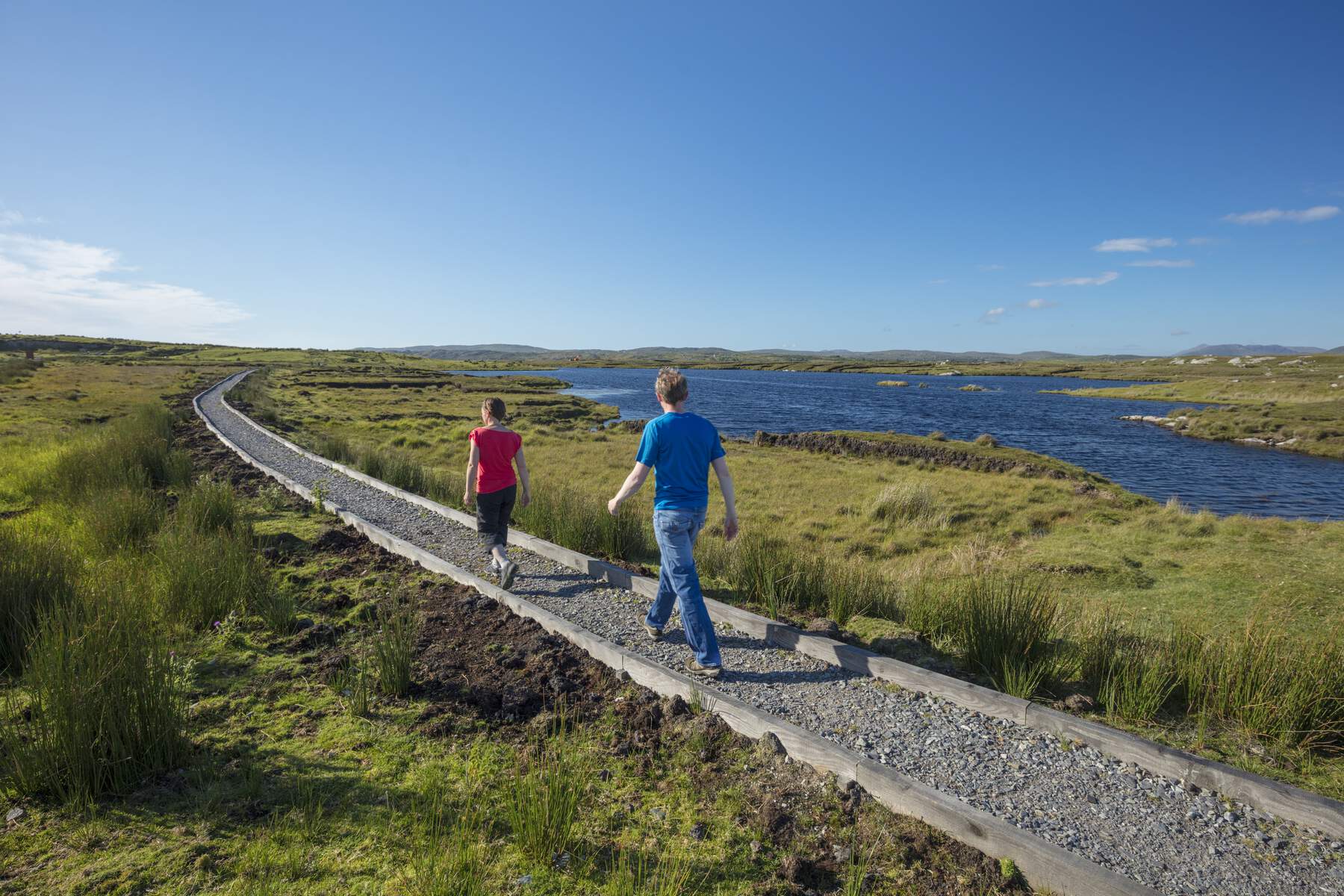
Derrigimlagh Loop Walk is a 5 km (3.1 mi) circular trail that winds through one of Europe’s most striking blanket bogs on the western edge of Connemara. The walk is part of the Wild Atlantic Way Signature Discovery Points and is designed as an immersive, self‑guided journey through both natural beauty and groundbreaking 20th‑century technology. Six of the seven stop points are sheltered shelters that double as weather‑proof viewing platforms, while the seventh is a cairn marking the historic landing of Alcock and Brown. The route is largely timber‑boarded, keeping the fragile peatland intact while offering comfortable footing for most walkers.
History
Marconi’s Transatlantic Wireless Station
In 1905 Guglielmo Marconi erected a commercial radio station on the Derrigimlagh bog, taking advantage of the flat, open landscape to broadcast the first successful commercial transatlantic wireless transmission in 1907. At its peak the site employed several hundred workers, including Jack Phillips, the chief wireless operator who later served on the RMS Titanic. The station dominated the local skyline until it was partially destroyed during the Irish Civil War (1922‑1923). Foundations of the original Condenser House, Power Station and Social Club remain visible, and interpretive panels explain the engineering feats that made the first two‑way full‑duplex radio possible.
Alcock & Brown’s Non‑Stop Flight
On 15 June 1919, British aviators John Alcock and Arthur Whitten‑Brown completed the first non‑stop transatlantic flight, landing their Vickers Vimy in the Derrigimlagh bog after 16 hours 28 minutes in the air. Their triumphant arrival was broadcast worldwide from the Marconi station, cementing Derrigimlagh as the first European site directly connected to North America by both air and radio. A cairn on the loop marks the exact landing spot, and a short detour leads to the wing‑shaped memorial on the nearby Errislannan Peninsula, a striking tribute to the daring flight.
What to See & Do
| Stop | Feature | Highlights |
|---|---|---|
| 1 | Orientation Point | Introduction to Marconi’s station, map of the loop, and a sheltered bench. |
| 2 | Condenser House Remains | Visible stone foundations, interpretive plaque on early radio technology. |
| 3 | Power Station Site | Ruins of the original generator building, information on early 20th‑century electricity. |
| 4 | Social Club Remains | Remnants of the workers’ communal space, anecdotes about daily life on the bog. |
| 5 | Art Installation | Contemporary sculpture celebrating innovation, positioned on a raised boardwalk. |
| 6 | Cairn – Alcock & Brown Landing | Stone cairn with engraved plaque, view of the surrounding bog that greeted the aviators. |
| 7 | Shelter & Viewpoint | Weather‑proof shelter with seating, perfect for a brief rest and spotting the occasional grazing sheep. |
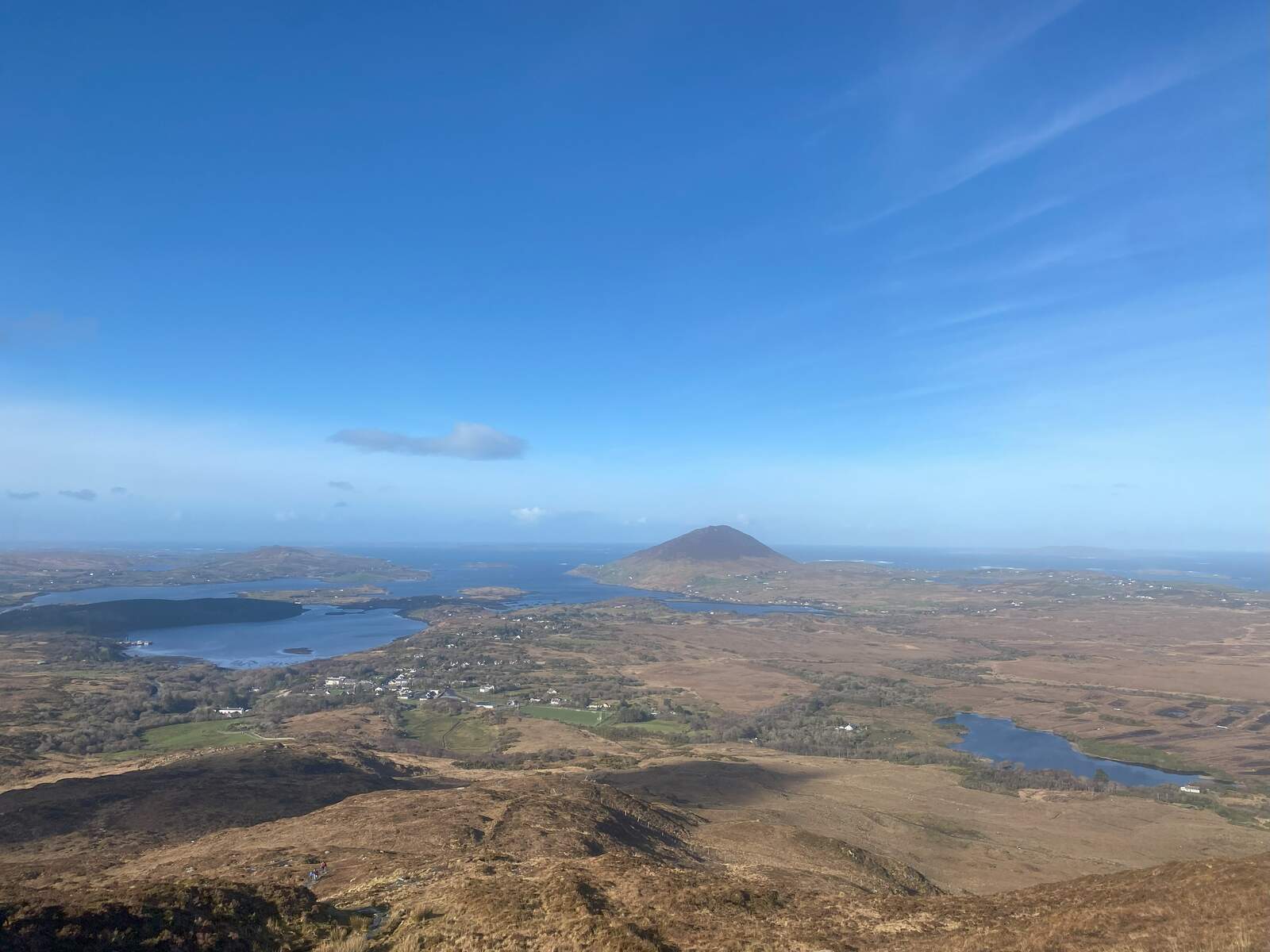
The boardwalks thread through a mosaic of tiny lakes, peat hummocks, and low‑lying vegetation, offering ever‑changing vistas of the Atlantic horizon and the looming Twelve Bens mountains in the distance. Wildlife is subtle but present; walkers often encounter sheep grazing nearby, and the bog’s unique flora adds a quiet, almost otherworldly ambience.
Practical Information
The trail begins at the Derrigimlagh Wild Atlantic Way Discovery Point car park, located 4.3 km south of Clifden on the R341 (Ballyconneely Road). From Clifden, follow the road across three small bridges and look for signage directing you to the “Signature Discovery Point”. Parking is free on‑site, and the car park provides a clear space for bicycles – a popular option for those staying in Clifden’s “capital of Connemara”.
The loop takes roughly 1½–2 hours to complete at a leisurely pace, allowing time to read the interpretive panels and enjoy the art installations. All seven stop points are equipped with basic shelters that protect against rain and wind, and the timber boardwalks are maintained year‑round. No admission fee is required; the walk is open to the public daily.
For navigation, the coordinates of the main discovery point are 53.4615 N, ‑10.0235 W. The nearby Alcock & Brown wing‑shaped memorial on the Errislannan Peninsula sits at 53.4671 N, ‑10.0330 W and can be reached via a short side path from the cairn stop.
While the walk is suitable for most ages, the boardwalks involve some uneven surfaces and occasional steps, so families with very young children may wish to keep a close eye on little ones. The trail is not wheelchair‑accessible due to the natural terrain, but the shelters provide comfortable resting spots for those who can manage the boardwalk sections.
For further details, photographs, and updates, visit the official Connemara tourism page linked above.