Overview
Just outside Killarney National Park, Derrycunihy Valley (often called Derrycunihy Nature Reserve) is a 136 ha (336 acres) pocket of pristine wilderness in County Kerry. Owned by Coillte Teoranta, the reserve is celebrated for its ancient sessile oak woodlands, moss‑covered trunks, and a patchwork of bogs, lakeshores and glacially carved valleys. The landscape is a haven for walkers, cyclists and wildlife enthusiasts, offering everything from gentle boardwalk strolls to challenging climbs that thread through the iconic Kerry Way.
History & Background
The woodlands of Derrycunihy are among the oldest native oak forests in Ireland, a living reminder of the island’s post‑glacial forest cover. Historically the area served as a hunting ground for the landed gentry; Lord Brandon’s Cottage, perched on the Upper Lake’s shore, was once a hunting lodge and now operates as a modest tea room. The Old Kenmare Road, an ancient trackway, still cuts through the reserve, while the Cillín Burial Ground bears testimony to Penal‑time worship, with a stone once used for clandestine Masses. These cultural layers sit alongside a thriving natural ecosystem, making the valley both a historic and ecological treasure.
What to See & Do
| Feature | Highlights | Access |
|---|---|---|
| Boardwalk | A raised wooden path that glides through wetland and oak woodland, keeping feet dry on boggy ground. | Starts at the Kerry Way near Derrycunihy Church car park. |
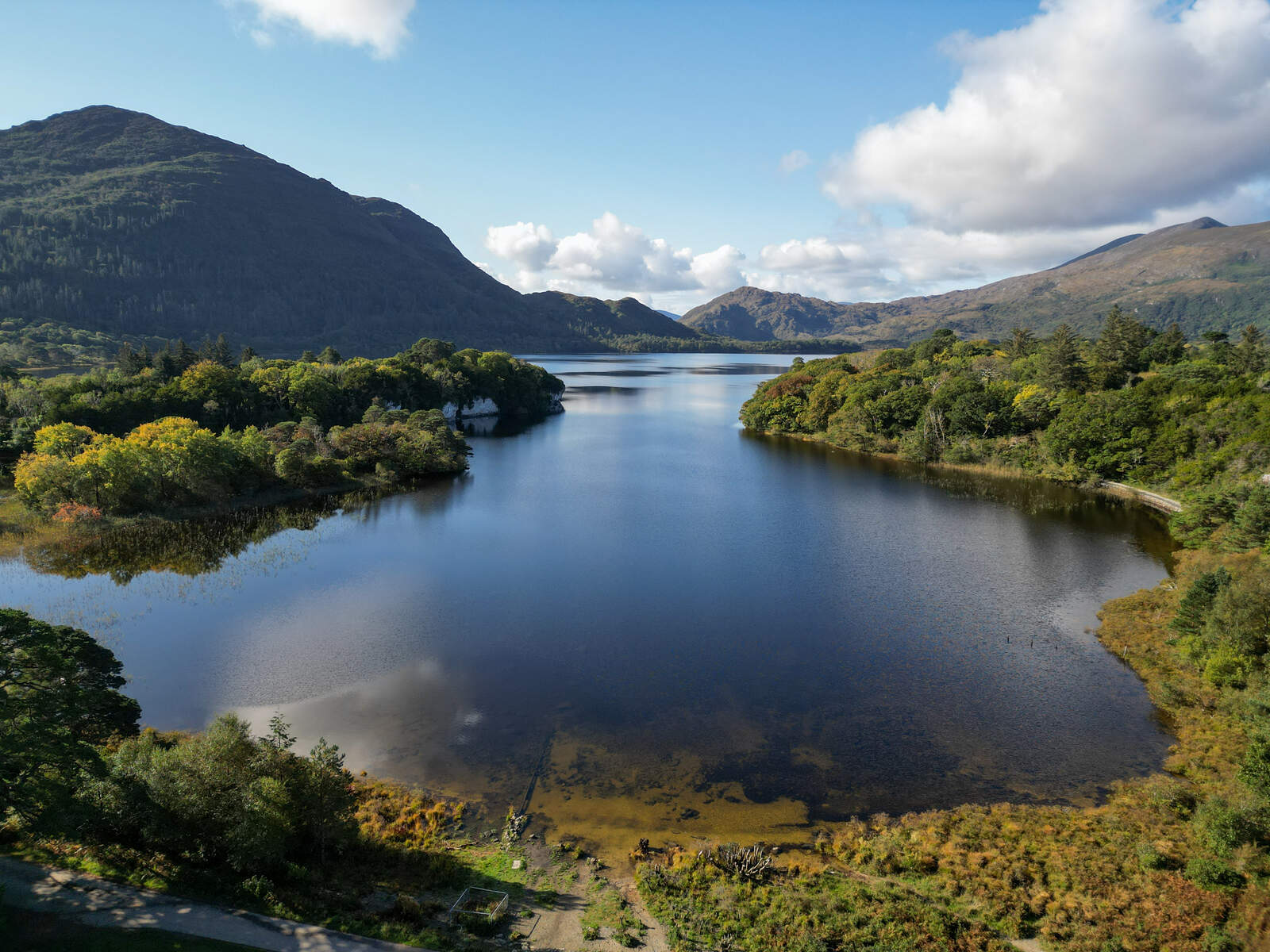
| Ladies View | Panoramic vista over the Upper and Muckross Lakes, famously admired by Queen Victoria’s ladies‑in‑waiting in 1861. | Short walk from the main trail; café and souvenir shop on site. |
| View of the Lakes from Ladies’ View | Sweeping sight of the lake chain framed by the McGillycuddy Reeks. | Adjacent to Ladies View; ideal for a coffee break at Avoca Café. |
| Derrycunihy Cascade & Falls | A series of waterfalls that roar louder after rain, with a picturesque wooden bridge nearby. | Follow the riverbank trail from the church car park (≈1 km to the cascade). |
| Lord Brandon’s Cottage | Historic tea room serving tea, coffee, soup and sandwiches; a good base for longer walks. | 3–4 km along the Kerry Way from the church; note winter flooding risk. |
| Cillín Burial Ground | Small historic site with a stone used for secret Masses during Penal times. | Visible from the Kerry Way near the Upper Lake. |
| Wildlife spotting | Red Deer, introduced Japanese Sika Deer, a wealth of mosses, ferns, and over 200 species of liverworts; excellent birdwatching (Eurasian jay, European robin, red squirrels). | Throughout the reserve; early morning offers the best chances. |
Walking & Cycling
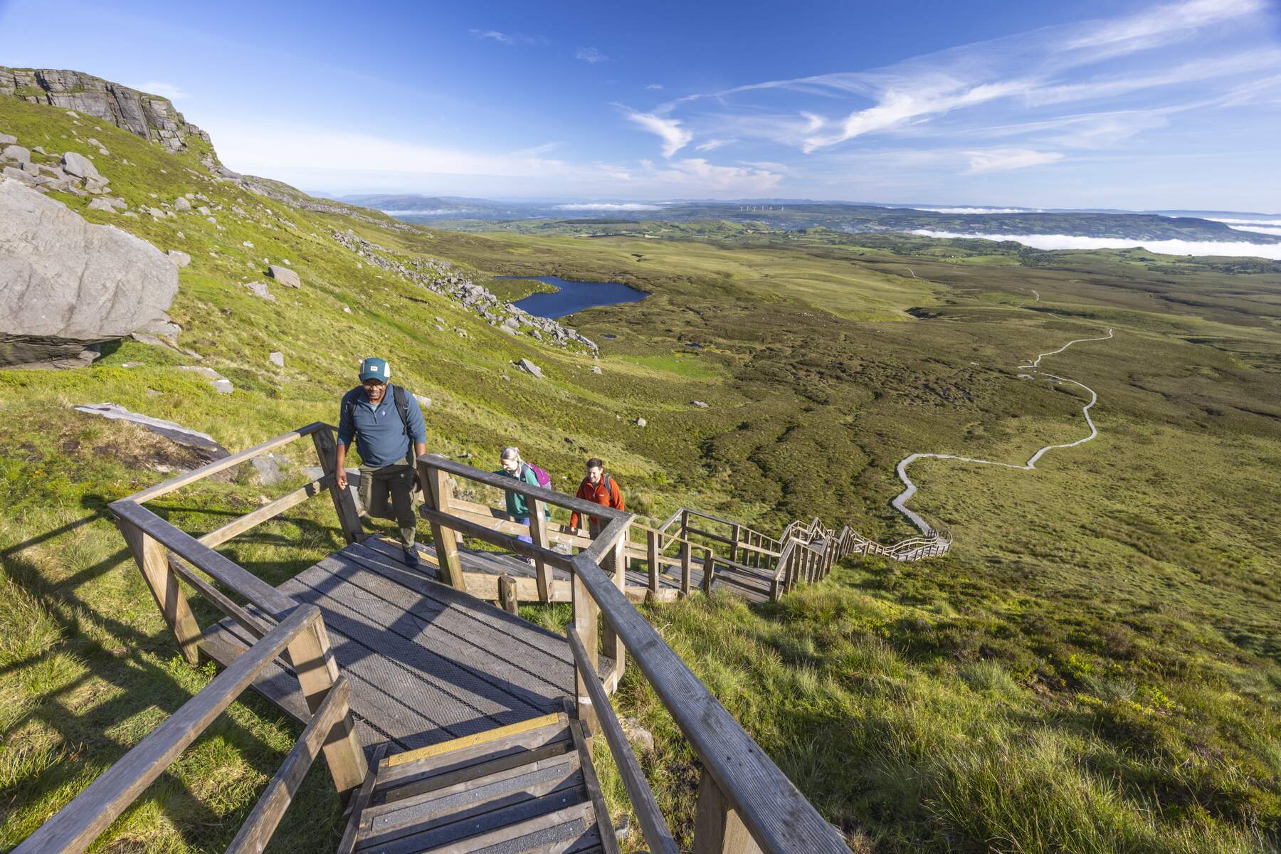
The Kerry Way, a long‑distance trail that circles the Iveragh Peninsula, threads through Derrycunihy, offering several loop options:
- View of the Upper Lake loop – a gentle 2 km walk that showcases the lake’s mirror‑like surface and the surrounding oak canopy.
- Narrow Bridge – Derrycunihy Wood loop – a 3 km circuit that includes the boardwalk and the historic bridge.
- Moll’s Gap Climb and Descent – a more demanding 5 km ride for cyclists seeking panoramic sweeps and a taste of the famous Ring of Kerry.
All routes are marked on the Komoot guides linked throughout this article, and the ActiveME app provides downloadable GPS tracks.
Getting There & Parking
Location – Derrycunihy Valley lies about 12 km south of Killarney on the N71 Kenmare Road.
Car access – The most convenient entry point is the small car park beside Derrycunihy Church (free, limited spaces). An alternative lay‑by on the N71, roughly 1 km from the church, offers a flatter surface and is popular with cyclists.
Parking – Both the church car park and the lay‑by provide free parking. During the summer months the road can become busy with tour buses, so arriving early secures a space.
Flora & Fauna Highlights
The reserve’s ancient oak woods support a rich understory of ferns, mosses and liverworts – over 200 species have been recorded. Birdwatchers can spot Eurasian jay, European robin and occasional red‑squirrel. Deer (both native red and introduced Japanese sika) roam the woods, and the riverbanks attract dragonflies and other insects.
Practical Information
Trail conditions – The boardwalk is generally easy, but wooden planks become slick when wet. Riverbank sections to the cascade are rocky and may be slippery after rain.
Facilities – A café at Ladies View and the tea room at Lord Brandon’s Cottage serve refreshments. Basic shelters are scattered along the main trail, offering a place to rest.
Accessibility – The boardwalk is suitable for most walkers, though uneven ground and occasional steep sections may challenge those with limited mobility.
Maps & Navigation – Detailed OSI Map Discovery 78 (ISBN 978‑190663 ) covers the area, and the Kerry Way signage (yellow walking man) is clear throughout. Digital users can rely on the Komoot guides:
Nearby attractions – The reserve sits within easy reach of the Upper Lake, Muckross House, and the iconic Ring of Kerry drive, making it an ideal stop on a day‑trip through Killarney National Park.