Overview
Diamond Hill, known in Irish as Binn Ghuaire (Guaire’s peak), dominates the landscape of Connemara National Park in County Galway. At 442 m (1,450 ft) it is technically a mountain, but its distinctive diamond‑shaped quartzite ridge gives the hill its English name. The quartzite glistens in bright sunshine, creating the illusion of a giant gemstone jutting from the earth. The hill sits just outside the village of Letterfrack, and the main trailhead begins at the park’s Visitor Centre.
Background
The name “Diamond Hill” reflects the hill’s visual character rather than any mineral wealth. The quartzite that forms the summit was deposited by ancient glaciers and, when the sun hits the stone at the right angle, it sparkles like a cut diamond. The Irish name Binn Ghuaire honours a local legend about a chieftain named Guaire, while an older Anglicised version, “Bengooria”, also appears in historic maps.
What to See & Do
Trail options
| Trail | Length | Approx. time | Difficulty | Highlights |
|---|---|---|---|---|
| Lower Loop | 2.8 km (1.7 mi) | 45 min | Moderate | Gentle inclines, board‑walk through bogland, early‑summit viewpoints |
| Upper Loop | 6 km (3.7 mi) | 2 h | Strenuous | Quartzite ridge, summit panorama |
| Full Circuit (Lower + Upper) | 7 km (4.3 mi) | 2.5–3 h | Strenuous | Complete summit experience |
| Both loops are fully way‑marked – blue arrows for the lower loop and red arrows for the upper – on timber posts throughout the park. |
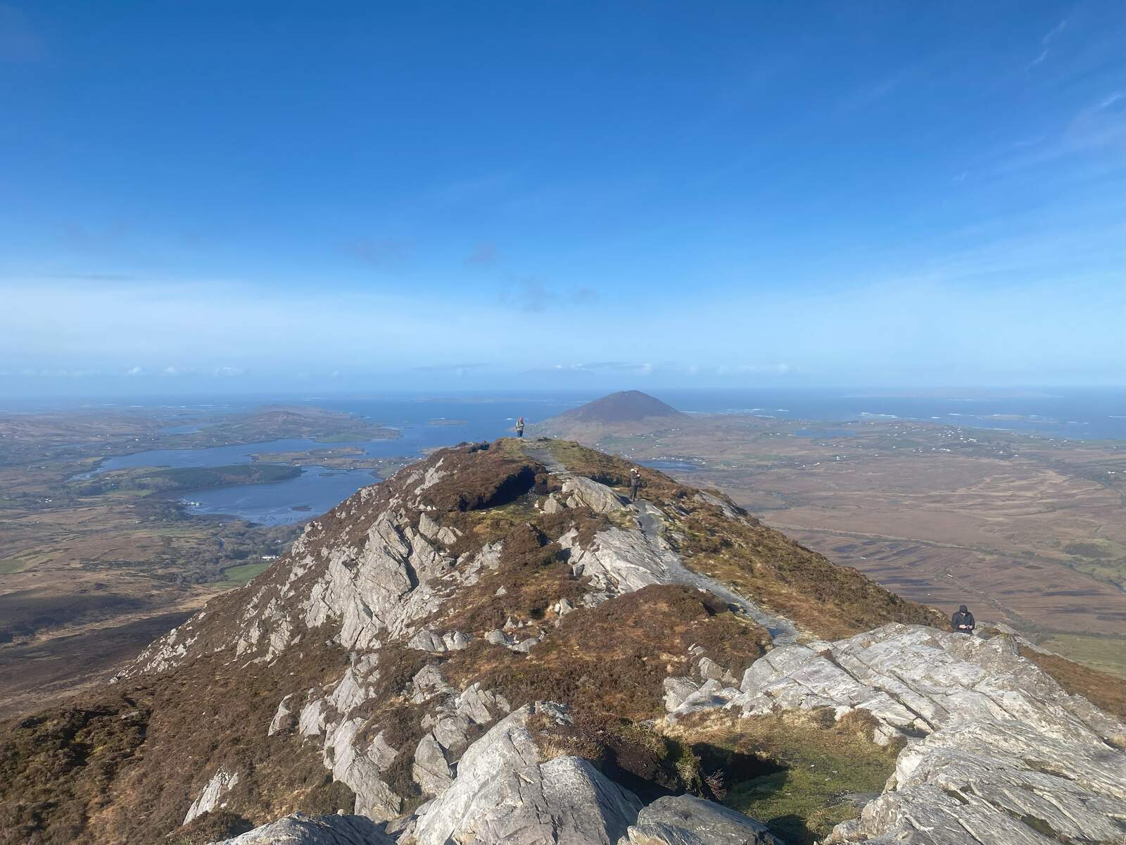
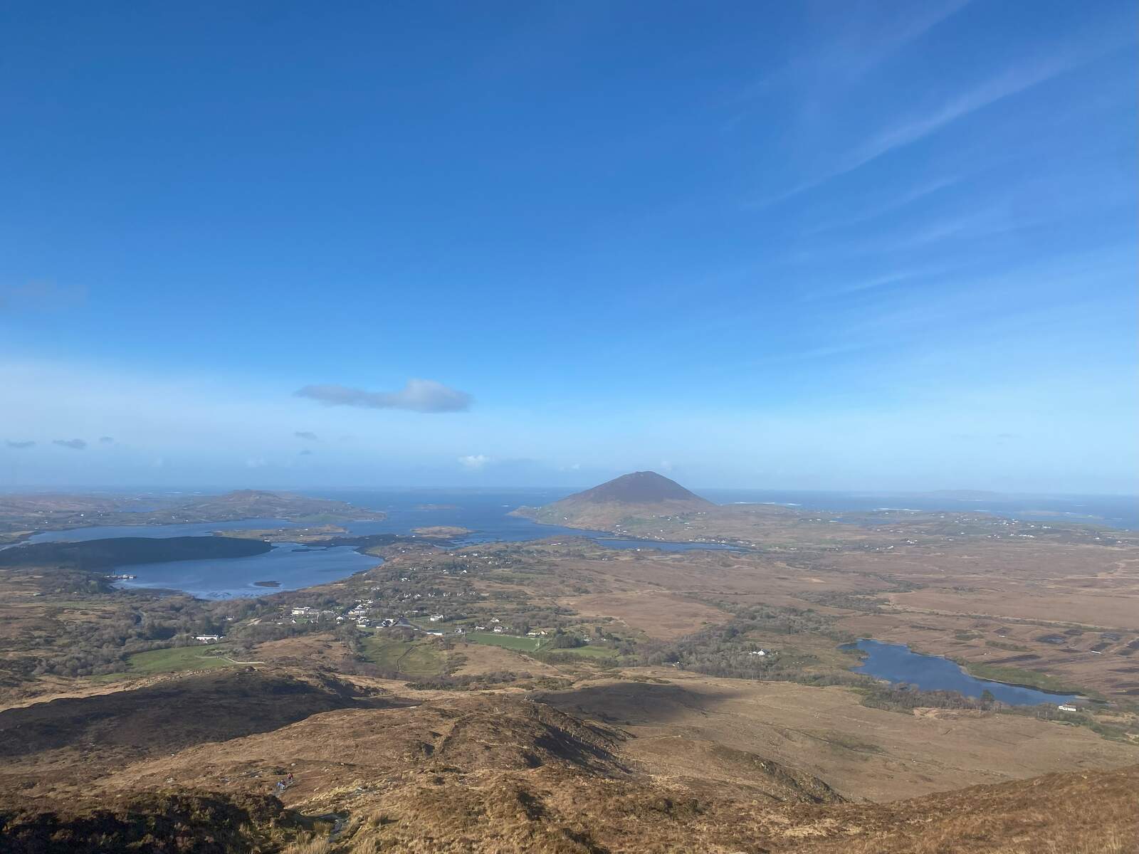
Summit scenery
Reaching the summit rewards hikers with a 360° panorama of Connemara’s wild coast. On a clear day you can spot:
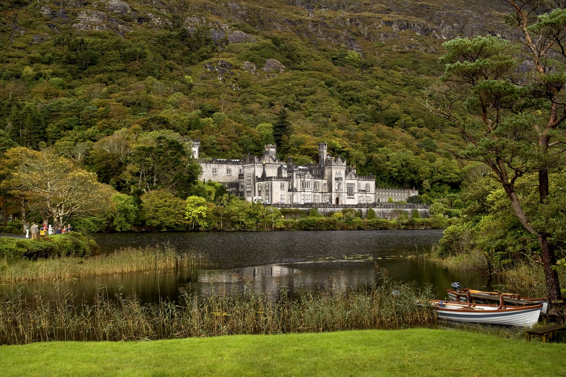
- Kylemore Abbey and the mirror‑like Kylemore Lough directly below.
- The Twelve Bens mountain range stretching across the horizon.
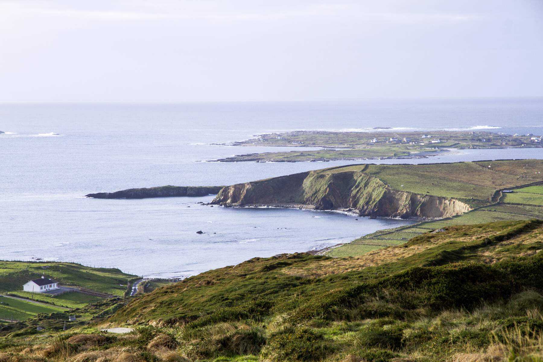
- The Atlantic Ocean and the islands of Inishturk, Inishbofin and Inishshark.
- Tully Mountain and Mweelrea in the distance. The view is especially striking from the monolithic stone that marks the halfway point of the full circuit – a natural “lighthouse” that frames the landscape.
Wildlife and flora
Connemara National Park protects one of Ireland’s largest blanket‑bog habitats. While walking, you may encounter:
- Connemara ponies grazing on the open heath.
- A chorus of birds such as meadow pipits, skylarks, stonechats and peregrine falcons.
- Seasonal wildflowers – marsh orchids, lousewort and purple heather – that carpet the bog and woodland edges. The board‑walk sections often cross small streams, adding the gentle sound of water to the experience.
Visitor Centre and amenities
The Visitor Centre, housed in former Letterfrack industrial‑school buildings (c. 1890), serves as the logical starting point. Inside you will find:
- Interactive exhibitions on the park’s geology, ecology and cultural history.
- A café offering hot drinks, soups and homemade scones – perfect for a post‑hike treat.
- Free maps and information sheets for all four park trails.
- Picnic benches, a playground and clean restroom facilities. All exhibitions are free to access.
Nearby attractions
After descending, the surrounding area offers several worthwhile stops:
- Kylemore Abbey – a short 8‑minute drive, famous for its Gothic turrets and lakeside gardens.
- Dog’s Bay – a white‑sand, horseshoe‑shaped beach ideal for a coastal walk.
- Clifden and the Sky Road – scenic drives that showcase the rugged Atlantic coastline.
- Glassilaun Beach and Roundstone for seafood dining and traditional music sessions.
Practical Information
Getting there
The most convenient entry point is the large car park beside the Visitor Centre in Letterfrack. From Galway City the drive takes about 1½ hours via the N59; from Dublin it is roughly a 3‑hour journey along the M6 and N59. Bus Éireann runs seasonal services from Galway to Letterfrack, but checking the latest timetable is advisable.
Opening hours & admission
| Facility | Opening hours |
|---|---|
| Visitor Centre & Café | 09:00 – 17:30 (daily, with seasonal variations) |
| Park access | Open year‑round |
| Admission to the park and the Diamond Hill trails is free. |
Parking & access
Ample parking is available at the Visitor Centre, though it can fill quickly in the summer months. Arriving early helps secure a space. The trails are fully accessible on foot; there are no wheelchair‑compatible routes to the summit due to the steep, rocky sections.
Dogs
Dogs are welcome on all Diamond Hill routes but must be kept under control and on a leash. Owners are asked to clean up after their pets to protect the delicate bog environment.
Navigation
All routes are clearly way‑marked, making it easy to stay on track without a map. However, a paper map or a mapping app (e.g., Hiiker) is useful for those who prefer a digital backup.
Coordinates
Latitude: 53.54819 N Longitude: –9.91470 W
Enjoy the blend of geological wonder, sweeping sea views and rich wildlife that makes Diamond Hill one of Ireland’s most beloved day‑hikes.