Overview
Diamond Hill, known in Irish as Binn Ghuaire (Guaire’s peak) and sometimes called Bengooria, dominates the landscape of Connemara National Park in County Galway. At 442 m (1,450 ft) it is technically a mountain, its quartzite ridgeline catching the sun like a glittering gem – the source of its English name. The hill sits just outside the picturesque village of Letterfrack, and the park’s visitor centre marks the trailhead for a network of four marked routes that together showcase some of the most spectacular scenery in western Ireland.
History & Background
The land that now forms Connemara National Park was once a patchwork of grazing fields, small vegetable plots and peat‑cutting bogs. The old farm buildings that house today’s visitor centre were part of the Letterfrack Industrial School, erected around 1890. Over the decades the area transitioned from agricultural use to a protected natural reserve, and the trail system was developed to let the public experience the park’s diverse habitats – from lowland bogs to upland heath and ancient quartzite outcrops.
What to See & Do
Trail Options
| Trail | Length | Typical Time | Difficulty |
|---|---|---|---|
| Ellis Wood Nature Trail (Green) | 0.5 km | 15 min | Easy (family friendly) |
| Sruffaunboy Trail (Purple) | 1.5 km | 30 min | Easy |
| Diamond Hill Lower Loop (Yellow) | 3 km | 45 min – 1 h | Moderate |
| Diamond Hill Lower & Upper Loop (Yellow) | 6.7 km | 2–3 h | Moderate‑to‑Strenuous |
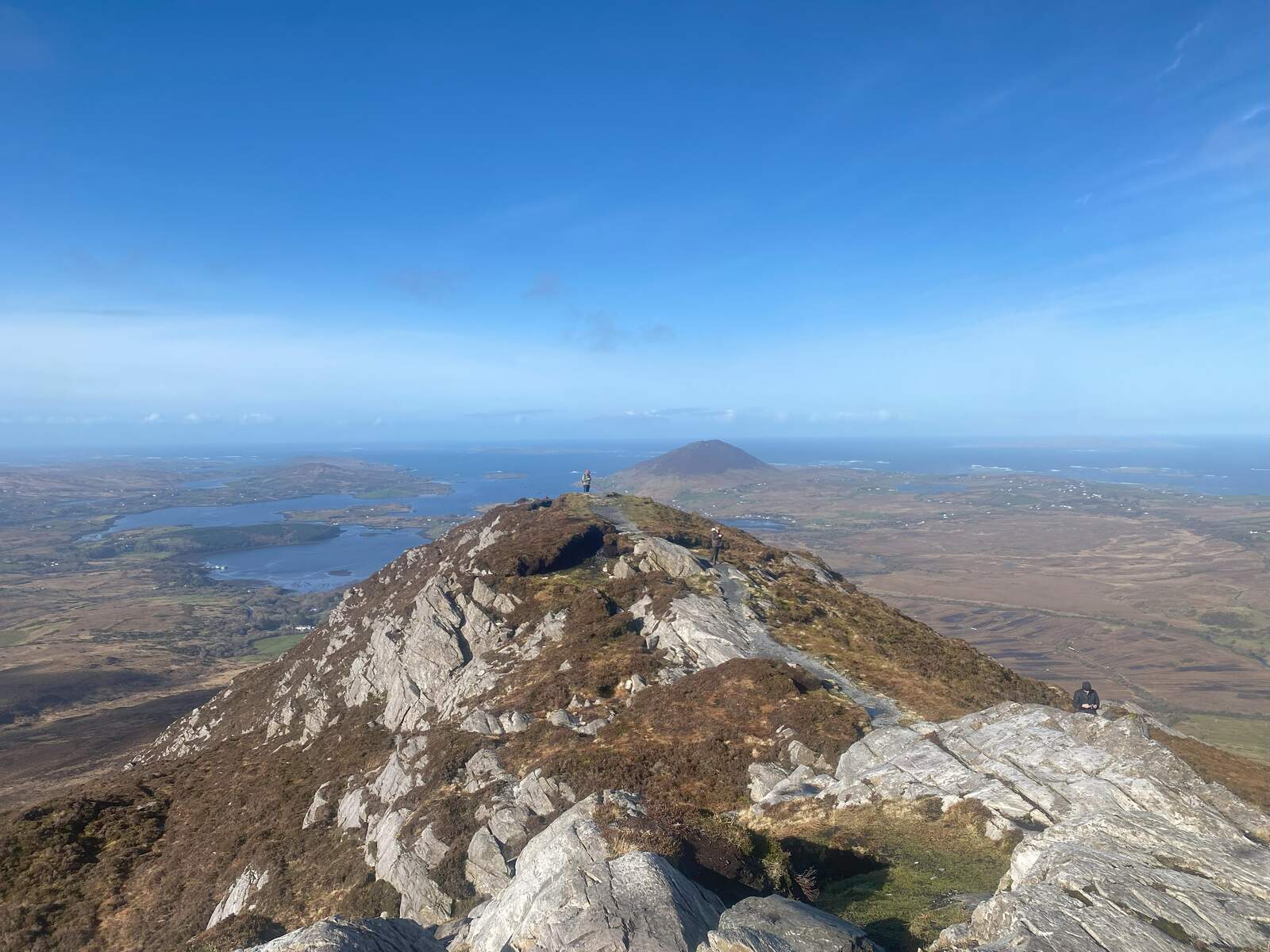
The Lower Loop climbs gently through bogland dotted with glacial boulders, offering early‑stage vistas of Kylemore Lough, Ballinakill Harbour and the distant Twelve Bens. Mid‑way a monolithic stone marks the halfway point; from here hikers can either return via the lower circuit or continue onto the Upper Loop that follows a narrow quartzite ridge to the summit.
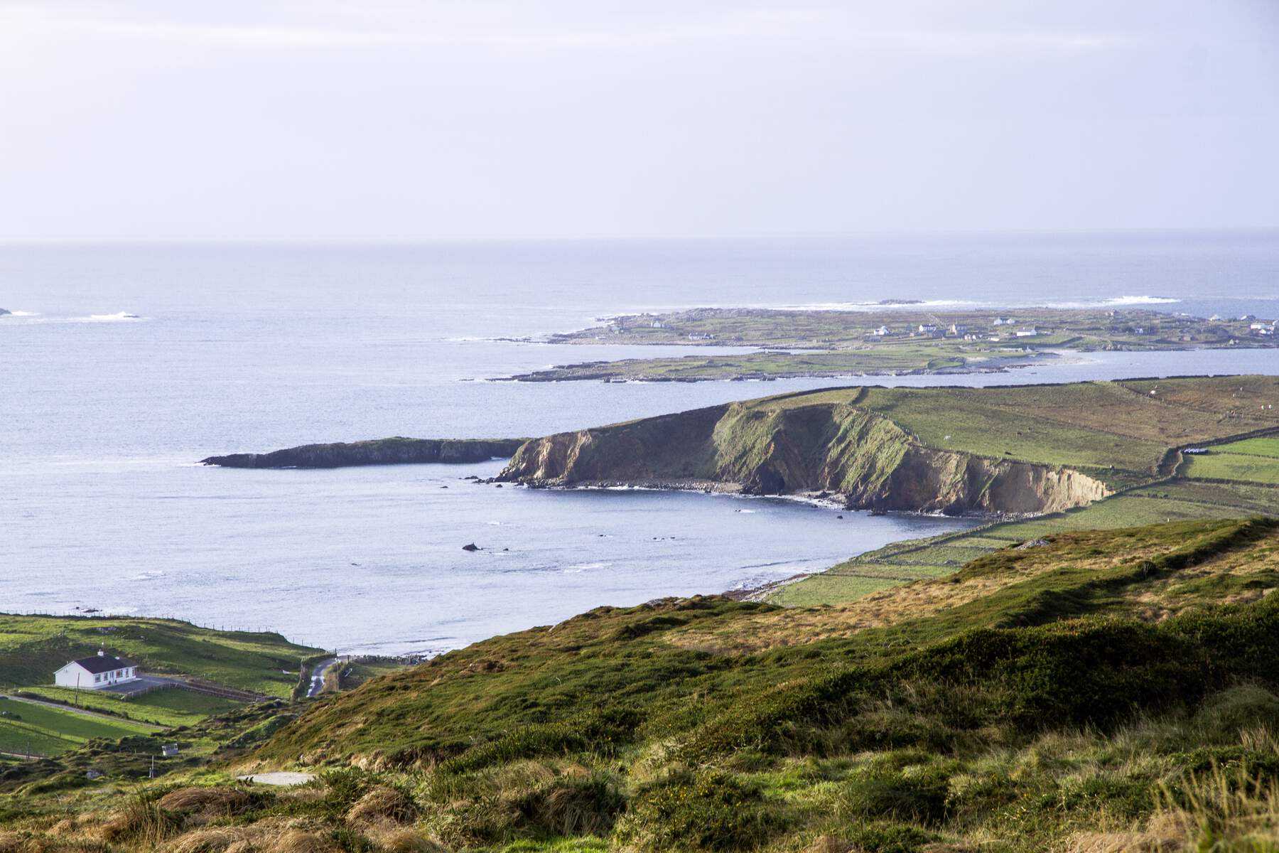
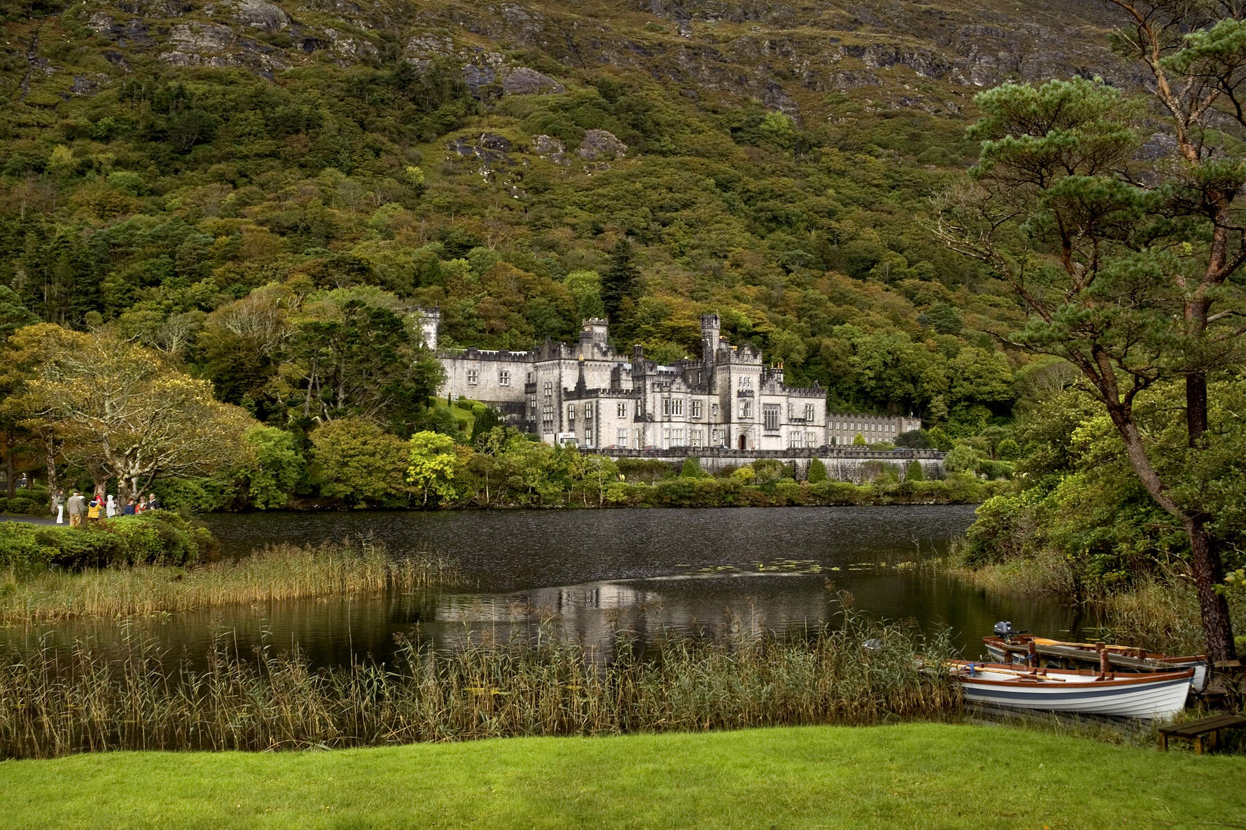
The Upper Loop adds roughly 3.7 km of ascent, taking the total circuit to about 7 km. At the summit (442 m) you are treated to a 360° panorama: the iconic spires of Kylemore Abbey, the shimmering surface of Kylemore Lough, the rugged Atlantic coastline, and the islands of Inishbofin, Inishturk and Inishark. On clear days the view stretches to the Twelve Bens, Mweelrea and Tully Mountains, making the climb feel like a reward for every step.
Flora, Fauna & Landscape
The trails wind through 3,000 ha of remote woodland, blanket bog and open mountain. In spring and early summer, marsh orchids, lousewort and purple heather carpet the slopes, while the occasional stream gurgles down the bog, adding a soothing soundtrack to the hike. Wildlife sightings include grazing sheep, wild ponies, and the occasional horse or donkey that roams the lower fields – a delight for younger walkers.
Visitor Centre & Amenities
The Connemara National Park Visitor Centre, housed in the former Letterfrack school buildings, provides a warm welcome with exhibitions, a café serving hot drinks, soups and sandwiches, picnic benches, a playground and clean toilet facilities. Ample parking is available adjacent to the centre, though it can fill quickly in the summer months, so early arrival is advisable.
Practical Information
- Opening hours (Visitor Centre): 9:00 am – 5:30 pm daily, except on certain public holidays and occasional seasonal adjustments. Check the official Connemara National Park website for the latest details.
- Trail access: Open year‑round unless temporary maintenance is required. The summit should be avoided in very high winds or severe weather.
- Admission: Free entry to the park and all trails.
- Parking: Free on‑site, but limited during peak season.
- Dogs: Allowed on leash; owners must clean up after their pets.
- Getting there: The trailhead is a short walk from the visitor centre on the R336 road near Letterfrack. The centre is about a 20‑minute drive from Clifden, 40 minutes from Roundstone and roughly 1 hour 15 minutes from Galway City.
- Navigation: All routes are fully way‑marked with coloured arrows on timber posts (lower loop – blue, upper loop – red). A mobile phone is useful for emergencies (112 or 999) as coverage can be spotty on the summit.
Why It Matters
Diamond Hill is Ireland’s second‑most‑visited trail after Croagh Patrick, yet it retains a sense of wilderness that feels far removed from the bustle of the west coast towns. Whether you are a family looking for a gentle loop, a photographer chasing the perfect sunrise over Kylemore Lough, or a seasoned hiker craving a summit with unrivalled coastal panoramas, Diamond Hill delivers a memorable experience that encapsulates the raw beauty of Connemara.
Nearby attractions – After your hike, consider a short drive to Kylemore Abbey, the Sky Road, or the charming village of Clifden for additional sightseeing, dining and accommodation options.