Overview
Errisbeg Mountain (Irish: Iorras Beag), also known as Errisbeg Hill, dominates the skyline above the fishing village of Roundstone in western County Galway. At roughly 280‑300 m (≈950 ft) high it qualifies as both a Marilyn and a Hewitt, marking it as one of Connemara’s most prominent peaks. The hill sits on the edge of the famed Roundstone Bog and drops sharply toward the Atlantic, offering one of the most accessible high‑point viewpoints on the Wild Atlantic Way.
History & Background
The name Iorras Beag translates to “little peninsula”, a nod to the hill’s jutting position into the sea‑filled landscape. While the summit bears no ancient ruins, its rugged slopes have long inspired artists and writers such as W. B. Yeats and J. M. Synge. Historically it served as a navigational landmark for local fishermen and a summer grazing ground for sheep.
What to See & Do
Hiking the Summit
- Trailhead: Small free car park off the R341, a short walk from Roundstone harbour.
- Route: A 5‑7 km round‑trip (the classic 7 km loop or a shorter 5 km direct ascent) with an elevation gain of about 450 m.
- Terrain: Open hillside, wet bog sections, a sheep‑track and brief stretches of surfaced minor road. The path is unmarked in places; a map or GPS (53.395050, -9.958932) is advisable.
- Duration: 4–5 hours total; most walkers reach the cairn‑topped summit in roughly two hours.
- Difficulty: Moderate to difficult – steady fitness and sturdy boots recommended.
- Dog‑friendly: Dogs are permitted on the trail, but owners should keep them on a lead in boggy sections and respect livestock.
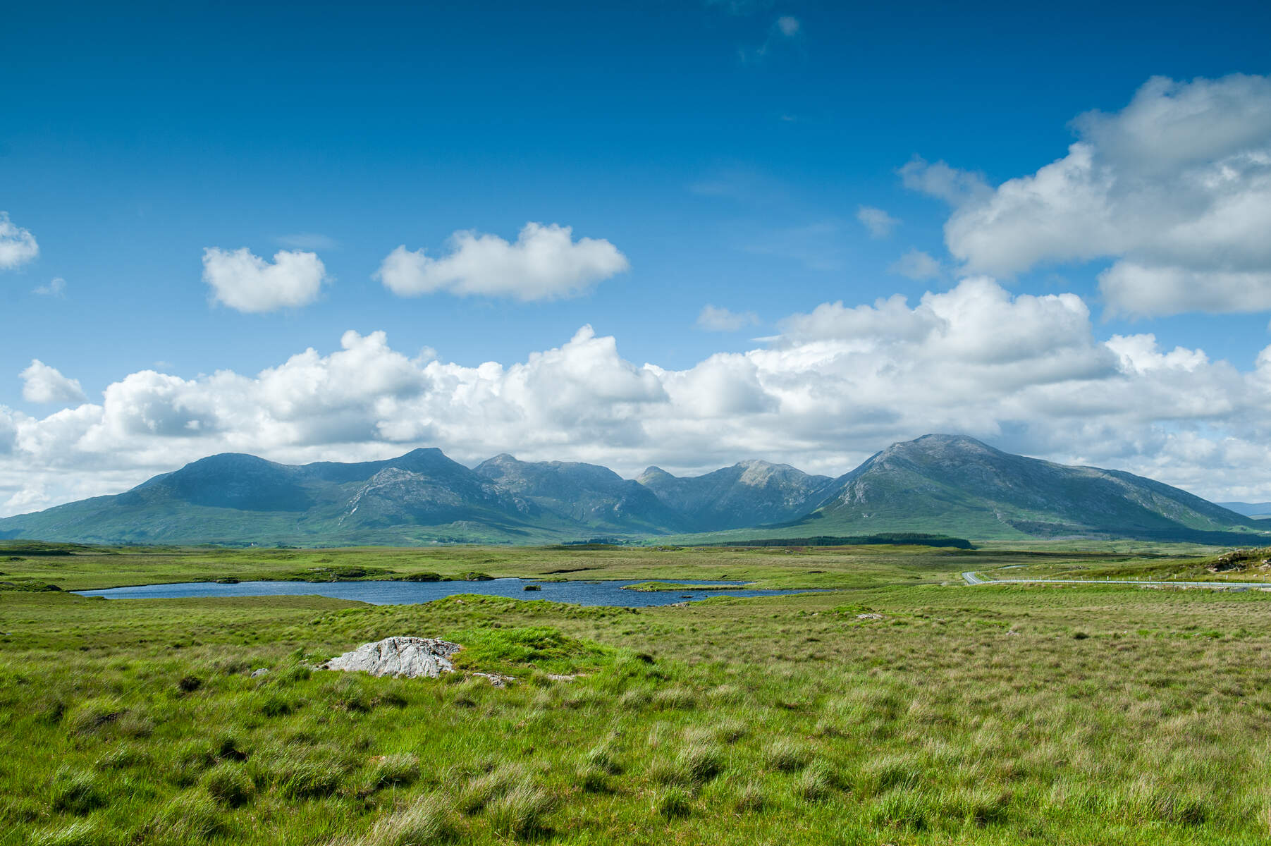
Flora, Fauna & Landscape
During the warmer months the slopes burst with heather, gorse and alpine wildflowers, while the lower bog supports rare blanket‑bog plants. Sheep are a common sight, and birds of prey often circle the ridge. The proximity to Roundstone Bog adds a chance to spot specialised bog‑land flora.
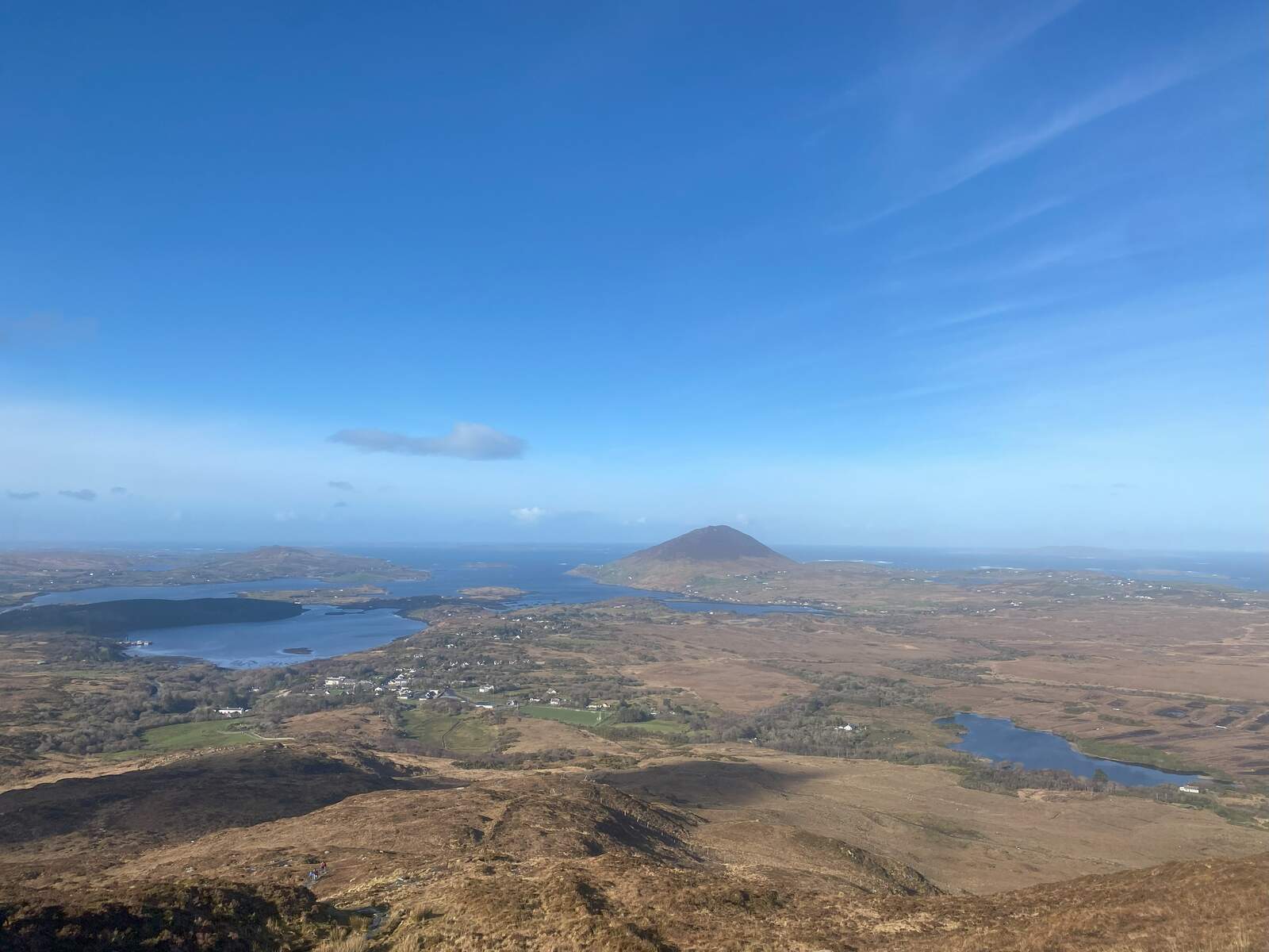
Panoramic Views
From the summit cairn a 360° vista unfolds:
- South – the Aran Islands on a clear day.
- North – the Twelve Bens and the village of Clifden on the horizon.
- East – Roundstone Bog and Dog’s Bay.
- West – the endless Atlantic, with the distant hills of County Mayo visible on exceptionally clear days.
Nearby Attractions & Beyond the Hike
- Roundstone Village – harbour, craft shops, pubs and seafood restaurants.
- Dog’s Bay & Gorteen Bay – sandy beaches perfect for a post‑hike stroll.
- An Trá Mór – a nearby Blue Flag beach ideal for a dip after walking.
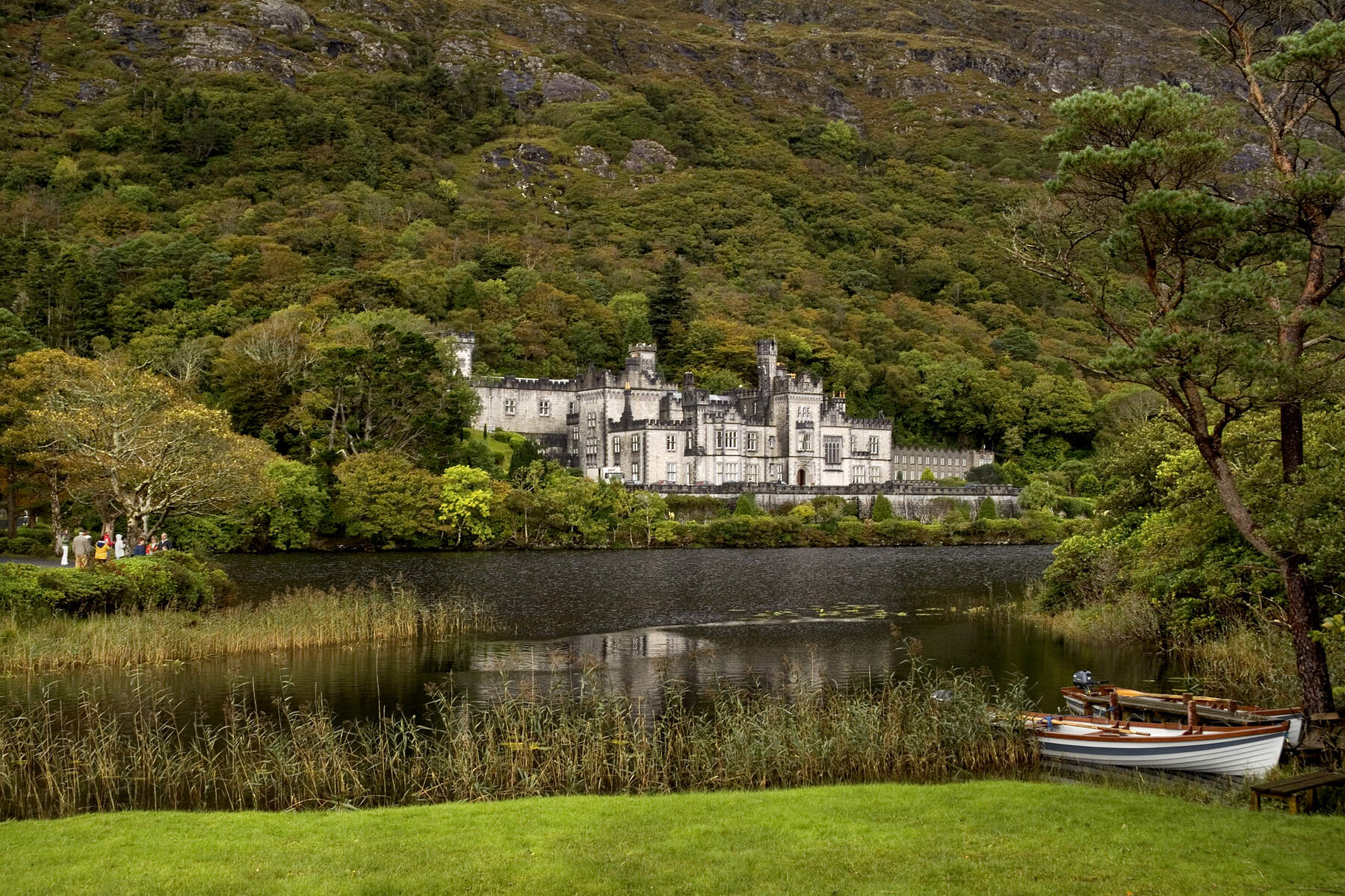
- Kylemore Abbey – historic estate a short drive away.
- Cycling – a 12 km ride from Ballynahinch Castle estate to the trailhead offers an alternative perspective.
Getting There
By Car – From Galway city take the R341 westwards; the trailhead car park is sign‑posted just outside Roundstone. Parking is free but limited, arriving early in peak season is advisable.
Public Transport – Bus services run from Galway to Roundstone on weekdays; check the latest Timetable for stops closest to the trailhead. (Further details to be confirmed.)
Practical Information
| Item | Details |
|---|---|
| Trail length | Approx. 5 km (direct) – 7 km (loop) |
| Elevation gain | ~450 m |
| Typical duration | 4–5 hrs (full loop) |
| Difficulty | Moderate to Difficult |
| Parking | Small free car park at trailhead off R341 |
| GPS Coordinates | 53.395050, -9.958932 |
| Admission | Free |
| Best season | Late spring to early autumn for wildflowers and clear views |
| Dog policy | Dogs allowed on leash in sensitive areas |
| Opening hours | Open year‑round |
Enjoy a day of walking, wildlife spotting and unrivalled coastal scenery on Errisbeg Mountain – a compact yet unforgettable slice of Connemara’s wild heart.