Overview
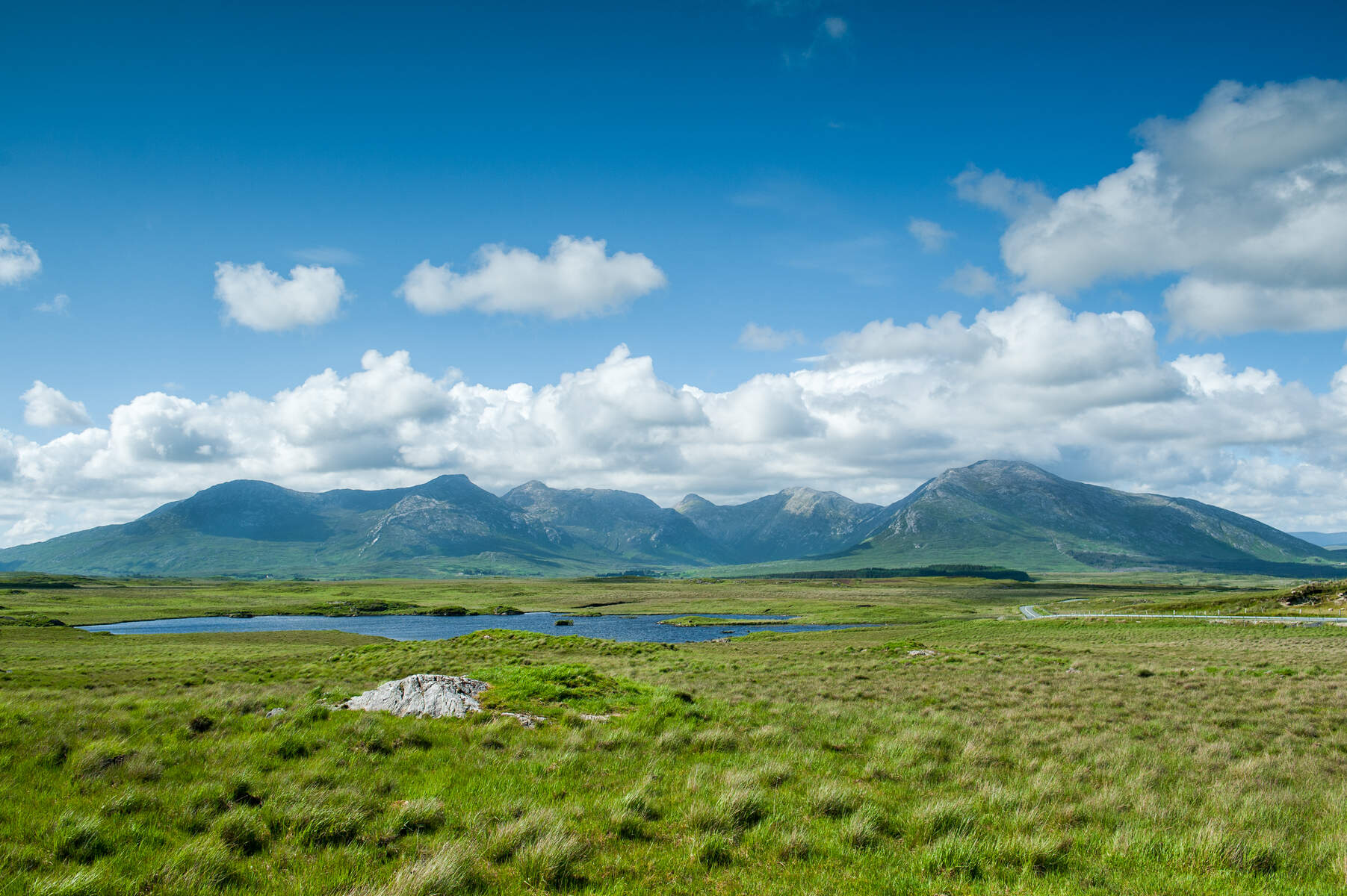
Garraun (Irish: Maolchnoc, meaning “bald hill”) is a 598 m (1,962 ft) mountain that crowns the most northerly tip of the Twelve Bens range in Connemara National Park. Its prominence of 553 m qualifies it as a Marilyn, making it a standout feature on the landscape surrounding Ireland’s largest fjord, Killary Harbour. From the summit you can see the Atlantic coastline, the islands off the coast, and the dramatic backdrop of Kylemore Abbey and Kylemore Lough to the south.
The massif is an isolated hill‑mass, set apart from the main body of the Bens by a broad saddle that opens onto the mouth of the fjord. The terrain is a mix of smooth, grassy slopes and rugged ridges, with stone cairns and shallow mountain lakes dotting the upland area. The eastern ridge, sharp enough to have inspired the name Garraun (possibly from gair “fang”), provides the most direct ascent route.
History & Naming
The name Garraun is of Irish origin. Linguist Paul Tempan suggests two possibilities: garrán “grove” or, more likely, gair “fang”, referring to the sharp eastern spur. Local tradition also records the name Maolchnoc – “bald hill” – which describes the summit’s flat, featureless top. Tim Robinson notes that maol (bald) is the more common descriptor in the area.
A colourful legend ties the mountain to the mythic hero Fionn Mac Cumhaill. Supposedly his dog Bran chased a doe that leapt from the summit; the dog fell into the lake below, giving rise to the place‑name Lemnaheltia (“the doe’s leap”) on the southern slopes. While the story is shared by many Irish locales, it adds a layer of folklore to the landscape.
What to See & Do
Summit Views
The summit itself is a broad, exposed plateau offering 360° panoramas: the Atlantic Ocean to the west, the jagged peaks of the Twelve Bens to the east, and the tranquil waters of Kylemore Lough framing the southern vista. On clear days the distant peaks of the Maumturks and the Mweelrea range are visible.
Nearby Peaks & Features
- Garraun South Top (578 m) – a subsidiary peak that overlooks Kylemore Lough and qualifies as an Arderin.
- Garraun South‑West Top (Altnagaighera) – noted for its conglomerate tors scattered across the summit.
- Doughruagh (596 m) – a double‑top summit directly opposite Kylemore Abbey; its south‑face bears a 1932 Sacred Heart statue erected by the Benedictine nuns, a modest pilgrimage landmark.
- Benchoona (610 m) – a rugged tableland of flat rocks described by Robert Macfarlane as “a rough broken tableland of flat rocks”.
- Letterettrin (Big Peak) – an isolated Marilyn across Lough Fee, offering a striking silhouette against the sky.
- Benbaun (729 m) – the highest peak of the Twelve Bens, reachable via longer ridge walks and linked by the same trail network (see Benbaun).
Walking Routes
| Route | Length | Approx. Time | Difficulty | Starting Point |
|---|---|---|---|---|
| East Spur via Creeragh Church | 5 km (round‑trip) | 2.5 h | B (Intermediate) | Car‑park at Creeragh Church (N59) |
| Lettergesh Loop / Benchoona Horseshoe | 9 km | 4 h | B (Intermediate) | Lettergesh Beach car‑park, Carrickglass |
| Doughruagh‑Kylemore Loop | 8‑10 km | 4‑5 h | B (Intermediate) | Various trailheads; often begins at Garraun South Top |
The East Spur is the most straightforward ascent: a well‑marked path climbs the sharp ridge from the roofed Creeragh Church car‑park, gaining the summit in about 1¼ hours each way. The Lettergesh Loop offers a more varied experience, taking walkers past Cloonagh, around Benchoona, over Garraun South‑West Top, and back via the same trailhead. The longer Doughruagh‑Kylemore Loop adds lakeside walking along Kylemore Lough and Pollacappul Lough, with the chance to view the Sacred Heart statue.
Flora & Fauna
The massif’s upland heath supports heather, gorse and a variety of alpine grasses. Birdwatchers may spot peregrine falcons, ravens and the occasional golden eagle soaring over the cliffs. The surrounding SAC (Special Area of Conservation) protects a mosaic of habitats, from blanket bog to limestone pavement, and is an important breeding ground for the Irish hare.
Geology
Garraun’s landscape is shaped by a complex glacial history. The summit area is underlain by conglomerate rock, giving rise to the distinctive tors on Garraun South‑West Top. Patches of limestone pavement, typical of Connemara’s karst terrain, can be seen on the lower slopes. These geological features contribute to the diverse flora and provide interesting outcrops for amateur geologists.
Practical Information
- Access: The main trailheads are reachable via the N59 road. Parking is free at the Creeragh Church car‑park and at the Lettergesh Beach car‑park.
- Nearest Towns: Letterfrack (≈ 5 km) and Clifden (≈ 15 km) provide cafés, shops and accommodation.
- Public Transport: Bus Éireann route 450 passes through Letterfrack; check the latest timetable for stops closest to the trailheads.
- Navigation: The area is covered by OSi50 map sheet 037 (Mayo, Galway). Grid reference for the summit is L76708 61036.
- Seasonality: May is the most popular month for climbing Garraun, when the weather is relatively stable and the mountain’s wildflowers are in bloom. Winter walks are possible but can be icy; waterproof boots and warm layers are essential.
- Dog Policy: Dogs are permitted on the trails but must be kept under control, especially in the SAC where nesting birds may be present.
- Facilities: No admission fee or opening hours apply; the mountain is open year‑round. There are no permanent facilities on the summit, so bring any required supplies.
- Safety: The routes are classified as B (Intermediate) – suitable for walkers with reasonable fitness and basic navigation skills. The terrain can be exposed, especially on the east ridge, so a map and compass (or a reliable GPS device) are recommended.
- Nearby Attractions: After a walk, visitors often stop at Kylemore Abbey, the historic Benedictine convent overlooking Kylemore Lough, or explore the nearby Diamond Hill for additional panoramic views.
Garraun’s blend of striking geology, mythic history and rewarding hill‑walking makes it a compelling destination for anyone exploring Connemara’s rugged west coast.