Overview
Inishshark, sometimes called Shark Island, lies about 11 km off the Connemara coast of County Galway, directly south of the larger Inishbofin. The island rises to roughly 97 m above sea level and is composed almost entirely of Silurian slates and shales. Today it is a silent landscape of weather‑worn stone cottages, a ruined 19th‑century church dedicated to St Leo, and a handful of Bronze Age burial sites. The last 23 residents were evacuated on 20 October 1960 after decades of isolation, making the island a poignant reminder of Ireland’s island‑evacuation era.
History
The name Inishshark (Irish Inis Airc) may derive from an ancient chief called Erc, the Old Irish word searc (love), or airc meaning “hardship” – a fitting description for a place that earned the nickname “Island of Hardship”. Archaeological evidence shows human activity dating back to the Bronze Age, with burial grounds and stone monuments scattered across the terrain.
In the early medieval period the island was home to a monastic settlement founded by its patron saint, Leo of Inis Airc, who lived there between the sixth and eighth centuries. Remains of a rectangular 19th‑century church, a holy well, stone altars and a beehive‑shaped hut (clochán)—traditionally linked to St Leo—still dot the landscape. The community survived on fishing and farming, but the lack of electricity, running water, and a reliable pier made life increasingly precarious. Tragic incidents, such as three young men drowning on Easter Sunday 1949 and a fatal case of appendicitis in 1948, accelerated the push for evacuation.
The final evacuation in 1960 was documented in the TG4 film Inis Airc, Bás Oileáin (Inishark, Death of an Island), directed by Kieran Concannon. The film interweaves archival footage with interviews from surviving islanders, offering a moving portrait of the island’s last days.
What to See & Do
Ruins and Religious Sites
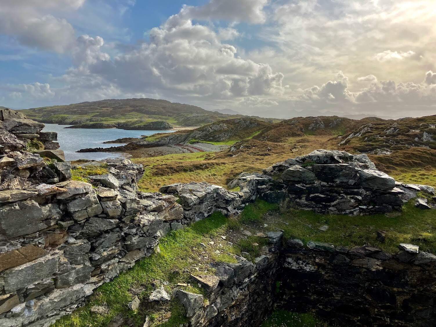
- St Leo’s Church – The stone shell of the 19th‑century church still stands on a modest rise, its graveyard perched on a cliff edge. Visitors can walk among the weathered gravestones and imagine the weekly mass that once echoed here.
- Clochan (Beehive Hut) – A low, circular stone structure that locals once believed to be St Leo’s dwelling. Its thick walls have withstood centuries of Atlantic storms.
- Holy Well and Stone Altars – Scattered near the church, these sites were part of a ritual circuit that islanders continued to visit even after the community left.
Bronze Age Monuments
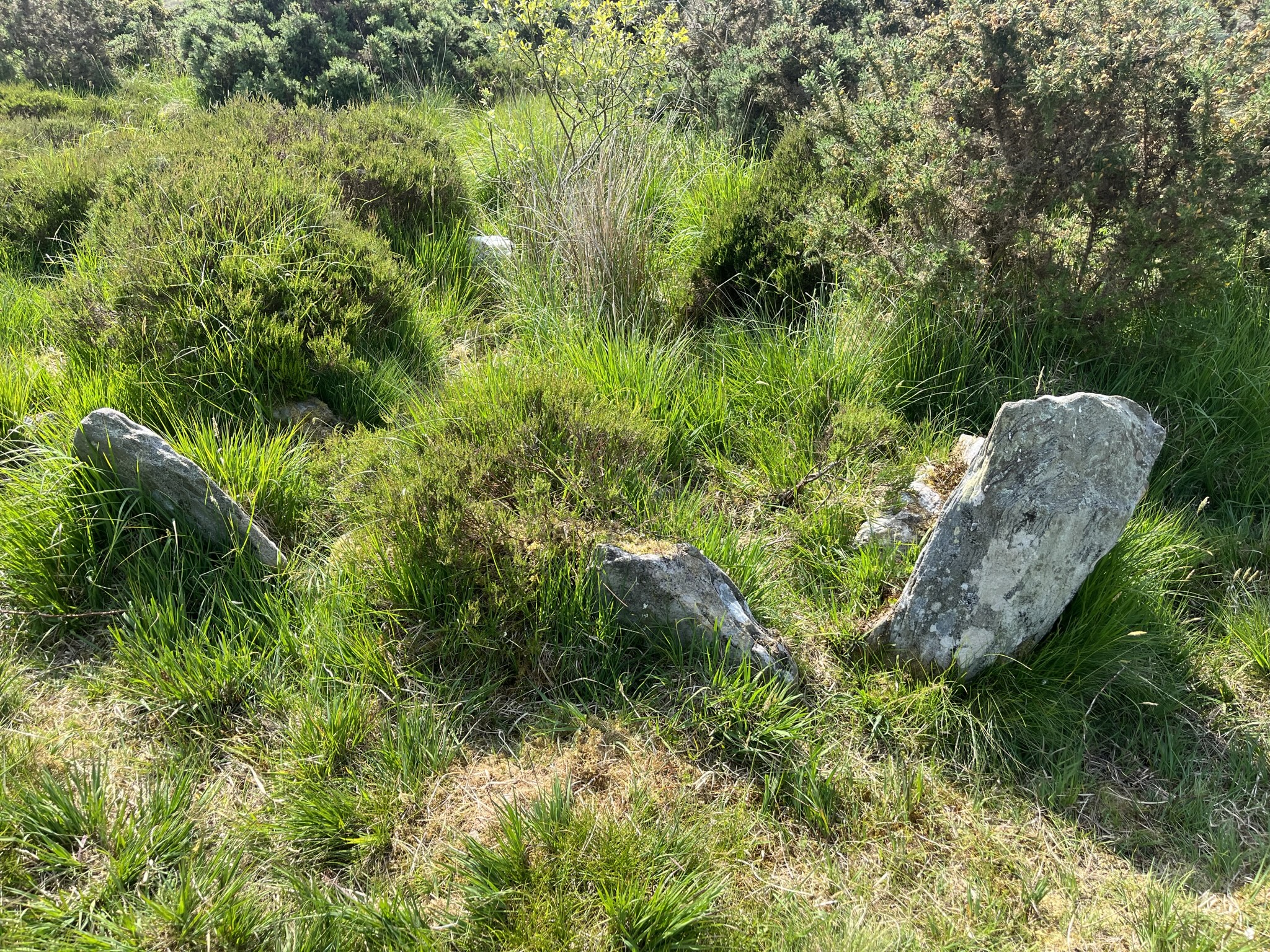
The island’s western slopes hide several burial cairns and stone circles, evidence of a settlement that predates Christianity by millennia. While the exact locations are best identified with a local guide, the sheer sense of antiquity is palpable.
Natural Landscape
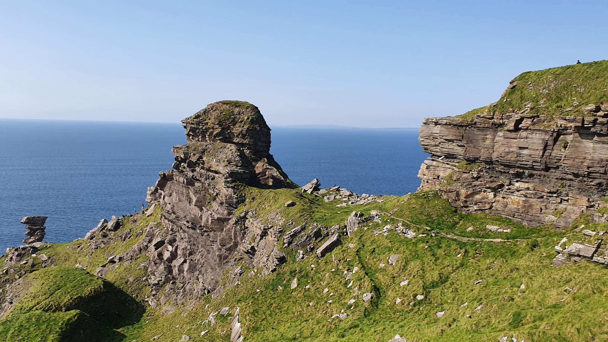
Sheep still graze the island’s green pastures, and the cliffs plunge dramatically into the Atlantic, offering spectacular sea‑stack views. Small alcoves and hidden beaches appear when the tide recedes, perfect for a quiet moment of contemplation.
Walking Routes
A popular self‑guided loop starts at the former pier, follows the low‑lying path past the beehive hut, ascends to St Leo’s church and then continues along the ridge to the western cairns before returning via the coastal track. The walk is roughly 3 km and takes 1½–2 hours, depending on fitness and weather. Bring sturdy footwear and a waterproof jacket.
Wildlife & Birdwatching
The island’s cliffs host colonies of seabirds such as guillemots, razorbills and kittiwakes during the breeding season (April‑July). Grey seals are occasionally sighted on the outer rocks, especially in early summer. Bird‑watchers should carry binoculars and respect nesting areas.
Archaeological Exploration
Since 2019, a team of students from the University of Notre Dame has been conducting intensive digs, examining kelp‑industry remains, emigration patterns, and medieval artefacts. Guided tours often include a brief overview of their latest discoveries.
Practical Information
Access – Inishshark is reachable only by boat. The most common route is a short charter from Inishbofin, itself accessed by a 40‑minute ferry from the mainland village of Cleggan. Boat operators usually wait for a suitable tide before departing; the landing point is a modest pier whose remains are still visible.
How to get there – Charter a boat from Inishbofin (local operator Aidan Day – phone 086 832 4123). The crossing takes roughly 10‑15 minutes, subject to sea conditions.
Admission – Free; the island is public land.
Facilities – None on Inishshark – no toilets, water or shelter. Visitors should bring food, water, a map and a fully charged mobile phone.
Guided tours – Local historian Tommy Burke offers walking tours that highlight Bronze Age sites, monastic ruins and the ongoing archaeological work. Book in advance, especially during the Inishbofin Walking Festival in April.
Safety – Terrain is uneven and cliffs can be slippery when wet. Wear sturdy footwear, check tide tables before setting out, and keep to the established paths.
Best time to visit – Late spring to early autumn provides the most reliable weather and longer daylight hours, allowing ample time to explore the ruins before the tide changes.
Contact Details
- Boat charter (Aidan Day, Inishbofin): 086 832 4123
- Guided tours (Tommy Burke): 086 832 4123 (same number as the charter operator)
- Documentary: Inis Airc, Bás Oileáin – available through TG4 and the Irish Studies Film Series.
Nearby Islands & Day Trips
While on the same boat, consider a quick stop at Inishbofin to experience its vibrant community, bird‑watching opportunities and historic sites. The two islands together illustrate the contrasting fortunes of Connemara’s offshore communities. For a broader island‑hopping experience, the Aran Islands lie further west and are reachable from the mainland via regular ferries.
Inishshark may be uninhabited, but its silent stones, sweeping cliffs and layered history make it a compelling destination for anyone interested in Ireland’s maritime heritage and the resilience of its island peoples.