Overview
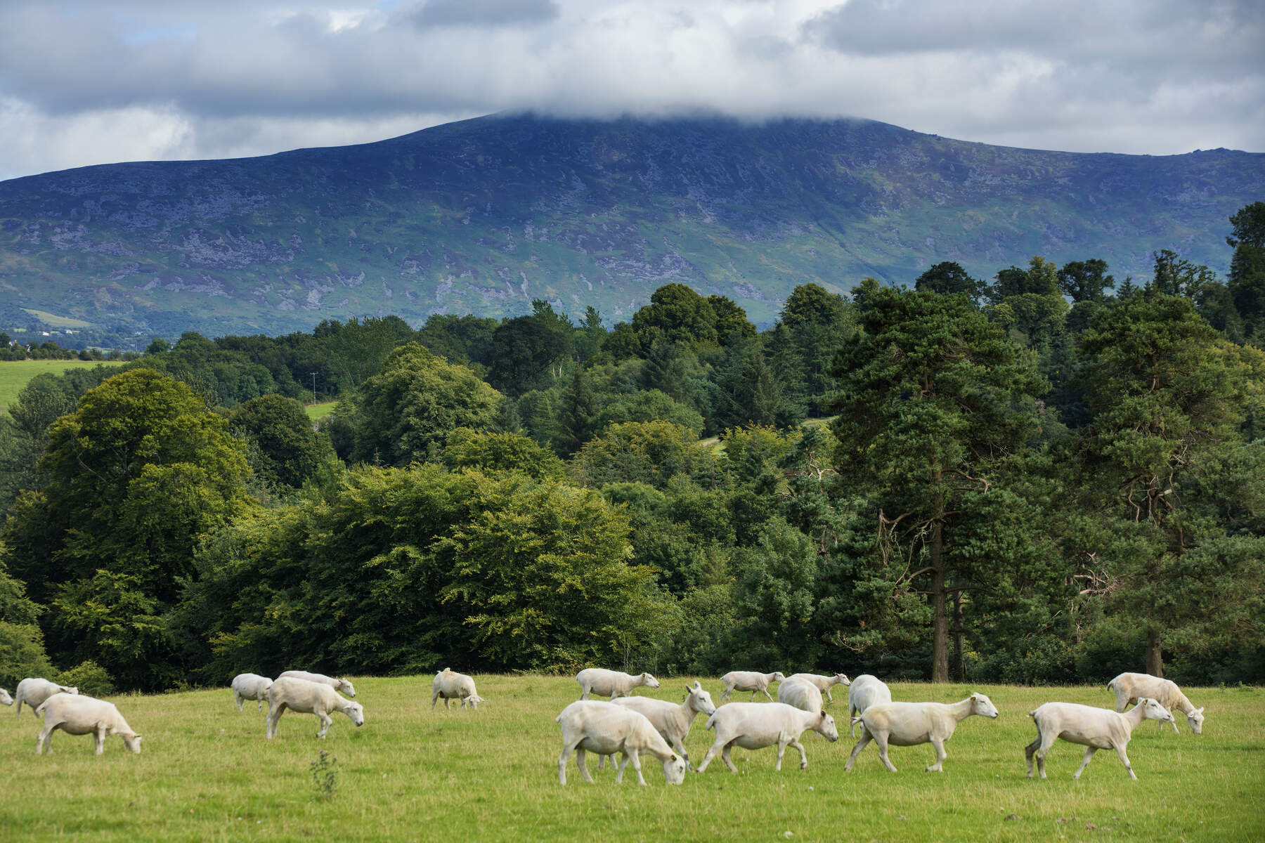
Kilbranish (Irish: Cill Breatnais or Coill Breatnais) sits on the fringe of the Carlow lowlands, a short drive north of Bunclody. Managed by Coillte, the forest is a mixed plantation of spruce, fir, larch and pine. From the forest floor walkers enjoy sweeping panoramas of Mount Leinster, the Blackstairs Mountains and the wind‑farm turbines perched on Greenoge Hill. The site is open 24 hours a day, all year, and entry is free.
History & Background
The dual Irish names reveal the area’s heritage – Cill Breatnais means “Walsh’s Church” and Coill Breatnais means “Walsh’s Wood”. While the trees are a modern re‑forestation effort, the surrounding landscape has been shaped by centuries of farming and the historic South Leinster Way, a long‑distance walking route that still threads through the woods.
What to See & Do
The Three Way‑Marked Loops
| Loop | Length | Ascent | Difficulty | Typical Time | Waymark |
|---|---|---|---|---|---|
| Kilbrannish Loop | 5.1 km | 150 m | Strenuous | 1 h 40 min | Purple arrows on yellow background |
| Wind Farm Loop | 3 km | – | Moderate | 1 h | Blue markers |
| John’s Hill Loop | 11 km | – | Strenuous | 3 h | Blue markers |
- Kilbrannish Loop – The flagship route climbs the forestry road to Kilbrannish Hill, passes the Croaghan standing stone and offers intermittent clear‑cut viewpoints over the Carlow plains, Myshall, Tullow and the distant transmission mast on Mount Leinster.
- Wind Farm Loop – A gentle 3 km circuit that shares the initial ascent of the main loop before returning to the car‑park. It provides quick, scenic views of the turbines on Greenoge Hill, which power roughly 4,500 homes.
- John’s Hill Loop – The most demanding trek, winding to John’s Hill and looping back. It rewards walkers with expansive vistas of Bunclody, the Carlow lowlands and the Blackstairs range.
Additional experiences include bird‑watching in the quiet interior, a short stretch of the South Leinster Way that links Kilbranish to a wider network of Irish trails, and a modest picnic site beside the car‑park.
Practical Information
- Trailhead & Parking: Kilbrannish Woods car‑park (≈10 free spaces) off the Mount Leinster road, open 24 / 7.
- GPS Coordinates: 52.6563175, ‑6.7544674 (alternative: 52.6564606, ‑6.7545627).
- Dog Policy: Dogs are welcome but must be kept on a lead at all times to protect wildlife and other walkers.
- Waymarking: Purple arrows for the Kilbrannish Loop; blue markers for the Wind Farm and John’s Hill loops.
- Facilities: Free picnic area near the car‑park; no toilet facilities are mentioned in the sources.
- Navigation: A downloadable OSI map is available from Coillte (see Coillte’s forest‑map page for Kilbranish).
Nearby Attractions
While you’re in the area, consider adding a few more Carlow highlights to your itinerary:
- Kilbrannish Hill – The hill that gives the forest its name, offering a short, steep climb and 360° views of the surrounding countryside.
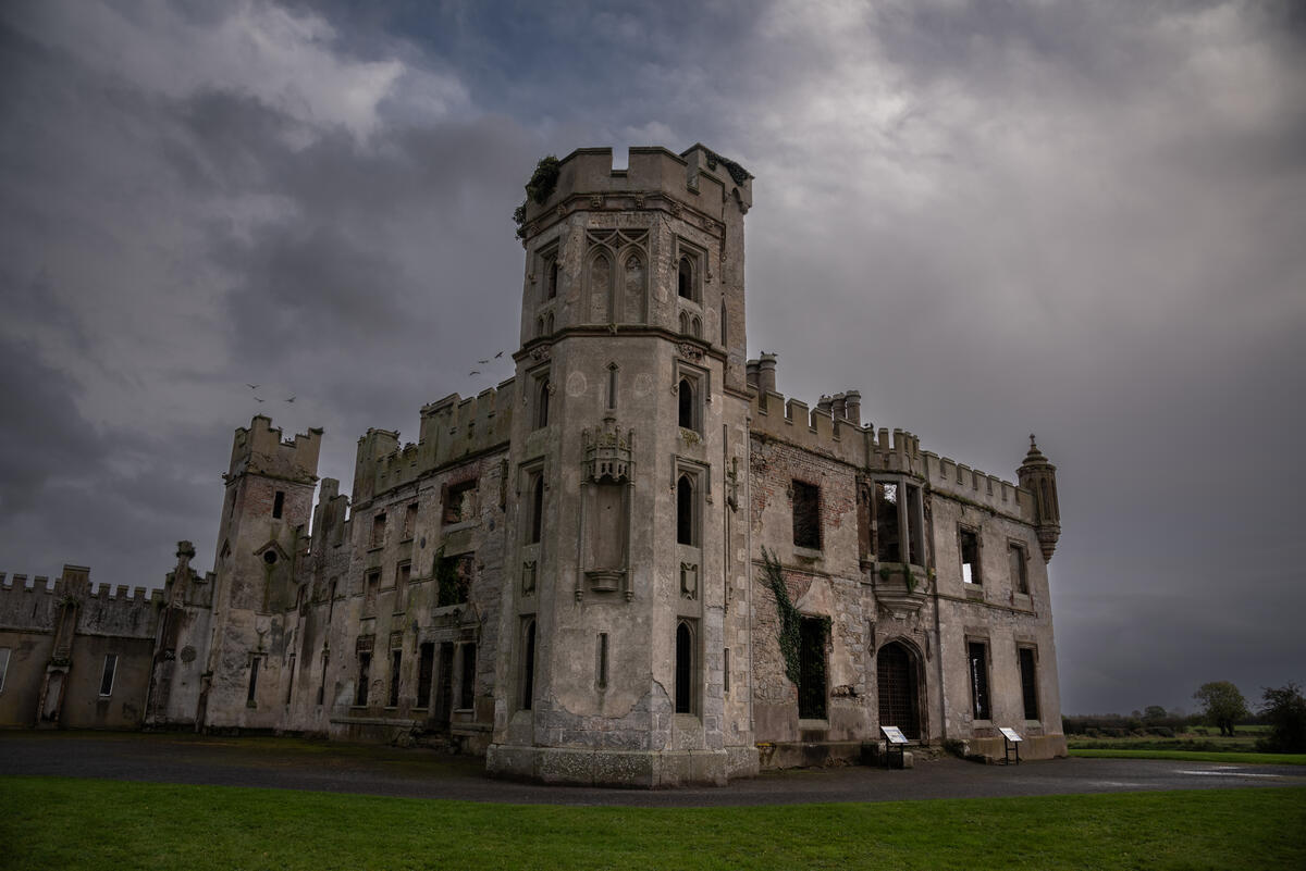
- Duckett’s Grove – A short drive east, this gothic ruin and restored walled garden provide a historic contrast to the forest walks.
- Brownshill Dolmen – An impressive Neolithic portal tomb near Carlow town, ideal for a quick cultural stop.
- Mount Leinster Heritage Drive – A scenic loop road that showcases the dramatic peaks and wind‑farm landscape visible from Kilbranish.
Enjoy a day of fresh forest air, striking mountain scenery and well‑maintained trails at Kilbranish Village and Kilbrannish Hill.