Overview
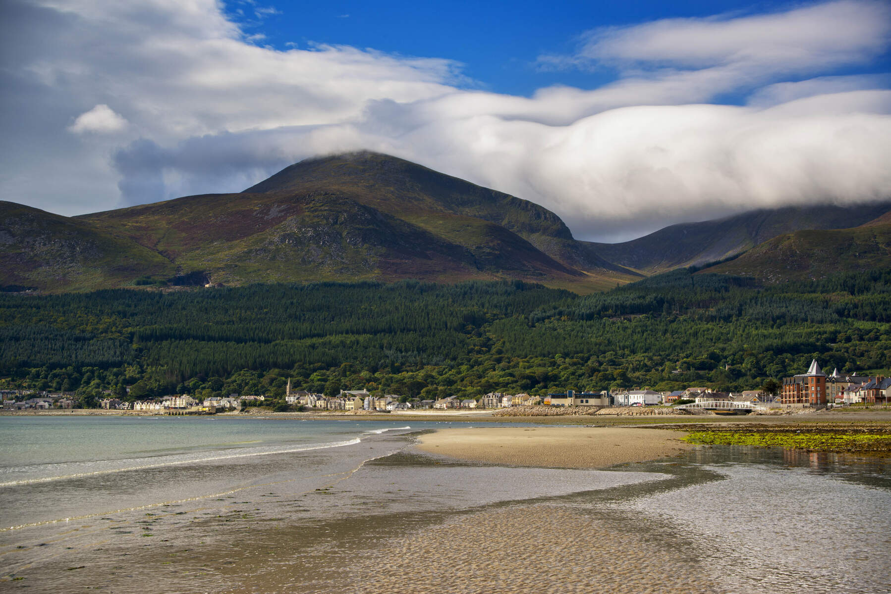
The Mourne Mountains, often simply called the Mournes, are a compact granite range stretching roughly nine miles between Newcastle and Rostrevor in County Down. Designated an Area of Outstanding Natural Beauty and a UNESCO Global Geopark, the Mournes boast twelve summits over 2,000 ft, the highest being Slieve Donard at 850 m (2,790 ft) – the tallest peak in Ulster. Over 50,000 visitors a year wander the heather‑capped ridges, the dry‑stone Mourne Wall, and the deep‑valley reservoirs that supply water to Belfast and the surrounding counties.
History & Background
The name Mourne derives from the Gaelic clan Múghdhorna, while the older Irish name na Beanna Boirche means “the peaks of the peak district”. The range’s granite was formed 66 million years ago by deep‑seated magma and later sculpted by successive glaciations, leaving classic U‑shaped valleys such as Silent Valley. In the early 20th century the Belfast Water Commissioners purchased 36 km² of the high ground to protect the catchment for the Silent Valley Reservoir and Ben Crom reservoirs. To keep livestock out of the water supply, a 35‑km dry‑stone wall – the Mourne Wall – was erected between 1904 and 1922, crossing fifteen summits and now a listed historic structure.
The National Trust acquired nearly 1,000 ha of the range in 1993, including parts of Slieve Donard and Slieve Commedagh. Proposals to elevate the area to Northern Ireland’s first national park have sparked debate among the 1,000 + farmers who live within the landscape, balancing conservation with long‑standing agricultural practices such as controlled gorse burning.
What to See & Do
Peaks and Walks
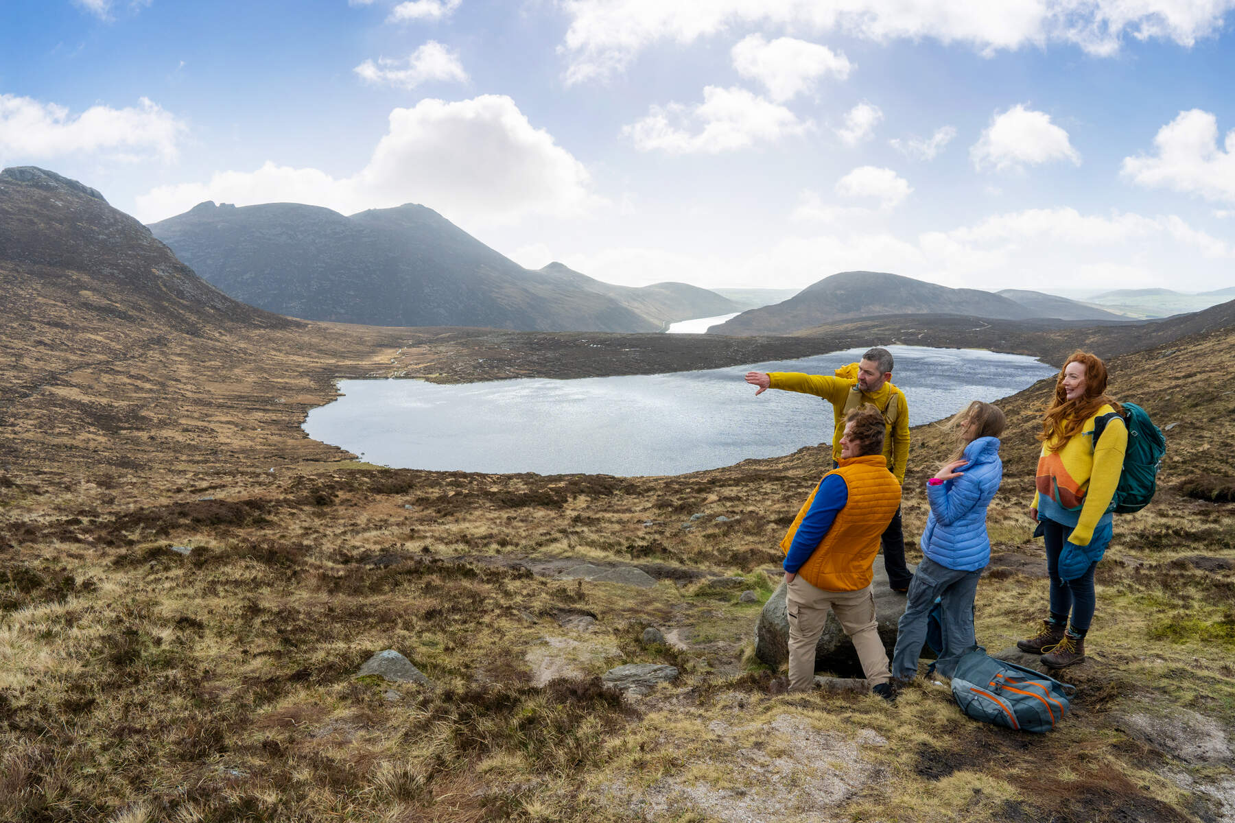
- Slieve Donard – the classic Glen River route (≈9 km round‑trip, 4‑5 hrs) follows the Mourne Wall to the summit cairns, offering panoramic views that can stretch to the Isle of Man, Scotland and the Wicklow Mountains on a clear day.
- Mourne Wall Challenge – a 30‑km strenuous circuit that traverses fifteen summits, popular with charity walkers each July. The route can be split over two days, with a midway campsite at Meelmore Lodge.
- Six‑Peak Challenge – a three‑day trek covering Slieve Donard, Slieve Commedagh, Slieve Bearnagh, Slieve Binnian, Slieve Meelmore and Slieve Meelbeg, ideal for seasoned hikers.
- Hare’s Gap – a dramatic mountain pass accessed from Trassey Car Park; the walk is relatively short (≈7 km) but rewards with sweeping valley vistas.
Forests and Reservoirs
- Tollymore Forest Park (near Newcastle) – 630 ha of mixed woodland, 16 historic stone bridges over the Shimna River, and four colour‑coded walking trails, including the popular Long Haul Trail.
- Donard Forest – borders Donard Park and offers gentle riverside walks along the Glen River, perfect for families.
- Rostrevor Forest – home to the legendary 30‑tonne Cloughmore Stone and the Narnia‑themed trail.
- Silent Valley Reservoir – built 1922‑33, it supplies most of County Down and Belfast. The reservoir is surrounded by the Heritage Trail (3 km) and the longer Ben Crom Dam Walk (10.5 km).
- Ben Crom and Spelga Reservoirs – striking upland lakes that provide dramatic backdrops for photography and quieter walks.

Rock Climbing and Wildlife
The Mournes host around 900 climbing routes across 26 crags, with granite tors offering excellent friction. While the climbs are generally moderate, many require cams for protection. Birdwatchers can spot raptors such as the peregrine falcon and buzzard, as well as wren, stonechat and the occasional golden‑eagle (last recorded 1836). Sheep graze the high‑altitude heaths, and the flora is dominated by heather, gorse, wild thyme and the rare heath‑spotted orchid.
Culture and Film
Percy French’s 1896 song The Mountains of Mourne immortalised the range, and the area inspired C. S. Lewis’s Narnia. More recently, the Mournes have featured in HBO’s Game of Thrones and numerous local art works.
Practical Information
| Feature | Details |
|---|---|
| Coordinates | 54.15693 ° N, ‑6.15346 ° W |
| Highest summit | Slieve Donard – 850 m |
| Mourne Wall length | 35 km (22 mi), crosses 15 summits |
| Reservoir access | Silent Valley open daily 10:00‑18:00 (Apr‑Oct) / 10:00‑16:00 (Nov‑Mar) – car park £5, on‑foot £1.60 adult |
| Parking | Free car parks at Donard Forest, Tollymore, and many trailheads; paid car park at Silent Valley (see above) |
| Public transport | Ulsterbus routes from Belfast Europa to Newcastle and Newry; a less‑frequent cross‑country bus from Newry to Newcastle; the “Rambler Bus” runs an anti‑clockwise loop from Newcastle three times daily |
| Visitor centre | Newcastle Visitor Information Centre, 10‑14 Central Promenade, BT33 0AA – Tel 0330 137 4046 |
| Website | Discover Northern Ireland – Mourne Mountains |
Getting There
The Mournes lie about an hour’s drive south of Belfast. From Belfast International Airport or George Best Belfast City Airport, follow the A2 coastal road to Newcastle, then follow sign‑posted routes to the various trailheads. For those preferring public transport, regular Ulsterbus services connect Belfast, Newry and Newcastle; the nearest train stations are Newry (Enterprise service) and Belfast Central.
Parking and Fees
Most trailheads have free parking, but the Silent Valley car park charges a modest fee (see table). No entry fee is required to walk the mountains themselves – the area is open access land. If you plan to use the Mourne Wall Challenge organised event, check the event website for any registration costs.
Safety and Services
Mountain rescue is provided by the volunteer Mourne Mountain Rescue Team based in Newcastle; their safety advice is available at Mourne Mountain Rescue. Mobile coverage is generally good in towns but can be patchy on higher ridges, so carry a fully charged phone and consider a personal locator beacon for longer routes.
Accessibility
While the high‑level summits involve steep, uneven terrain unsuitable for wheelchairs, several lower‑level walks are more accessible. The Tollymore Forest Stepstones Loop and the Silent Valley Heritage Trail are relatively flat and well‑maintained, offering wheelchair‑friendly sections.
Seasonal Notes
The Mournes receive up to 2,000 mm of rain annually, creating lush vegetation but also occasional landslides after heavy storms. In April 2021 a major gorse wildfire burned large swathes of the eastern Mournes; fire‑breaks are now maintained, and burning of gorse/heather is only permitted between 1 Sept and 14 Apr under strict supervision.
Current Issues
A proposed wind‑farm at Gruggandoo (eight 200‑ft turbines) has met strong local opposition due to its location within the AONB and potential impact on wildlife. As of 2020 the council has asked for a public inquiry. Visitors are encouraged to respect ongoing conservation efforts and stay on marked paths.
Suggested Itinerary (Sample)
Day 1 – Newcastle base: Start with the Glen River ascent to Slieve Donard, descend via the Mourne Wall, then unwind in Donard Forest. Evening in Newcastle’s seaside pubs.
Day 2 – Tollymore & Silent Valley: Explore Tollymore’s stone bridges and the Long Haul Trail, then drive to Silent Valley for the Heritage Trail and a coffee at the on‑site café.
Day 3 – Wall Challenge or Coastal Walk: Either tackle a section of the Mourne Wall (e.g., Slieve Bearnagh to Slieve Meelmore) or follow the coastal route from Newcastle to Annalong, ending with a sunset on Newcastle Beach.
Whether you’re after a gentle forest stroll, a challenging multi‑day ridge walk, or a glimpse of the mythic landscapes that inspired legends, the Mourne Mountains deliver an unforgettable Irish adventure.