Overview
North Bull Wall stretches out into Dublin Bay as the southern spine of North Bull Island, a 5 km long sand spit that emerged in the early 19th century when the wall was built to deepen the Liffey’s shipping channel. Today the wall frames a popular seaside promenade, a small but well‑maintained bathing zone, a historic lighthouse and the striking Star of the Sea statue at its seaward tip. The area is free to enter and forms part of Dublin City Council’s extensive network of parks, nature reserves and coastal walkways.
History
The silting of the River Liffey plagued Dublin’s port for centuries. After the Great South Wall (completed 1730) failed to keep the channel clear, the Ballast Board commissioned a new barrier. Captain William Bligh surveyed the bay in 1801 and recommended using the North Bull sandbank to create a Venturi‑effect flow. Construction began in 1820 under engineer George Halpin; the stone wall was finished in 1825 at a cost of £95,000. The resulting tidal currents deepened the Liffey mouth from 1.8 m to 4.8 m and deposited sand on the leeward side, gradually forming the island we now know as North Bull Island.
The wall’s early years saw a wooden bridge (Bull Bridge) erected in 1819 to aid construction, later replaced in 1906‑07. Over the next decades the island hosted horse‑tram services, a Coast Guard station, shooting ranges and even a World War I trench‑training ground. In 1931 the island was declared Ireland’s first National Bird Sanctuary, and it now carries a suite of EU and UNESCO designations, including a Biosphere Reserve and Special Protection Area.
What to See & Do
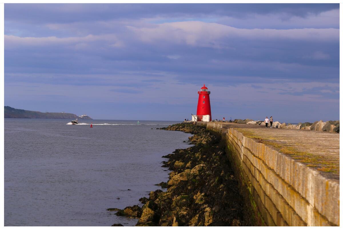
- North Bull Lighthouse – perched at the wall’s low‑tide end, the lighthouse is a classic red‑brick beacon that still guides vessels into Dublin Bay.
- Star of the Sea statue – a bronze figure funded by Dublin Port workers in 1972, standing as a maritime tribute.
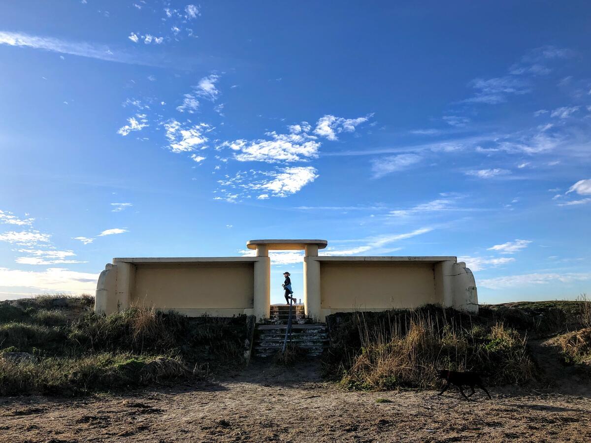
- Lifeguarded bathing area – a series of changing shelters and steps lead directly to the water. Lifeguards are on duty throughout the official bathing season, and the area is equipped with public toilets.
- Interpretative Centre – located at the right‑hand side of the causeway, the centre offers displays on the island’s flora, fauna and engineering heritage. It is a popular stop for school groups.
- Bird‑watching – the wall borders the National Bird Sanctuary; winter flocks of Brent geese, Bar‑tailed Godwit and Oystercatchers are common, while summer brings terns and skylarks nesting in the dunes.
- Kite‑surfing launch – the shallow, wind‑swept stretch near the wall is a designated launch zone, ideal for beginners.
- Happy Out café – a small café at the wall’s end provides coffee, snacks and a place to rest while taking in panoramic views of Dublin Bay.
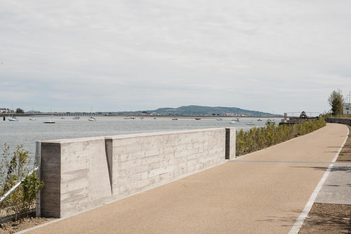
- Walking & cycling – the promenade forms part of the North Bull Island walk, a 1‑2 hour circuit that can be extended into St Anne’s Park or along Dollymount Strand.
Getting there
Information on the nearest DART stations, bus routes and cycle‑path connections is required.
Practical Information
Access – The wall is reachable via two pedestrian links: the historic wooden Bull Bridge at the Clontarf/Dollymount end and the causeway road at Raheny. Both are car‑free; the causeway is a level road that does not flood at high tide.
Parking – No dedicated car park exists on the wall itself. Free on‑street parking is available along the Bull Wall, but drivers must avoid blocking the footpath. Golf‑course members may use the club’s private bays, and St Anne’s Golf Club provides a public car park on Clontarf Road.
Facilities – Public toilets are situated near the bathing shelters. The lifeguarded zone is clearly sign‑posted, and the bathing area is accessed via steps from the shelters. Dogs must be kept on a leash at all times to protect nesting birds and ground‑dwelling wildlife.
Opening hours & fees – The promenade and beach are open every day, 24 hours. Entry is free of charge. Lifeguard services operate only during the official bathing season (typically May‑September) and follow the standard Dublin City Council seasonal schedule.
Navigation – For precise location, use the coordinates 53.3594 N, 6.1795 W (Google Maps link: North Bull Wall).
Nearby attractions – After a walk, visitors often continue to Dollymount Strand, St Anne’s Park, or the historic Clontarf area. The island’s two golf clubs (Royal Dublin Golf Club and St Anne’s Golf Club) are also accessible from the wall.
Conservation note – The wall and surrounding dunes are part of a protected nature reserve. Visitors are asked to stay on marked paths, avoid disturbing nesting sites and refrain from feeding wildlife.
North Bull Wall offers a rare blend of engineering heritage, coastal recreation and wildlife sanctuary – all within a short walk from Dublin’s city centre.