Overview
Painestown is a quiet pocket of County Kildare where the landscape is dominated by the meandering Painestown River. The river, a tributary of the Morell River, threads its way through farmland, under major transport routes and past the impressive Painestown River Aqueduct on the Grand Canal. A short drive north of the village brings you to the site of an extraordinary early‑medieval Ogham stone, now housed in the National Museum of Ireland, that commemorates a king of Leinster. Together, the river and the stone give visitors a rare glimpse of both natural serenity and Ireland’s deep Celtic past.
History & Background
The Painestown River rises in Porterstown, Kilteel, and flows northwest, crossing the N7 at Blackhill before meeting the Kill and Slane Rivers at Painestown. Its course continues north, passing under the Grand Canal at the Painestown River Aqueduct – a fine example of 18th‑century engineering that allowed canal traffic to cross the river without interruption. The river finally joins the Morell River near Turnings Upper, south of Straffan, contributing to the larger River Liffey system.
The cultural heritage of the area is highlighted by the Painestown Ogham stone (catalogue CIIC 40). Discovered lying in a field near Seneschalstown House in the barony of Duleek Lower, the stone measures 2.24 m × 0.76 m × 0.33 m. Its inscription, carved in two lines on the face, reads MAQI‑CAIRATINI AVI INEQAGLAS, which translates to “of Mac‑Cáirthinn Uí Enechglais”. Linguistic analysis dates the stone to the first half of the 6th century, linking it to a king of Leinster and Tara mentioned in early Irish annals. After being recorded in 1898, the stone spent time in the grounds of Piltown House near Drogheda before being transferred to the National Museum of Ireland, where it can be viewed today.
What to See & Do
Follow the River Trail
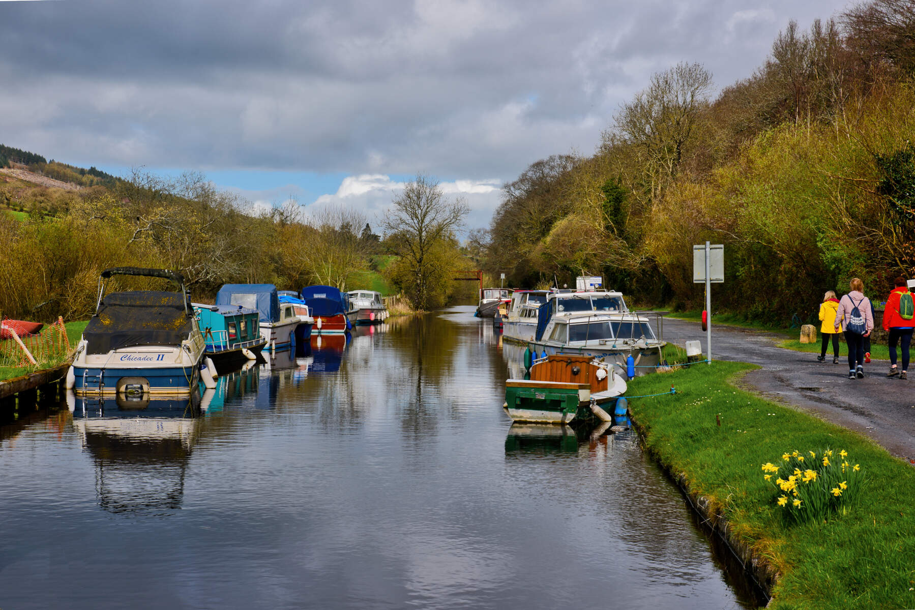
The Painestown River corridor is ideal for a relaxed walk or a gentle bike ride. Starting at the N7 crossing at Blackhill, you can trace the river’s path northward, pausing at the historic Killeenmore Bridge for photos of the stone arch spanning the water. The Grand Canal aqueduct is a highlight – the stone structure allows canal barges to glide over the river, and the surrounding towpath offers a flat, well‑maintained route suitable for families and wheelchair users where the surface is compacted stone. For longer treks, the trail links to the nearby Barrow Way, a 120‑km walking route that follows the River Barrow through Kildare and beyond.
Explore the Aqueduct and Canal Heritage
The Grand Canal, completed in the late 1700s, remains a working waterway. Near the aqueduct, interpretive signs explain the engineering techniques used to build the stone arches and the role of the canal in Ireland’s commercial development. You can watch narrowboats navigating the canal while the river flows quietly beneath.
Visit the Ogham Stone (via the National Museum)
Although the original stone now resides in Dublin, the National Museum of Ireland provides a detailed display, including 3‑D models and high‑resolution photographs accessible through the museum’s online portal. The museum’s opening hours are Monday‑Saturday 10:00‑17:00 and Sunday 12:00‑17:00; admission to the permanent collection is free.
Dive Deeper with Digital Resources
The Ogham stone’s digital record is hosted at the School of Celtic Studies’ Ogham database. Visitors can download the 3‑D PDF, OBJ files, or view the inscription in the EPIDOC format. These resources are valuable for anyone interested in Celtic linguistics or archaeology and can be explored before or after a field visit.
Practical Information
Painestown is easily reached by car via the N7 motorway, which runs east‑west between Dublin and Limerick. A convenient parking area exists near the Blackhill river crossing; from there, the river trail is a short walk. The Grand Canal towpath is public and wheelchair‑accessible where the surface is compacted stone, though some sections near the aqueduct may be uneven.
Getting there
- By car: Take the N7 eastbound from Dublin, exit at Blackhill, and follow local signs to the river trailhead.
- By train: The Dublin‑Cork railway line passes over the river at Baronrath; the nearest station is Kildare, from which a short taxi ride brings you to the trail.
- Public transport: Bus routes serving Kildare town stop within a 5‑minute walk of the river access point.
Nearby amenities Painestown lies a few kilometres from the town of Kildare, where you’ll find cafés, pubs, and a visitor centre offering maps of local walking routes. Restrooms are available at the Kildare Visitor Centre.
Coordinates – The original find‑spot of the Ogham stone is approximately ‑6.565704 longitude, 53.667656 latitude; the stone’s current museum location is ‑6.254558 longitude, 53.340408 latitude.
Seasonal Tip
The canal towpath is at its most pleasant in late spring and early autumn, when the surrounding fields are lush and the water level is stable, making for comfortable walking and cycling conditions.
For further reading, see the Painestown River Wikipedia page and the Ogham stone digital record.