Overview
Slea Head (Irish: Ceann Sléibhe) marks the westernmost tip of the Dingle Peninsula in County Kerry. The 38 km (24 mi) Slea Head Drive (Slí Cheann Sléibhe) loops from Dingle along the R559, hugging sheer Atlantic cliffs and offering uninterrupted panoramas of the Blasket Islands, Dunmore Head – the absolute westernmost point of mainland Ireland – and, on clear days, the distant Skellig Islands. The route lies in the Gaeltacht, where Irish is spoken daily, and forms a highlight of the Wild Atlantic Way.
History / Background
The landscape is built on the Devonian‑age Slea Head Formation, a bed of pebbly sandstones and conglomerates known locally as “old red sandstone”. Millennia of Atlantic storms have sculpted the dramatic headlands and cliffs seen today. To the north‑west, Dunmore Head bears the wreck of the Spanish container ship Ranga (1982).
Human history is equally rich:
- Pre‑historic forts such as Dunbeg Fort guard the coastline.
- Early Christian beehive huts (clocháns) dot the shore, with a notable cluster near Fahan.
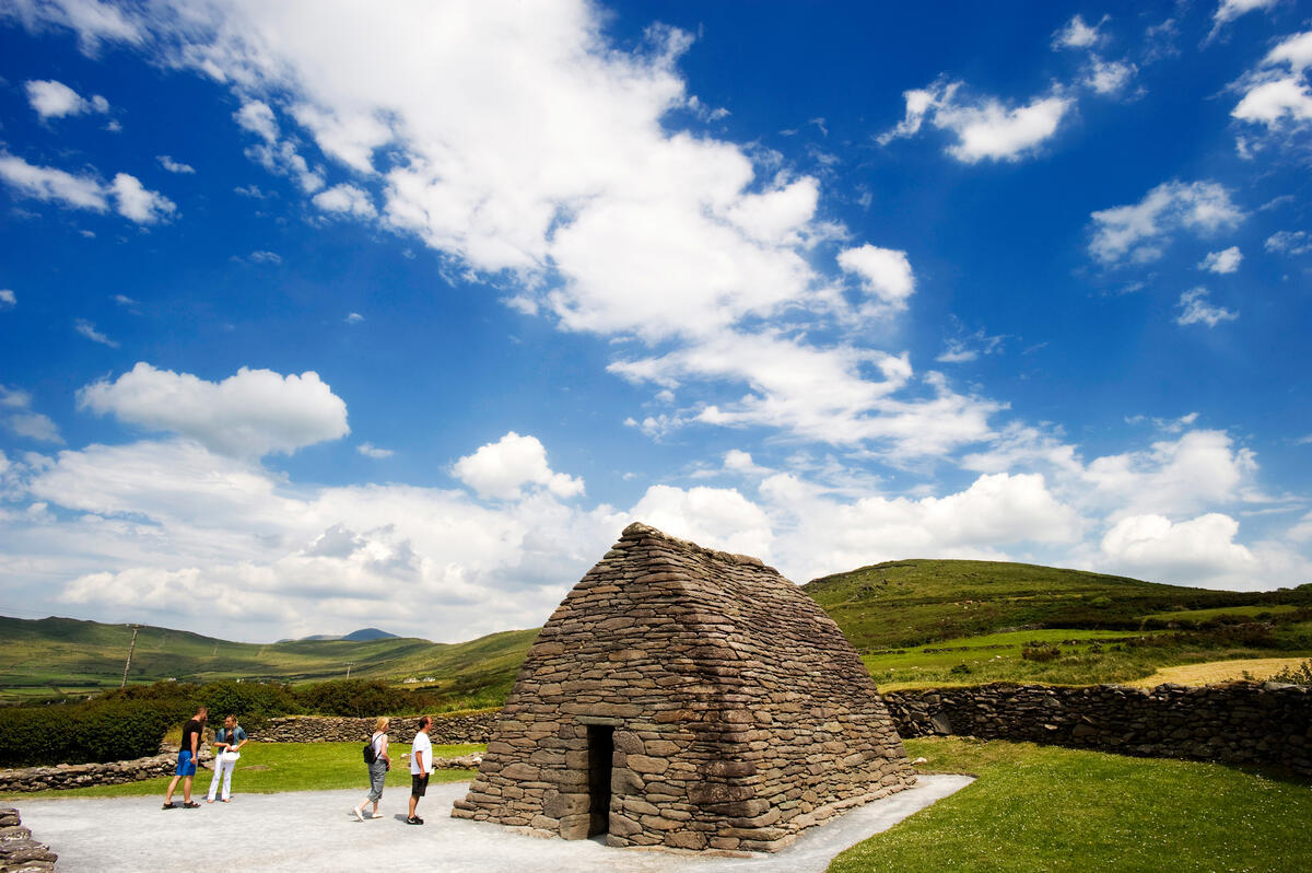
- The 11th‑12th‑century Gallarus Oratory stands as one of Ireland’s best‑preserved stone churches.
- 19th‑century famine cottages at Ventry recall the Great Irish Famine.
- Traditional mountain farming lives on through sheep‑dog demonstrations.
The area has also attracted filmmakers – Coumeenoole Beach featured in Ryan’s Daughter and the Ceann Sibéal headland doubled for the Skellig Islands in Star Wars: The Force Awakens.
What to See & Do
- Ventry (Ceann Trá) Beach – A blue‑flag, three‑kilometre sandy stretch backed by dunes and a small lake; perfect for a walk or shell‑collecting.
- Dunbeg Fort – A well‑preserved promontory fort with a short paved walkway to the ramparts; seasonal visitor centre.
- Beehive Huts (Fahan) – A cluster of stone beehive dwellings accessible from a lay‑by.
- The White Cross – A classic pull‑over point with a low wall for safe viewing of the Blasket Islands and Dunmore Head.
- Radharc na mBlascaoidí (Blasket Viewpoint) – A modest car park and grassy overlook, especially photogenic at sunrise.
- Caife Na Tra – A tiny café perched just before Coumeenoole Beach, ideal for a hot drink with the Atlantic rolling below.
- Coumeenoole Beach – Famous for Ryan’s Daughter, framed by sheer cliffs; offers a short walk to the sand or a longer trek toward Dunmore Head.
- Dún Chaoin (Dunquin) Pier – Departure point for the Great Blasket Island ferry (operates April‑October) and a striking photo‑op with its zig‑zag road.
- The Blasket Centre – A museum in Dún Chaoin that brings the island community’s language, music and daily life to life through interactive displays.
- Ceann Sibéal Viewpoint – The Star Wars filming spot where the Skellig beehive huts were recreated; sweeping Atlantic views toward the Skellig and Blasket islands.
- Clogher Strand – A secluded crescent beach framed by jagged cliffs; on clear days the silhouette of ‘Fear Marbh’ (the Dead Man) island is visible.
- Gallarus Oratory – A dry‑stone, corbel‑vaulted chapel, one of the finest examples of early Irish Christian architecture.
Practical Information
- Driving the Loop: The route is well sign‑posted; allow 3–4 hours to fully enjoy the scenery and stops. A half‑day is the absolute minimum.
- Parking: Most pull‑outs have limited spaces; arrive early in peak season (summer) to secure a spot.
- Ferry to the Blasket Islands: Operates from Dún Chaoin Pier April – October; check the timetable in advance.
- Weather: The Atlantic can be changeable; bring waterproof layers and sturdy shoes for cliff‑side walks.
- Facilities: Restrooms are available at Ventry, Coumeenoole and Dún Chaoin. The café at Caife Na Tra offers hot drinks and light snacks.
- Accessibility: Viewpoints such as the White Cross and Radharc na mBlascaoidí have limited wheelchair access due to uneven terrain.
- Cultural Note: As a Gaeltacht area, many signs are in Irish; a few Irish phrases (e.g., Dia dhuit – hello) are appreciated by locals.
- Official Information: The Discover Ireland page for Slea Head provides up‑to‑date details on the route and attractions – see https://www.discoverireland.ie/kerry/ceann-sleibhe-slea-head.
Nearby Villages & Attractions
While exploring Slea Head, consider a short detour to these neighbouring spots on the Dingle Peninsula:
- Baile an Fheirtéaraigh – A lively Gaeltacht village with colourful houses, craft shops and a harbour.
- Annascaul – Known as the birthplace of Tom Crean, the village offers a small museum and coastal walks.
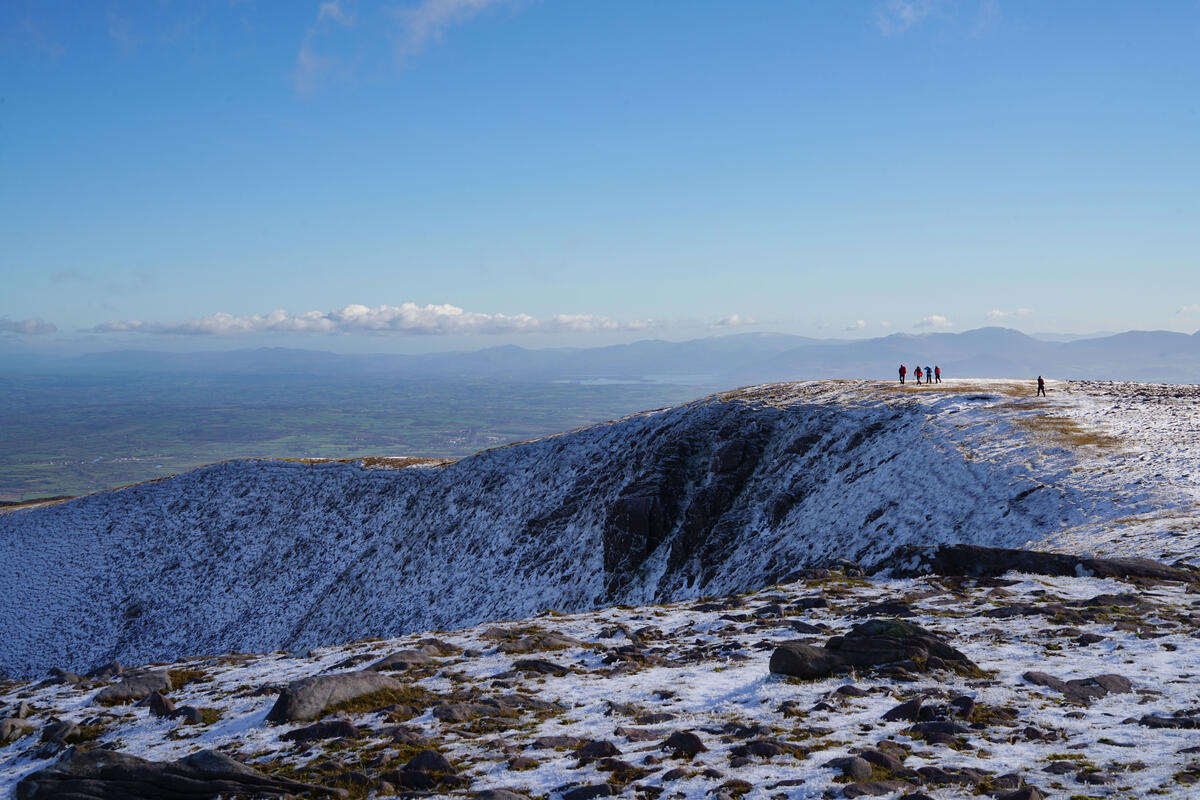
- Brandon Bay – A blue‑flag beach backed by dunes and the impressive Mount Brandon, ideal for wind‑surfing and sunset views.
Enjoy the wild beauty, ancient history and cinematic landscapes that make Slea Head the crown jewel of Ireland’s Wild Atlantic Way.