Overview
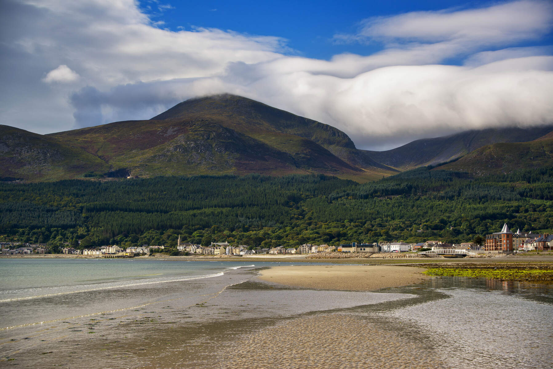
Slieve Donard (Irish: Sliabh Dónairt) dominates the Mourne Mountains at 850 m (2,789 ft), making it the highest summit in Northern Ireland, the highest in Ulster and the seventh‑highest in the whole island of Ireland. The mountain rises dramatically from the coastal town of Newcastle, overlooking Dundrum Bay and the Irish Sea. Its granite peak is a magnet for walkers, photographers and anyone keen to touch a piece of Irish myth and history.
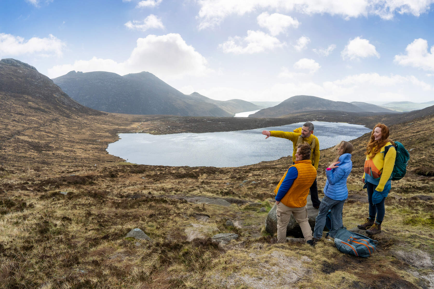
The most popular ascent is the Glen River route, which starts in Donard Park car park (grid reference J375305) and follows a well‑marked trail through mixed woodland of Scots pine, oak and birch. The climb is roughly 4.6 km (2.9 mi) one‑way and typically takes 4–5 hours round‑trip, depending on fitness and conditions. Along the way you’ll cross three low‑level bridges, negotiate a short over‑hanging river section, and finally join the historic Mourne Wall for the final steep push to the summit.
From the summit you are rewarded with a 360° panorama that can include the Isle of Man, Dublin Bay, Belfast Lough, the Wicklow Mountains, the Scottish coast and, on exceptionally clear days, the mountains of Wales. The view is arguably the best in the Mournes and a highlight for any visitor to County Down.
History & Background
Slieve Donard’s story stretches back thousands of years. At the very top lie the remains of two prehistoric cairns. The larger, known as the Great Cairn, is a Neolithic passage tomb dated to 3300–3000 BC and is the highest known passage tomb in Britain and Ireland. It measures roughly 3 m high, 12 m north‑south and 10 m east‑west. About 210 m to the north‑east sits the Lesser Cairn, an Early Bronze Age multiple‑cist cairn (c. 2300–1950 BC) that once served as an oratory.
In early Irish mythology the mountain was associated with the legendary figures Boirche and Slángha. Later, a fifth‑century hermit, Saint Donard (Domhanghart), is said to have taken up residence on the summit, converting the cairns into a hermitage and an oratory. Pilgrimages to the peak were recorded from at least 1645 and continued until the 1830s, originally linked to the Lughnasadh harvest festival.
The mountain also played a role in the scientific mapping of Ireland. In 1826 Royal Engineers camped on the summit for four months as part of the Ordnance Survey’s Principal Triangulation, using the cairns as triangulation points. The Mourne Wall, a 22‑mile dry‑stone wall built between 1904 and 1922 to enclose the water catchment, climbs the western and southern slopes of Slieve Donard and terminates at a small stone tower near the summit.
More recent history includes a tragic lightning strike in April 2006 that claimed a life, commemorated by a brass plaque, and a major gorse fire on the eastern slopes in April 2021 that devastated local wildlife.
What to See & Do
- Summit cairns – Examine the Great Cairn and Lesser Cairn; respect their fragile condition, as folklore warns that damaging them brings a curse.
- Mourne Wall & stone tower – Follow the wall’s line for a few hundred metres; the wall is a testament to early‑20th‑century engineering.
- Panoramic views – Look east to the Isle of Man, south to Dublin Bay, north to Belfast Lough, and west to the rolling hills of the Mournes.
- Flora and fauna – The lower woodland is rich in oak, birch and Scots pine, while higher slopes host typical alpine plants and occasional bird of prey.
- Post‑hike Newcastle – After descending, treat yourself to a meal in one of Newcastle’s pubs (e.g., Quinn’s) or a stroll along the award‑winning Newcastle Beach.
Practical Information
| Item | Details |
|---|---|
| Start point | Donard Car Park, Newcastle (grid J375305) – see Google Maps |
| Distance | 4.6 km (9.2 km round‑trip) |
| Elevation gain | ~850 m from sea level |
| Estimated time | 4–5 hours total (ascent 2–2.5 h, descent 1.5–2 h) |
| Terrain | Forest tracks, stone‑paved sections on steep parts, rough mountain path; avoid the Eagle Rocks cliffs on the north side |
| Facilities | Free parking (charges may apply), accessible toilets at Donard Park, refreshments in Newcastle town |
| OS map | Sheet 29 |
| Best season | Late spring to early autumn; the route is busiest in summer, so early morning starts help avoid crowds |
| Safety notes | The summit can be windy; the river over‑hang can be slippery when wet. The Mountain Rescue Service operates from Newcastle – see their safety advice. |
Access – The trailhead is reachable by car via the A2 coastal road from Belfast (≈1 h). Public transport options include local bus services to Newcastle; the nearest airports are Belfast International and City Airport.
Booking – The walk is free; however, guided tours (e.g., Mountain Ways Ireland) require advance booking and have variable prices.
Accessibility – While the car park and toilets are accessible, the ascent involves steep, uneven ground and is not suitable for wheelchair users.
Conservation – Slieve Donard lies within the Mourne Area of Outstanding Natural Beauty (AONB). Visitors are asked to stay on the marked path, avoid disturbing the cairns and take any litter home.
Enjoy the climb, soak in the ancient atmosphere, and let the sweeping sea‑to‑mountain vistas remind you why Slieve Donard has been a place of pilgrimage and wonder for millennia.