Overview
The Beara‑Breifne Way is Ireland’s longest national waymarked trail, stretching roughly 700 km (about 430 miles) from the wild Atlantic‑kissed Beara Peninsula in County Cork to the historic market town of Blacklion in County Cavan. It is a joint walking and cycling route that stitches together twelve pre‑existing National Waymarked Trails, creating a continuous north‑south spine through the heart of the island. The trail is celebrated for its dramatic scenery – from rugged coastal cliffs and copper‑rich mountain crags to the tranquil banks of the River Shannon and the lake‑dotted landscapes of Roscommon and Leitrim – and for the living history that unfolds along its length.
History & Development
The Beara‑Breifne Way follows the line of the legendary fourteen‑day march undertaken by Donal Cam O’Sullivan Beare and his followers in 1603 after the Battle of Kinsale. Their desperate trek northwards, seeking aid from allies in the province of Breifne, left a cultural imprint that modern trail‑builders have chosen to honour. The route is a grassroots, community‑led initiative involving more than sixty local groups, landowners, volunteers and statutory bodies such as the Heritage Council, Fáilte Ireland and Sport Ireland. Funding milestones include a €300,000 allocation from the Rural Regeneration and Development Fund in 2020, aimed at bringing the trail up to international standards.
Trail Markings, Difficulty & Practicalities
- Waymark colour – The whole route is signed with the distinctive purple waymarker posts used on Irish long‑distance trails.
- Difficulty – Overall the trail is rated medium, but sections vary: the coastal Beara Way is strenuous with steep climbs, while the Shannon‑valley stretches are gentle. Mountain passes in the Caha and Ballyhoura ranges are best suited to experienced walkers.
- Dog policy – Dogs are permitted on most sections, but the Beara Way (the southernmost part) does not allow dogs on certain sections to protect wildlife and farmland. Check local signage before setting off.
- Navigation – Detailed maps and GPS files are downloadable from the official site, and stage‑by‑stage paper maps are available at tourist offices along the route.
What to See & Do
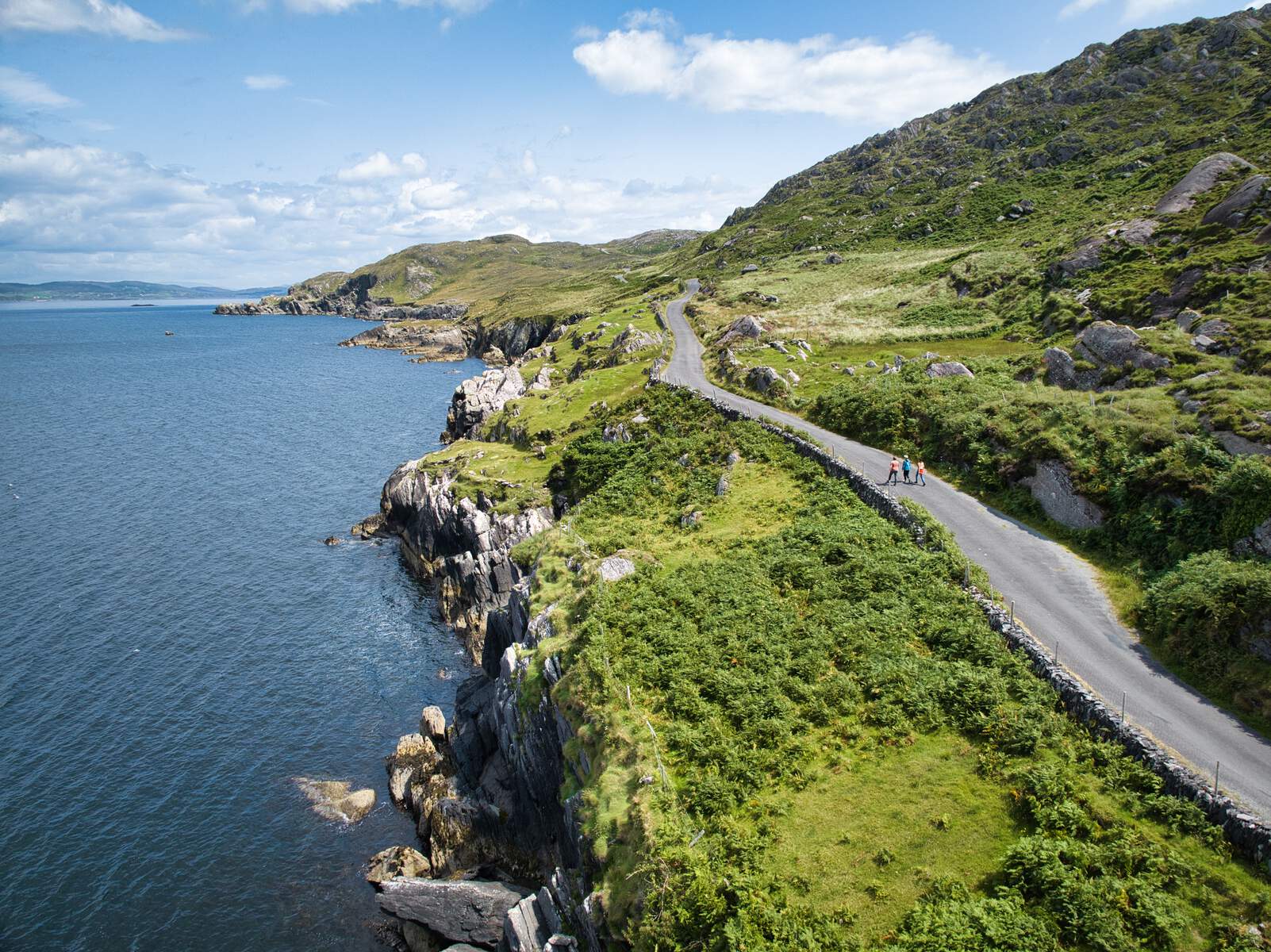
Beara Peninsula (Cork & Kerry)
The southern gateway begins either at Dursey Sound – where Ireland’s only cable car links the mainland to Dursey Island – or at Glengarriff, the trailhead of the Beara Way. Walkers encounter the Caha Mountains, the dramatic Sugarloaf pass, the historic copper mines of Allihies (Allihies Copper Mines) and the colourful villages of Castletownbere, Eyeries and Ard groom. The Beara Way’s 20‑year‑old upgrades added 20 bridges, 200 stiles and a wealth of interpretive panels, making the coastal section both scenic and accessible.
Gaeltacht & North‑West Cork
From Beara the route becomes the Slí Gaeltacht Mhuscraí, crossing two mountain ranges into the Gaeltacht heartland of Ballyvourney before reaching Millstreet. The North‑West Cork Way then picks up, crossing the Blackwater River, threading through Newmarket and joining the Ballyhoura Way at St John’s Bridge.
Midlands & River Shannon
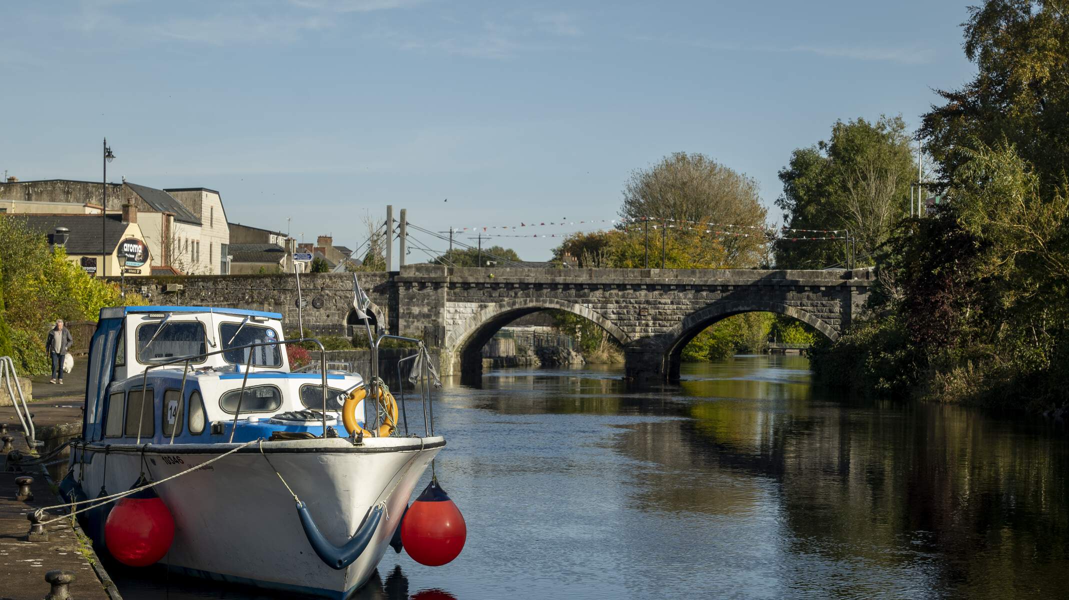
Further north the trail incorporates the Multeen Way, Ormond Way, Hymany Way and the Suck Valley Way. Highlights include the river‑side villages of Keadue (Co Roscommon) and Aughrim (Co Galway), the “nine friendly villages” of the Suck Valley, and the La Tène stone at Castlerange – an Iron‑Age granite boulder that testifies to the area’s ancient occupation.
The Miner’s Way & Historical Trail
In the north‑midlands walkers can explore the Miner’s Way and Historical Trail, a 118 km loop that skirts Lough Allen, Lough Arrow and Lough Key. The Arigna Mining Experience offers a glimpse into four centuries of coal and iron extraction, while the surrounding landscape provides sweeping mountain vistas across the Corry, Curlew and Bricklieve ranges.
Leitrim & Cavan
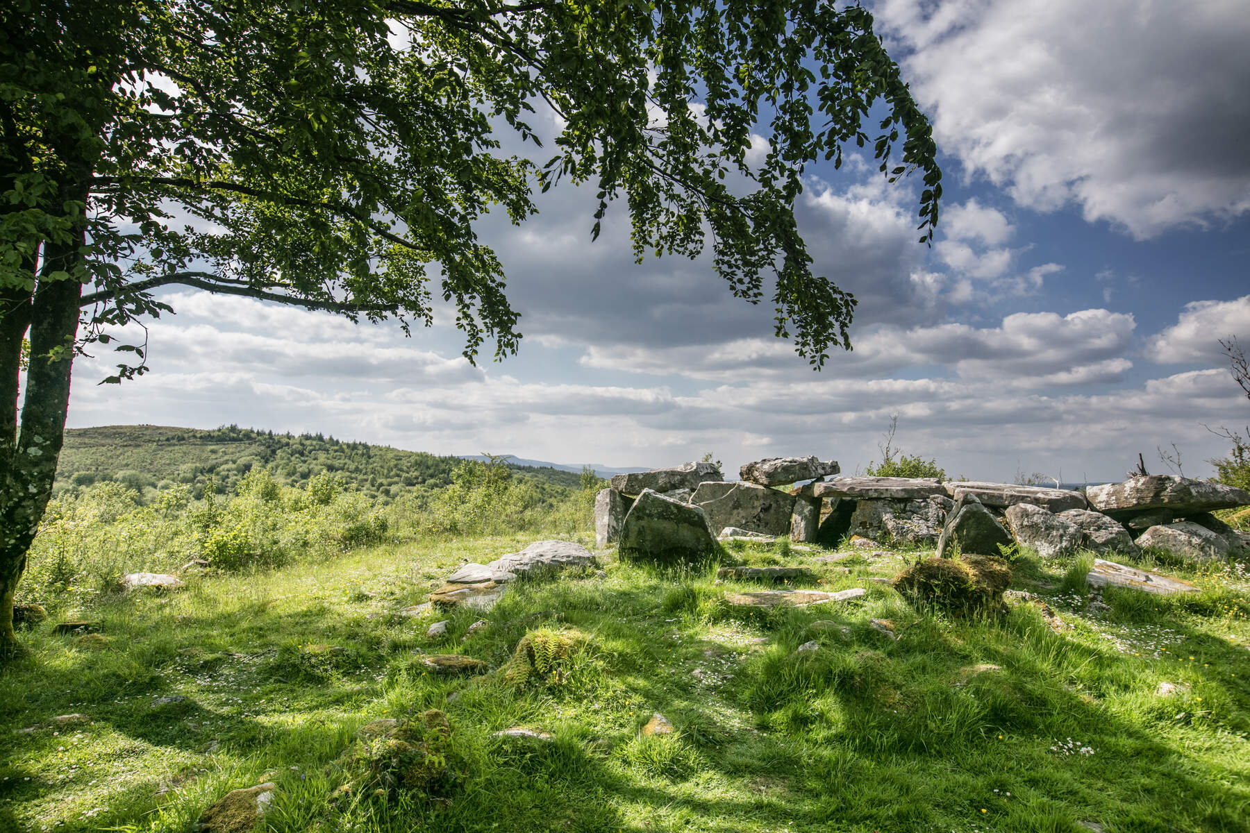
The Leitrim Way adds a series of short loops – from the 3 km Aghacashel Loop to the 12 km Crummy Loop – each passing wetlands, stone‑age sites and the famous Acres Lake floating boardwalk. The final leg, the Cavan Way, winds from Dowra through the limestone‑rich Cuilcagh Mountains and the Cavan Burren Park before ending in Blacklion. From Blacklion the Ulster Way continues northwards.
Beara‑Breifne Passport
A unique feature of the trail is the Beara‑Breifne Way passport, available on the official website and at most tourist information offices along the route. Each of the twelve sections carries a stamp; completing the whole route yields a tangible record of the journey and makes an excellent family challenge.
Getting There & Transport
- By car – From Cork Airport the southern trailheads are about 125 km away (≈2 h). The N71 takes you to Glengarriff, the most popular start‑point.
- By public transport – Regular Bus Éireann services run from Cork city centre to Glengarriff (≈1.5 h). Smaller local buses connect the larger villages along the way. Most towns provide secure parking for those arriving by car.
Accommodation & Services
The trail passes through dozens of B&Bs, guesthouses, small hotels and campsites. In the Beara Peninsula popular options include the Beara Coast Hotel, Hungry Hill Lodge and Realt na Mara in Castletownbere. Along the middle sections, villages such as Millstreet, Newmarket and Keadue offer a range of family‑run B&Bs and pubs with hot meals. Information boards at trailheads point out nearby cafés, toilets and emergency contact numbers.
Events & Seasonal Highlights
While the Way is open year‑round, several local festivals add extra colour during the summer months:
- West Cork Chamber Music Festival (June, Bantry) – a short bus ride from the Beara Way.
- Beara Music Festival (July, Castletownbere) – live traditional music in the villages along the coastal section.
- Shannon River Festival (August, Athlone) – celebrates the river that the trail follows for many kilometres. Check local tourism websites for exact dates.
Practical Information
The Beara‑Breifne Way is fully waymarked and open year‑round; there is no admission charge. The trail is designed for both walkers and cyclists, though some mountain passes (e.g., the Caha range) are more suited to experienced hikers. Detailed maps and GPS files are downloadable from the official site, and a stage‑by‑stage map is also available at local tourist offices.
Starting points – The most common southern trailheads are Dursey Sound (via the cable car) and Glengarriff. The northern terminus is Blacklion, where visitors can enjoy a celebratory meal in the town’s pubs.
Transport – Cork Airport lies approximately 125 km from the southern trailhead, while Cork City centre is about 119 km away. Public bus services connect major villages along the route, and most towns offer secure parking for those arriving by car.
Accommodation & Amenities – The trail passes through dozens of B&Bs, guesthouses and small hotels. Many sections, especially the Beara and Suck Valley stretches, have dedicated information boards and way‑marking plaques that guide walkers to nearby pubs, cafés and restrooms.
Online Resources
- Official website: Beara‑Breifne Way
- Route map and stage guide: Beara‑Breifne maps
- Passport purchase: Beara‑Breifne passport
The Beara‑Breifne Way offers a rare blend of natural beauty, cultural heritage and community spirit. Whether you aim to tackle the entire 700 km or simply explore a favourite section, the trail provides a compelling way to experience Ireland’s hidden heartlands from coast to countryside.