Overview
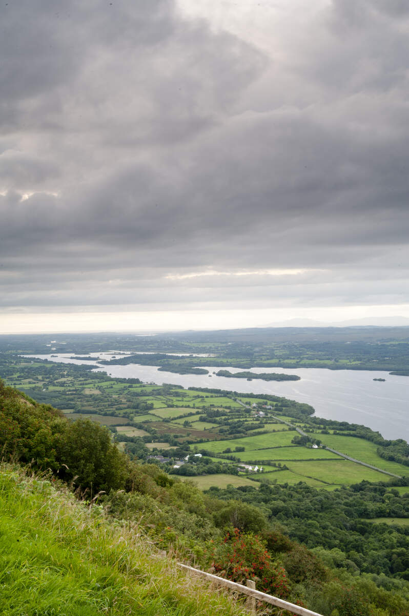
The Magho Cliffs form a striking 9 km limestone escarpment that drops about 300 metres onto the northern shore of Lower Lough Erne. Located in the townland of Magho, County Fermanagh, the cliffs face north‑north‑west and dominate the skyline of Lough Navar Forest. From the Magho Viewpoint at the summit you can see across Lower Lough Erne into the counties of Fermanagh, Sligo, Tyrone and Donegal, with the Wild Atlantic Way visible on a clear day. The site lies within the Marble Arch Caves Global Geopark and is designated an Area of Special Scientific Interest, protecting a suite of rare calcareous habitats.
History & Geology
The escarpment is built from two Carboniferous limestone formations – the Glencar Limestone below and the overlying Dartry Limestone at the summit – resting on older Benbulben Shale. These rocks were sculpted by the last glaciation, about 13 000 years ago, when ice sheets carved the valleys and left the sheer faces seen today. A quieter chapter of history unfolded on 18 November 1943 when a Royal Air Force Short Sunderland flying boat crashed into the cliffs during a training take‑off from Lough Erne, claiming three lives. The cliffs also host the Irish Rock‑bristle (Seligeria oelandica), a black moss that is unique to this location in the United Kingdom, underscoring the scientific importance of the area.
Getting There
Magho Cliffs are most easily reached by car via the A46 from Enniskillen, turning onto the Loughshore Road (B46) towards Derrygonnelly. The main viewpoint car‑park sits on the forest drive (postcode BT93 6AH) and offers free parking – spaces are limited in summer, so early arrival is advisable. The nearest town is Derrygonnelly (about 5 km away). Public transport to the cliffs is limited; the closest bus stop is in Derrygonnelly, so a private vehicle or taxi is recommended.
What to See & Do
The Magho Cliffs Walk
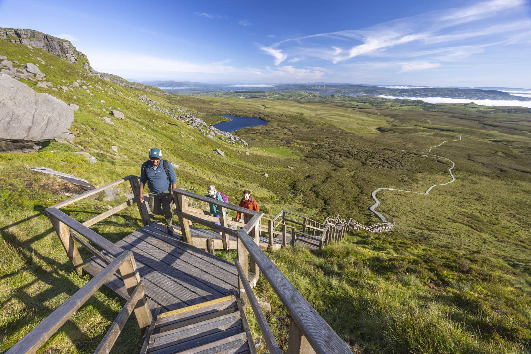
- Length & Grade: 1.5 mi (2.5 km), classified as Difficult due to steep, uneven forest track.
- Two starting options:
- Top‑down – begin at the Magho Cliffs Viewpoint car‑park on the forest drive, enjoy the panoramic outlook, then follow the black‑marked route down the cliff side.
- Bottom‑up – start at the Loughshore Road car‑park (toilets available), ascend through semi‑natural woodland, passing open clearings that reveal the sheer limestone face before reaching the summit.
- Flora & Fauna: The woodland supports the highest recorded number of woodland species in Northern Ireland, including bird’s‑nest orchid, early purple orchid, peregrine falcons, skylarks, meadow brown butterflies and, on damp calcareous rocks, the rare Irish Rock‑bristle moss.
- Summit: A bench at the viewpoint offers a place to pause and take in the sweeping vista – Lower Lough Erne stretches like a glassy ribbon, while distant hills of Sligo, Donegal and the Atlantic coastline frame the horizon. Benches, bins and an information board are provided at the top.
Additional Walks & Routes
Komoot lists several alternative routes that cater to different abilities:
- Cliffs of Magho loop – 2.82 mi (4.5 km), Easy. A gentle circuit that stays mostly on well‑maintained forest paths and returns to the viewpoint via a different track.
- View from the Cliffs of Magho – Magho Viewpoint loop from Drumcrow West – 1.30 mi (2.1 km), Easy. Ideal for families; the ascent is short and the viewpoint is reached within 30 minutes.
- Cliffs of Magho via Old Man’s Head – 10.8 mi (17.4 km), Hard. A longer trek that includes the distinctive “Old Man’s Head” rock outcrop, which resembles an elderly gentleman and offers an extra photo opportunity.
All routes are marked on the local trail map, which can be obtained from the information board at the viewpoint.
Geopark Highlights
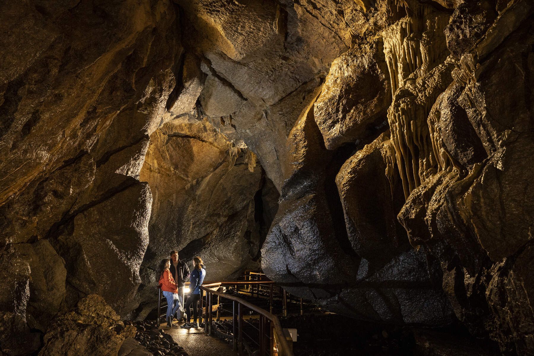
Because the cliffs sit within the Marble Arch Caves Global Geopark (also part of the Cuilcagh Lakelands UNESCO Global Geopark), the walk links directly to the region’s karst landscape. The same Dartry Limestone that caps the cliffs forms the spectacular Marble Arch Caves further south, and nearby attractions such as Castle Archdale Country Park, Tully Castle and Blackslee Waterfall Walk are easily accessed from the trailhead.
Seasonal Highlights
- Spring – early purple and bird’s‑nest orchids carpet the woodland floor; butterflies emerge.
- Summer – longer daylight gives ample time for the full loop; skylarks are most vocal.
- Autumn – the limestone cliffs take on a warm hue, and the surrounding woodlands display rich colour.
- Winter – stark, dramatic views of the cliffs and Lough Erne; good for photography in crisp light.
Practical Information
| Feature | Details |
|---|---|
| Distance | 1.5 mi / 2.5 km (main walk) |
| Grade | Difficult |
| Terrain | Mostly forest track with steep, uneven sections |
| Route | Linear, can be walked top‑down or bottom‑up |
| Wheelchair accessible | No |
| Dogs | Allowed, must be kept under control |
| Facilities | Car‑park on Loughshore Road (BT93 6AH) with basic toilet facilities; benches, bins and information board at the viewpoint |
| Parking | Free, limited spaces – arrive early in peak season |
| Best time to visit | Clear days for panoramic views; spring for orchids and butterflies |
| Opening | Open all year, no entry fee |
Tip: Allow extra time to linger at the viewpoint and to explore the surrounding woodland for wildlife spotting. The walk typically takes about 20 minutes to cover the distance, but most visitors spend longer admiring the scenery and the geological features.