Overview
The Owenduff Mountains rise from the remote western seaboard of County Mayo, forming the dramatic backbone of Wild Nephin National Park. The park now covers about 15,000 ha after a 2018 expansion, making it Ireland’s sixth national park and one of the largest intact Atlantic blanket‑bog systems in Europe. The range is a mosaic of rugged peaks, deep valleys and the Owenduff bog – a living laboratory of peatland ecology where moss‑covered flats stretch to the horizon. Visitors who venture here are rewarded with sweeping Atlantic vistas, rare birdsong and a palpable sense of isolation that has inspired naturalists for generations.
History
Wild Nephin National Park was officially designated on 1 November 1998. In 2018 the park’s boundary was extended, increasing its area to roughly 15,000 ha and incorporating additional blanket‑bog and mountain terrain. The whole complex is protected as a candidate Special Area of Conservation (cSAC), a Special Protection Area, and forms part of the Natura 2000 network (Owenduff/Nephin Complex SAC).
The mountains and surrounding bog have been traversed for centuries by the Bangor Trail, a livestock route used by Erris farmers. Irish naturalist Robert Lloyd Praeger described the scene in 1937 as “the very loneliest place in the country”, a phrase that still captures the stark beauty of the Owenduff expanse. Today the area is part of a rewilding programme aimed at allowing the bog and native woodlands to return to a more natural state.
Dark Sky & Night‑time Experience
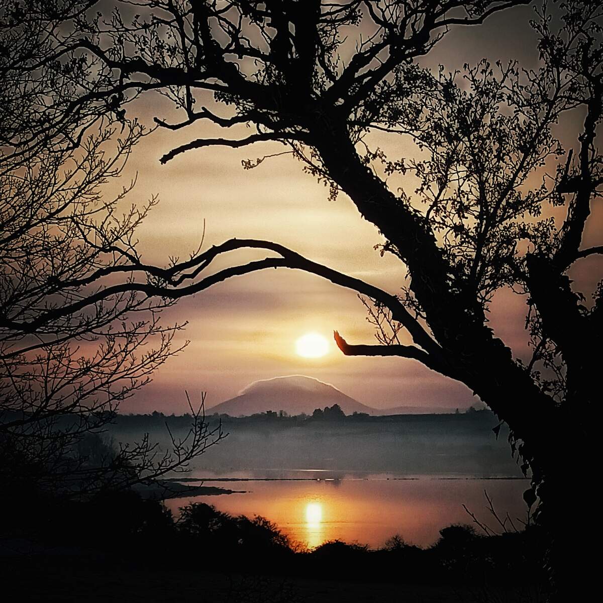
In May 2016 the International Dark‑Sky Association awarded the park Gold‑Tier International Dark Sky Park status – the first such designation in Ireland. The dark‑sky area stretches across the whole of Wild Nephin, offering some of the darkest night skies in Europe. On clear evenings visitors can see the Milky Way, the Andromeda Galaxy and thousands of stars with the naked eye.
The Ballycroy Visitor Centre runs a Dark Sky Educational Programme and staff can suggest the best viewing spots, such as the Claggan Mountain Boardwalk, the Letterkeen Bothy and the Scardaun Loughs viewpoint. Annual events include the May Bank Holiday Dark‑Sky celebrations and seasonal stargazing evenings organised by the park’s volunteer astronomers.
Walking & Hiking
Bangor Trail (26 km)
The classic long‑distance trek starts at the stone bothy in Letterkeen Wood and follows the historic livestock route to Bangor Erris. It is a challenging 8‑12 hour walk across peat‑soaked tracks, conifer plantations and the Nephin Beg range. Navigation skills are essential as the trail is only sparsely way‑marked.
Tóchar Daithí Bán Trail (20‑30 min)
A short, family‑friendly loop that starts at the visitor centre and offers panoramic views of Achill Island, the Nephin Beg range and the Atlantic Ocean.
Letterkeen Loop (12 km, purple marker)
A moderate‑difficulty circuit that passes the historic Robert Lloyd Praeger Bothy, Lios Na Gaoithe ring‑fort and several small lakes.
Bothy Loop (6 km, blue marker)
A gentle walk suitable for most abilities, taking you past peat‑bog flora and the shelter of the stone bothy.
Lough Aroher Loop (10 km, red marker)
A higher‑fitness route that climbs to the summit of Nephin Beg, delivering sweeping coastal panoramas.
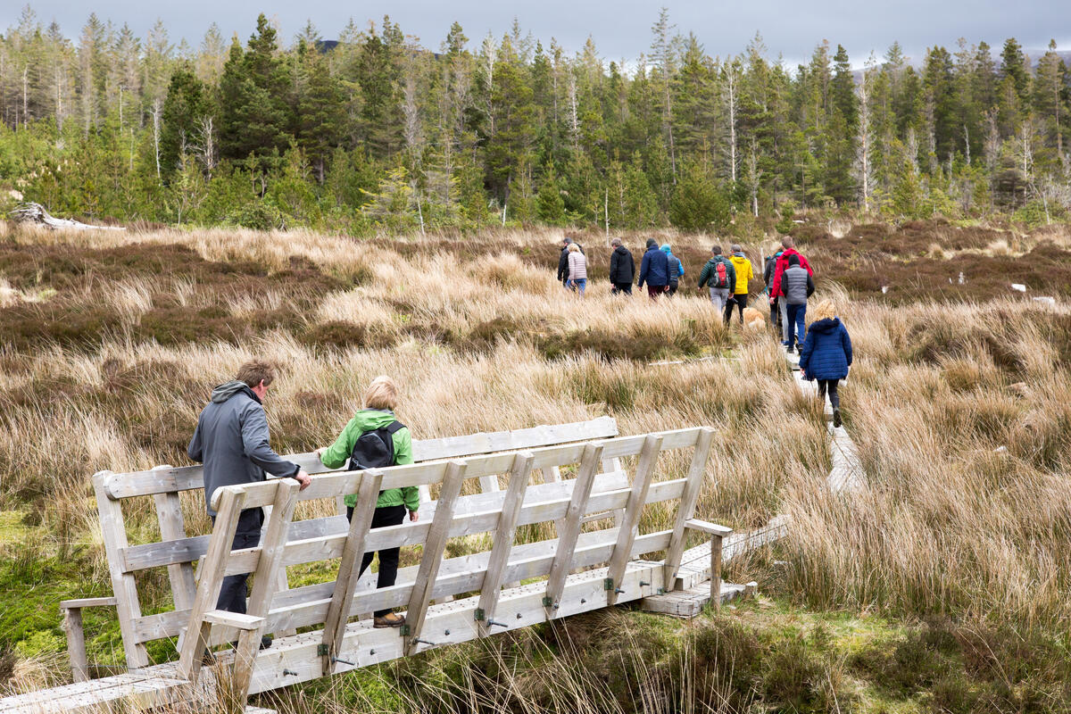
Claggan Mountain Coastal Trail (2 km boardwalk)
A coastal boardwalk on the Wild Atlantic Way between Mulranny and Ballycroy, with excellent parking and views east to the park mountains and west across the inlet to Achill Island.
All routes are marked with coloured way‑markers; detailed maps are available at the visitor centre or from the East‑West Mapping service.
Flora & Fauna
The park supports a remarkable range of habitats:
- Blanket bog – dominated by sphagnum mosses, bog cotton, black bog rush, deer‑grass and heather.
- Heath and grassland – home to ling, bell heather, bilberry and rare orchids such as the Irish lady’s‑tresses.
- Lakes and rivers – support water‑lobelia, pipewort and the marsh saxifrage.
Notable wildlife includes:
- Birds – golden plover, red grouse, Greenland white‑fronted geese (Oct‑Apr), curlew, skylark, woodcock and occasional red‑breasted merganser.
- Mammals – otters, red foxes, mountain hares, badgers, bats and a small population of non‑native red deer.
- Fish – salmon, sea trout and brown trout in the Owenduff and Tarsaghaun rivers.
- Insects – a rich dragonfly and damselfly community, including the common bluetip and moorland skimmer.
Archaeology & Cultural Heritage
The landscape is dotted with historic sites:
- Lios Na Gaoithe – a well‑preserved ring‑fort in Letterkeen Wood, excavated in the 1950s. Finds include Bronze‑Age burial goods and later medieval artefacts.
- Daithí Bán cairn – a summit cairn linked to folklore about a giant who guarded the area.
- Crinn an Sí – a “fairy fort” near Derrybrook Lough, associated with local legends of a protective curse.
- Remains of 19th‑century farmsteads and famine‑era mass graves are scattered along the Bangor Trail, offering a poignant reminder of the region’s social history.
Practical Information
| Detail | Information |
|---|---|
| Opening | Open 24 hours year‑round; Visitor Centre seasonal (typically March–October) |
| Admission | Free entry to the park and its trails |
| Website | Wild Nephin National Park |
| Parking | Car parks at the Ballycroy Visitor Centre and at the Letterkeen Wood trailhead (both with picnic tables) |
| Shuttle Bus | Free National Park shuttle runs Tue‑Sat (June‑August) between Westport and Bangor‑Erris, stopping at Newport, Letterkeen and the visitor centre – see timetable on the park website |
| Fire‑risk notice | During an Condition Orange fire‑risk warning (e.g., April 2026) camping is prohibited across the park |
| Camping & Shelters | Wild camping is not permitted; the repaired Lough Aroher shelter is available for overnight stays on the Lough Aroher Loop |
| Nearest towns | Ballycroy Village (≈5 km south), Newport (≈10 km north), Westport (≈30 km west) |
| Accessibility | Trails are un‑paved and may be boggy; suitable for experienced walkers. The short Tóchar Daithí Bán Trail is wheelchair‑friendly where conditions allow |
The Ballycroy Visitor Centre offers maps, an interactive exhibition, a nature trail (Tóchar Daithí Bán), a small shop and information on the Dark‑Sky programme. While the centre closes during the winter months, the dark‑sky viewing sites remain open year‑round.
Nearby Attractions
Combine a visit to the Owenduff Mountains with a drive to Ballycroy National Park, explore the coastal scenery of Achill Island, or stop at Bangor Erris for a taste of traditional west‑Mayo hospitality.