Overview
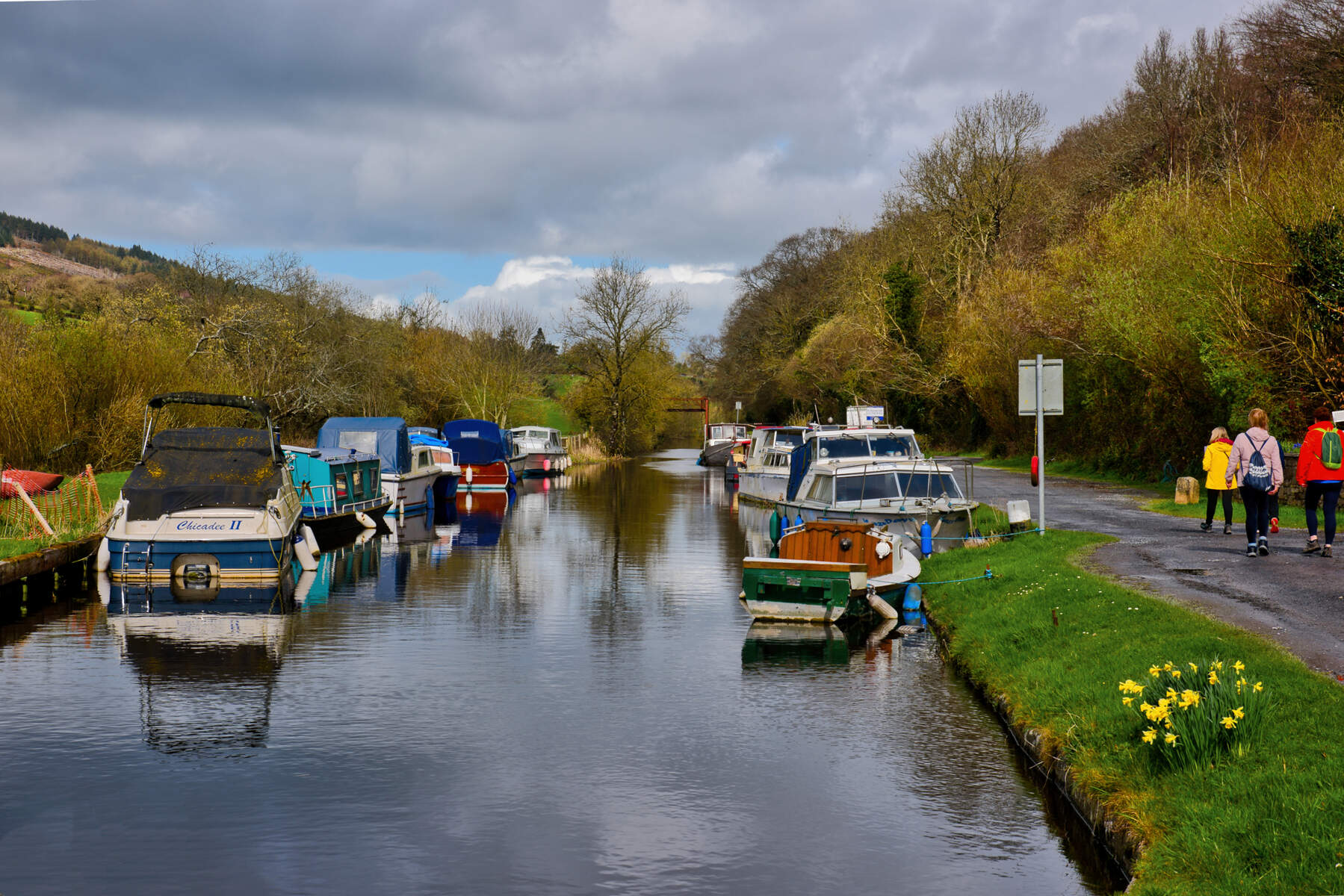
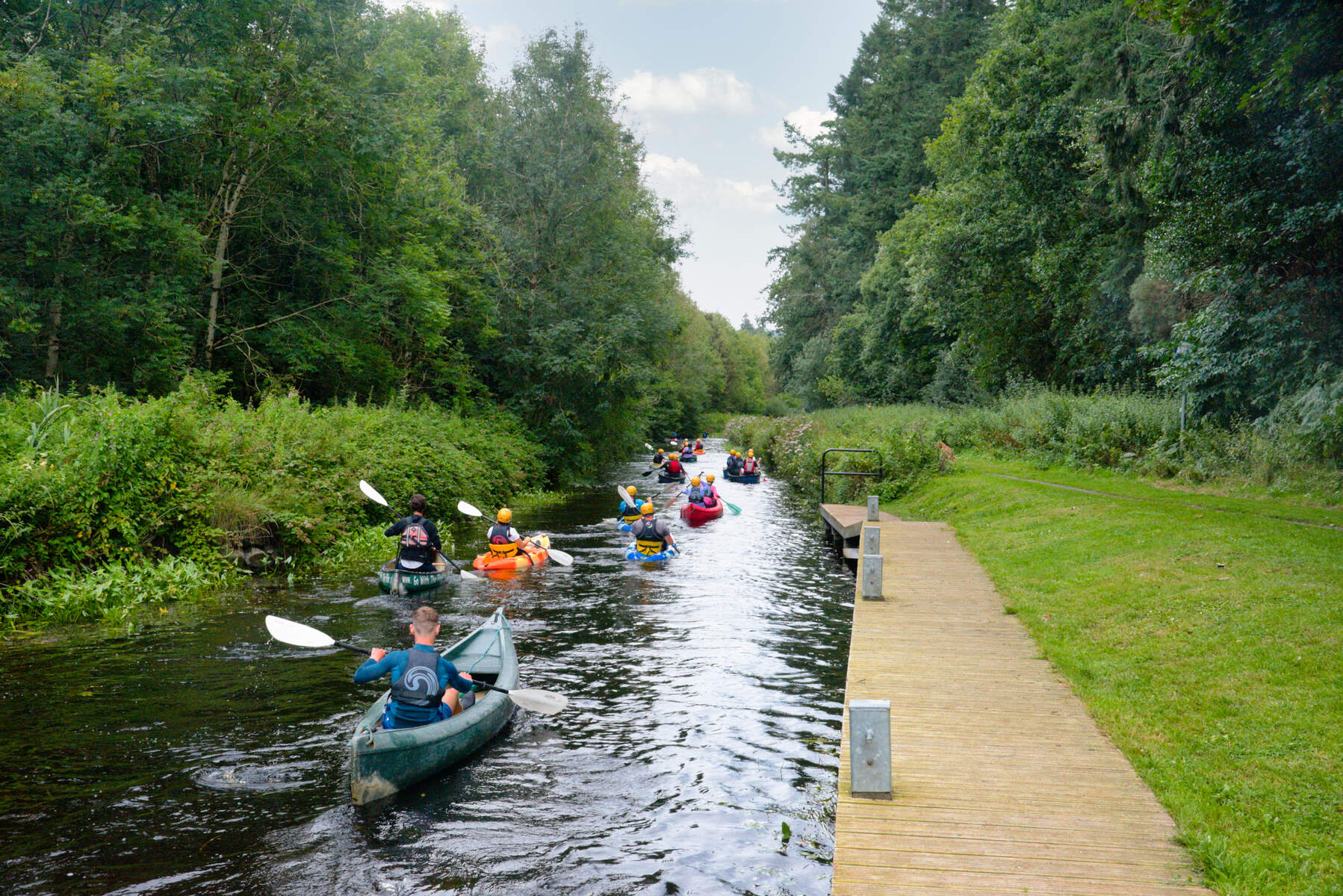
The Kings River – called the River Callan by locals – is a swift, narrow waterway that threads the south‑eastern heart of Ireland. Originating in the Slieveardagh Hills near Graigaman, it flows roughly 12 km (7½ mi) through County Tipperary and County Kilkenny, passing the villages of Kells and the historic market town of Callan before joining the River Nore. Its series of small weirs and rapid sections make it a favourite for white‑water kayakers, while a gentle, flat riverside path through Callan offers tranquil walks and wildlife spotting.
History / Background
The river’s name is steeped in legend and language. Irish tradition says the high king Niall Caille drowned while fording the waters in 844 AD, giving the town its name – Callainn, later anglicised to Callan. A 1533 church record refers to the waterway as “Unry”, linked to the Old Irish Abhainn Righe (king’s river), a name that appears on the Down Survey maps of the 1650s. Archaeological finds along its banks – a pre‑Christian fulacht fiadh uncovered during the 1996‑97 bypass works and the remains of an 18th‑century iron‑smelting site near Goats Bridge – testify to its long‑standing industrial importance. The valley has evolved from boggy ground to a managed landscape dotted with conifer plantations and the line of electricity pylons that descend from Turlough Hill toward the Poulaphuca reservoir.
What to See & Do
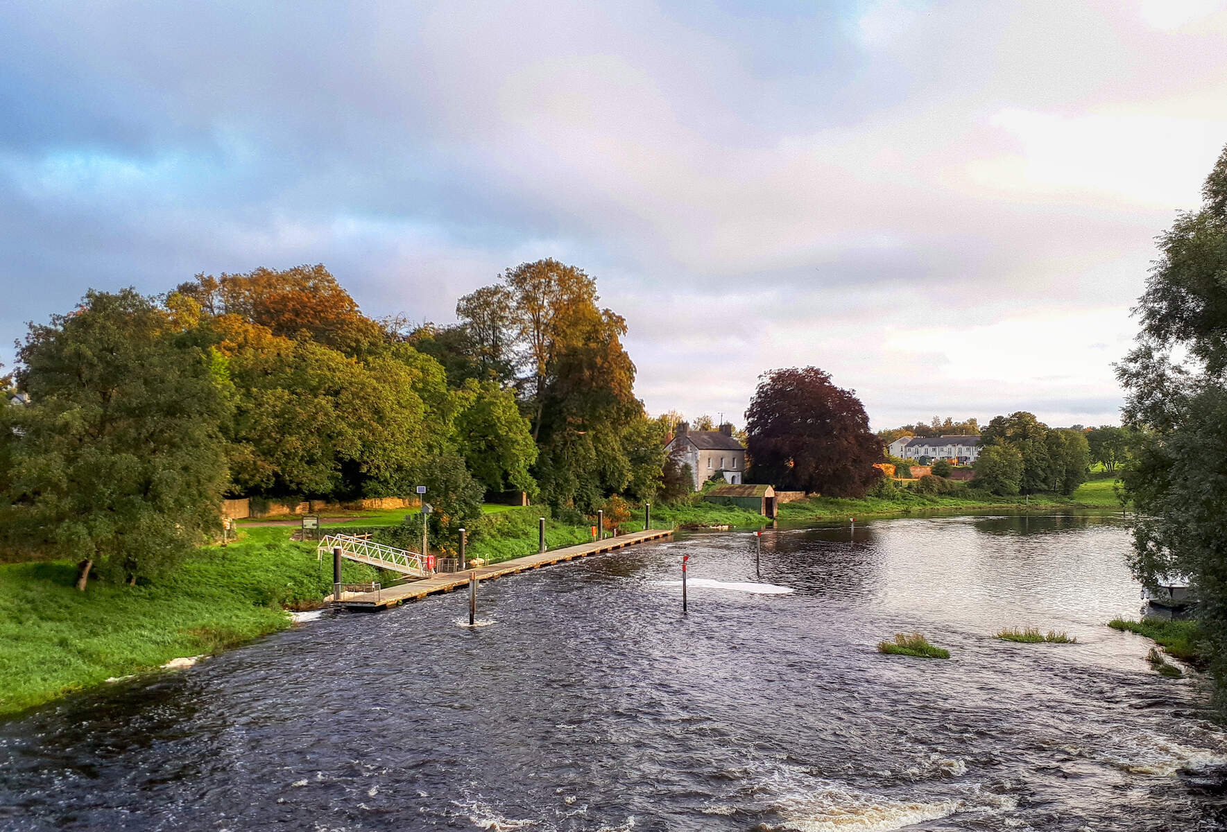
- Historic ford and “Big Bridge” – Walk to the stone bridge rebuilt after the 1990s bypass, the site linked to King Niall Caille’s tragic crossing.
- Riverbank walks – A flat, scenic path runs alongside the river through Callan’s “Cross” area, ideal for leisurely strolls, sketching, or quiet contemplation.
- Kayaking and play‑boating – The river is graded 1‑3, with a low‑head‑dam‑type weir near the Kells put‑in for side‑surfing and a larger downstream weir that creates a punchy shallow hole favoured by intermediate paddlers.
- Wildlife spotting – Clear waters support trout; kingfishers, water‑birds and small mammals frequent the riparian zones. Early risers may glimpse kingfishers darting over the shallows, while the lower stretch near the Nore offers excellent fishing (access controlled by the Mount Juliet estate).
- Cultural events – Summer festivals see pop‑up art displays on the riverbank, hosted by cafés such as Fennelly’s and Café L’Arche.
- Heritage trail – Combine a riverside walk with visits to nearby high crosses at Killamery, Kilkieran and Ahenny, all within a short drive.
- Scenic valley views – Walks beyond the town reveal conifer‑clad hills, the striking line of electricity pylons, and the historic stone bridge at Ennisnag.
Getting There
- By car – The river is easily reached via the N76, which passes through Callan. There is free street parking on the riverbank near the “Cross” and a larger lay‑by at the Kells put‑in (GPS 52.542346 N, ‑7.271880 W). Parking can fill quickly in summer, so an early arrival is advisable.
- Public transport – The nearest bus stop is the Callan town centre stop served by Bus Éireann routes 4 and 4A. The closest railway station is Kilkenny, about 20 km away, with regular services to Dublin and Cork. (Please verify current timetables.)
- Walking & cycling – The flat riverside path is suitable for walkers and cyclists of all abilities. It connects with the Barrow Valley Greenway, offering a longer off‑road cycling option.
- Accessibility – The main riverside promenade in Callan is paved and wheelchair‑friendly. Some of the historic bridges have uneven stone steps; visitors with limited mobility may prefer the newer “Big Bridge” access point.
Seasonal Highlights
- Spring (March‑May) – Rising water levels create gentle rapids ideal for beginner kayakers, while blooming wildflowers add colour to the banks.
- Summer (June‑August) – Long daylight hours make the riverbank walks perfect for family picnics. The town’s summer arts festival often stages open‑air exhibitions beside the water.
- Autumn (September‑November) – The surrounding conifer woods turn a deep gold, and trout fishing is at its peak. Early evenings are excellent for spotting kingfishers.
- Winter (December‑February) – While water levels drop, the tranquil scenery is still worth a brisk walk; the historic bridge is beautifully lit for the holiday season.
Practical Information
- Access – The river is freely accessible at all points within Callan’s town limits; there is no admission charge.
- Parking – Street parking is available around the riverbank in Callan. For kayakers, the most convenient put‑in is at the village of Kells (GPS 52.542346 N, ‑7.271880 W). Road‑side parking fills quickly, so a single vehicle is advisable.
- Put‑in / Take‑out – Put‑in at Kells; take‑out just after the river merges with the Nore within the Mount Juliet estate (left‑bank exit).
- Safety – The river is safe for walking year‑round, though water levels can rise after heavy rain. Kayakers should check local conditions and respect estate access rules downstream.
- Further information – The Callan Heritage Centre (http://callanheritage.org) offers exhibitions on the king’s drowning and the river’s industrial past. Detailed kayaking maps are available via the linked Google Maps resource.
Nearby Attractions
- Kells Priory (/kells-priory/) – A well‑preserved medieval friary a short drive from the river, set in a tranquil valley.
- Black Abbey (/black-abbey/) – Kilkenny city’s historic Dominican abbey, reachable by a 30‑minute bus ride.
- Inistioge (/inistioge/) – A charming riverside village on the River Nore, ideal for a scenic lunch after a day on the Callan.
- Barrow Valley (/barrow-valley/) – Offers additional walking and cycling routes that link with the Callan riverside path.