Overview
Srahmore Valley (Irish: An Srath Mór) is a tranquil valley and townland in the Electoral Division of Goolamore, Civil Parish of Kilcommon, Barony of Erris, County Mayo. The landscape is dominated by the modest summit of Srahmore, rising to 186 m (610 ft) with a prominence of 120 m, classed as a “Hump” in hill‑listing terminology. The valley sits at the coordinates 53.967088 N, ‑9.565644 W and forms part of the North Mayo mountain range, a region celebrated for its blanket bog, pine‑covered slopes and the historic Bangor Trail.
History & Background
While Srahmore itself is not a settlement, the surrounding area bears deep historical layers. The townland appears in the national database Logainm.ie and was added to OpenStreetMap in 2016. Nearby, the 15th‑century Burrishoole Friary tells of Dominican monastic life, and Rockfleet Castle, linked to the pirate queen Gráinne O’Malley, adds a medieval flavour to the landscape. The valley’s name, An Srath Mór, translates to “the great strath”, hinting at its long‑standing role as a natural corridor through the rugged west of Ireland.
What to See & Do
Summit Walk
The Srahmore summit is a short, rewarding climb that offers panoramic views across the Nephin Beg range, the Lough Feeagh catchment and, on clear days, the distant Atlantic coastline. The hill is listed as the 1 531st tallest in Ireland and the 15 317th highest peak in the British Isles, making it an accessible target for walkers seeking a gentle ascent.
Mountain Meitheal Shelter
A three‑sided wooden hut, erected by the volunteer group Mountain Meitheal, sits near the summit. The shelter sleeps five and provides a simple platform and picnic table, with “great views overlooking the Srahmore Valley”. It is a popular stop for those tackling the Bangor Trail, an ancient drovers’ road that threads through the remote wilderness of North Mayo.
Bangor Trail Experience
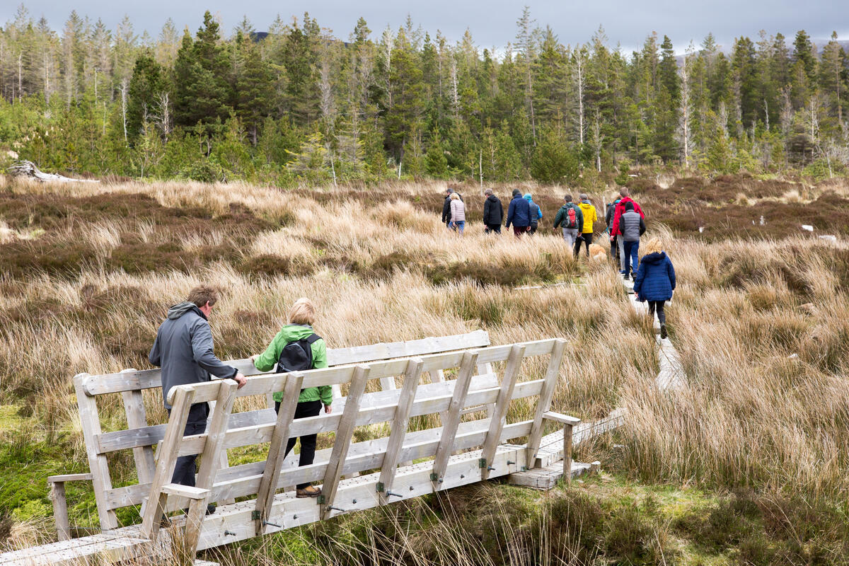
The Bangor Trail, although not a National Waymarked Trail, follows a historic route from Bangor Erris to Newport. Walkers traverse blanket bog, cross the Tarsaghaunmore River, and pass the ruins of old cottages before reaching the Srahmore area. The trail’s highest point is only 260 m, but the terrain is boggy and demanding, rewarding perseverance with expansive vistas of Achill Island, Slieve Carr, and the Atlantic.
Nearby Attractions
- Lough Feeagh – the largest lake in the Burrishoole catchment, a freshwater body studied by the Global Lake Ecological Observatory Network.
- Burrishoole Friary – a 15th‑century Dominican ruin, a National Monument.
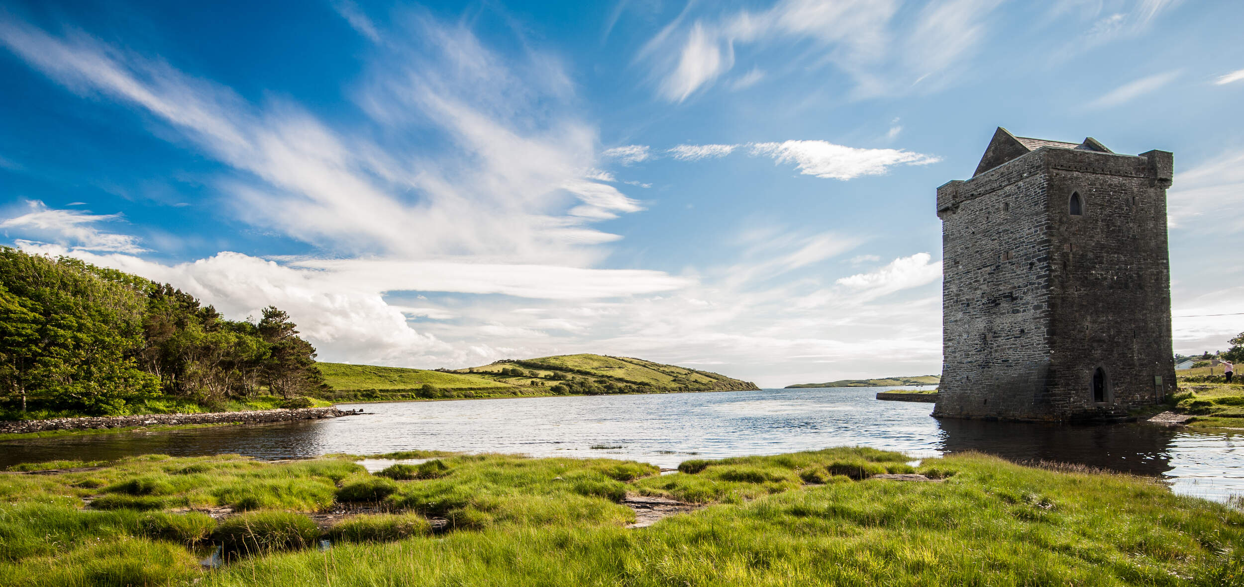
- Rockfleet Castle – a 16th‑century tower house associated with Gráinne O’Malley, open year‑round.
- Nephin Beg – the 627 m peak that crowns the surrounding range, offering more challenging climbs for experienced hikers.
Practical Information
Srahmore Valley is open year‑round and free of charge. There is no formal visitor centre, ticket office or scheduled opening hours; the area is public land. Access is primarily on foot via the Bangor Trail or by local roads leading to the trailhead at Bangor Erris. The Mountain Meitheal shelter operates on a first‑come, first‑served basis; no reservation system is in place, and visitors are asked to leave the hut clean and tidy for the next party.
The summit can be located on the OSi50 map sheet 031 (Mayo). For detailed navigation, the Discovery Map 31 is recommended, as noted by Mud and Routes. The grid reference for the summit is F973031.
Parking is available at the trailhead in Bangor Erris, a small village with basic amenities. The nearest town with additional services (shops, cafés, accommodation) is Newport, roughly 10 km to the south.
Getting There
- By Car: From Westport, follow the N59 north to Bangor Erris; turn onto the local road to the trailhead.
- Public Transport: Bus services run between Westport and Bangor Erris on weekdays; check the latest timetables for connections.
- Air: The closest airport is Ireland West Airport Knock, about 70 km east, with car‑hire options for onward travel.
Navigation & Maps
A table of essential map references:
| Resource | Details |
|---|---|
| OS Map | OSi50 sheet 031 (Mayo) |
| Recommended Map | Discovery Map 31 (Amazon link) |
| Grid Reference | F973031 |
| Coordinates | 53.967088 N, ‑9.565644 W |
Visitors should carry a reliable map and compass, as the boggy sections of the Bangor Trail can become indistinct in mist. The trail is marked by occasional posts, but way‑marking is limited.
Safety Notes
The valley’s terrain is boggy and can be wet year‑round. The Mountain Meitheal shelter is basic; bring a sleeping bag and waterproof clothing if you plan to stay overnight. Mobile signal is unreliable in the remote sections, so inform someone of your intended route.
Srahmore Valley offers a rare glimpse of Ireland’s wild west – a place where ancient pathways, modest summits and historic ruins converge. Whether you are a casual walker seeking a gentle hilltop or a seasoned trekker tackling the Bangor Trail, the valley’s quiet beauty and open skies promise a memorable experience.