Overview
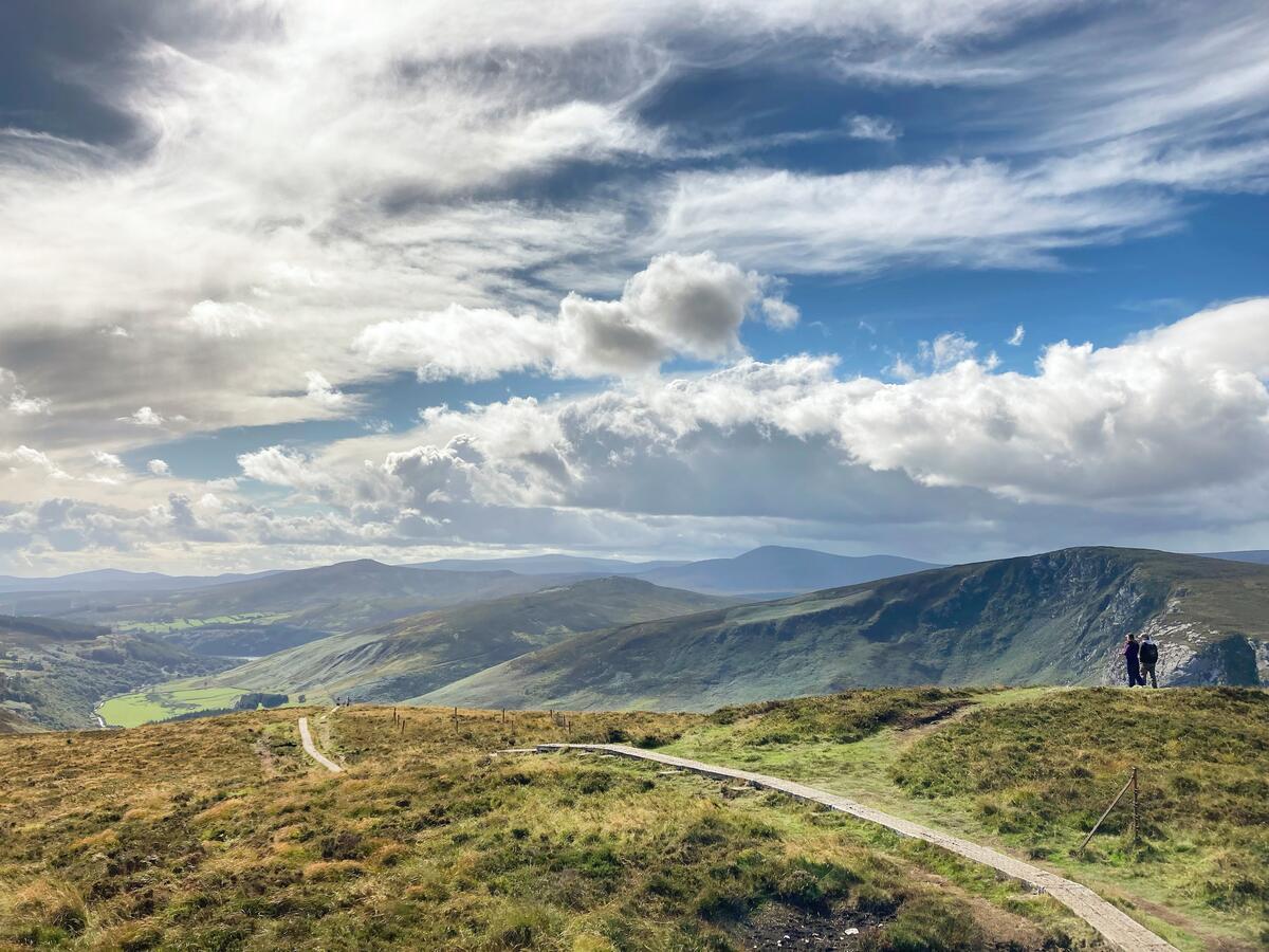
Stoney Top rises to 714 m (2,342 ft) on the central spine of the Wicklow Mountains, sitting just north‑west of the higher Tonelagee summit. Though modest in height, its Vandeleur‑Lynam classification (prominence ≈ 20 m) makes it a recognised peak for hill‑walkers seeking a quieter alternative to the more crowded main summits. The mountain is part of the Dublin/Wicklow range and is mapped at grid reference O082027. Its location offers sweeping views across the “central boggy ridge”, with the heart‑shaped corrie lake Lough Ouler visible to the east and a jagged skyline of Croaghan Kinsella, Crouganmoira, and Camaderry SE Top to the west.
History & Background
Stoney Top derives its name from the stony character of the ridge that links it to Tonelagee. Irish academic Paul Tempan notes a cross‑inscribed standing stone sits between Stoney Top and Tonelagee, hinting at ancient ritual use of the area. Historically the ridge formed part of the St Kevin’s Way, an old pilgrim route that still guides modern walkers from the Wicklow Gap. The summit is listed among the Vandeleur‑Lynam peaks, a classification that requires a minimum prominence of 15 m, confirming its status as a distinct mountain rather than a mere shoulder.
What to See & Do
- Summit Panorama – From the cairn at the top, the ridge line stretches toward Tonelagee, while the distant silhouettes of Mullaghcleevaun, Lugnaquilla, and the glacial valleys of the Wicklow range dominate the horizon. On clear days the lake‑filled valleys of Lough Ouler and Lough Nahanagan are visible.
- Standing Stone – A short detour on the way to Tonelagee passes a cross‑inscribed stone, offering a tangible link to the mountain’s early cultural landscape.
- Wildlife Encounters – Hikers have reported seeing unafraid deer along the St Kevin’s Way section, especially in the early morning hours.
- Ridge Walks – The route continues beyond Stoney Top to Tonelagee, then sweeps south‑easterly over peaks such as Brockagh Mountain and Mullacor, providing a classic Wicklow ridge‑walking experience.
- Photographic Opportunities – The mist‑shrouded ridges and the abstract grey shapes of the surrounding peaks create dramatic compositions, particularly in the soft light of sunrise or late afternoon.
- Camaderry Views – The summit offers a clear line of sight to nearby Camaderry, making it a good spot for comparative peak photography.
Practical Information
Access & Parking – The most common start point is the Annalecka Bridge car‑park, located on the R115 near the Glenmacnass Waterfall. Parking is limited to roughly eight cars, so early arrival is advisable during peak season. From the bridge, a forest track leads north‑west onto the ridge, reaching Stoney Top after a moderate climb.
Route Details – The MountainViews track (ID 3796) describes a 14.4 km round‑trip with an ascent of 659 m and a descent of 599 m. The creator’s recorded time is 5 h 9 min for the ascent and about 4 h for the return, though many walkers complete the loop in under four hours by maintaining a steady pace. A shorter 6.1 km loop (≈ 2 h) is also popular, climbing directly to the summit and returning via the same ridge.
Navigation – The summit’s GPS coordinates are 53.0642659, ‑6.3860392. The recommended topographic map is Discovery Map 56, which covers the central Wicklow range in detail. The route also intersects the historic St Kevin’s Way, useful for orientation if you stray from the main track.
Facilities – There are no visitor facilities on the mountain itself; the nearest amenities are in Laragh (café, shops) and the Glendalough Visitor Centre (≈ 7 km). No tickets are required, and the area is open 24 hours year‑round. Entry is free, as confirmed by the official listing on Evendo.
Safety Notes – While the terrain is generally straightforward, sections of the ridge can be exposed to wind. The standing stone and the ridge’s rocky sections may be slippery when wet. The MountainViews disclaimer reminds walkers to assess their own ability and to respect weather conditions.
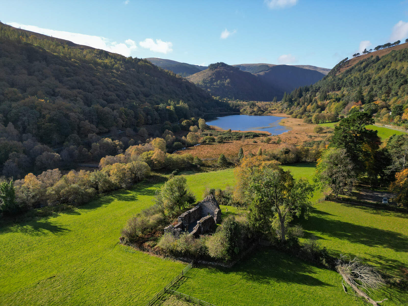
Nearby Attractions – After descending, consider a short drive to Lough Ouler (0.8 km away) for a tranquil lakeside walk, or explore the Glenmacnass Waterfall (≈ 3 km) for a scenic waterfall experience. The historic Glendalough Roundtower and the Vale of Glendalough are also within a short drive, offering cultural depth to your mountain day.
Getting There
- By Car – From Dublin, take the N11 south, exit onto the R755 towards Glendalough, continue to Laragh, then follow signs for Annalecka Bridge. The route is well‑signposted and the drive takes about 1 hour.
- Public Transport – Buses run from Dublin to Wicklow town, with a connection to Laragh. From Laragh, a short taxi ride (≈ 3 km) reaches the trailhead.
- Walking – If you are staying in Laragh, a 3 km walk north along the R755 leads directly to the bridge and the start of the forest track.
Seasonal Considerations – The most popular months for climbing Stoney Top are June (33 %), April (16 %), and February (16 %), according to Peakery data. Snow is rare but possible in winter; the ridge can be icy, so appropriate footwear is recommended.
Map & GPS Resources – The full GPS track is available on MountainViews (track 3796) and can be downloaded for use with handheld devices. Online maps such as Google Maps (search the coordinates) and the Hiiker app also provide route previews.
Enjoy the quiet grandeur of Stoney Top, a summit that rewards the diligent walker with expansive Wicklow vistas, a touch of ancient history, and the satisfaction of reaching a recognised Vandeleur‑Lynam peak without the crowds that flock to the higher neighbours.