Overview
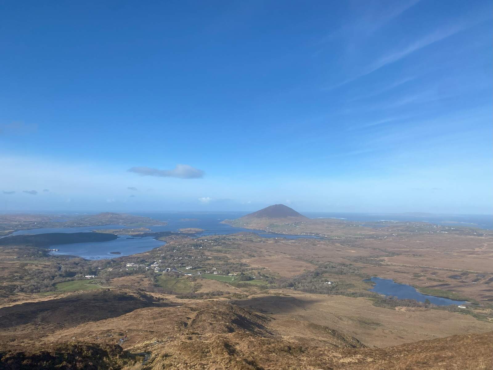
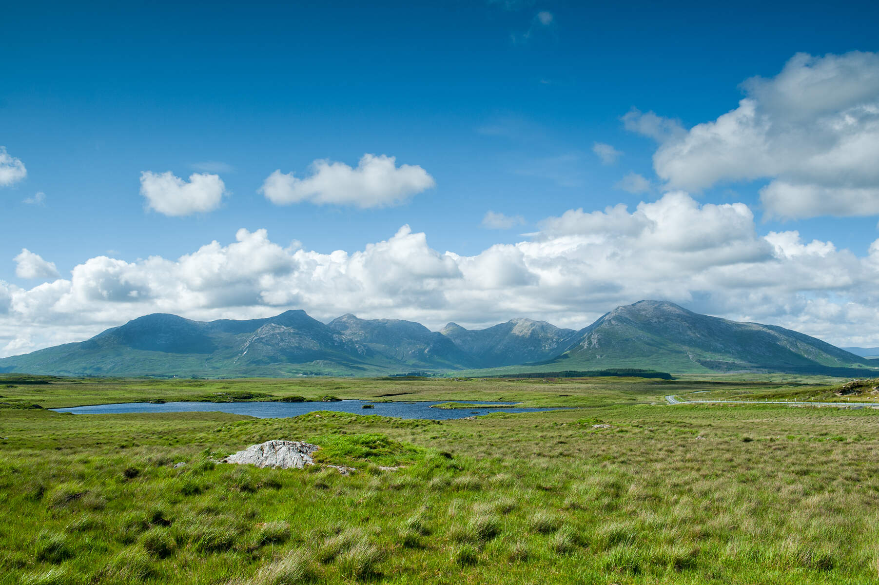
The Twelve Pins (Irish: Na Beanna Beola) dominate the heart of Connemara National Park in western Ireland. Often called the Twelve Bens, the range comprises a core massif of 22 quartzite‑capped peaks, plus the Garraun Complex to the north and a scattering of outliers to the west, giving a total of 38 summits above 100 m. The highest point, Benbaun, reaches 729 m (2 392 ft) and offers panoramic views across the Atlantic coastline, Lough Inagh and the neighbouring Maumturk Mountains. The entire range is designated a Special Area of Conservation (SAC) for its alpine heaths, blanket bogs, rare flora and fauna such as the freshwater pearl mussel, otter and slender naiad.
The landscape is a study in contrast: sharp, weather‑resistant quartzite ridges rise from deep glaciated U‑shaped valleys, while the surrounding lowlands are a patchwork of bog, heath and oak woodland. Geologically the peaks are formed from Precambrian‑Cambrian marine sediments that were metamorphosed into quartzite and schist, with occasional gabbro, mica schist and marble outcrops.
History
The name “Ben” derives from the Irish binn, meaning “peak”. The collective name “Twelve Bens” dates back at least to the 17th‑century historian Ruaidhrí Ó Flaithbheartaigh, who recorded the range as “the twelve high mountaines of Bennabeola”. The Irish term Na Beanna Beola simply means “the peaks of Beola”, a mythic Fir Bolg leader whose name also appears in the nearby village of Toombeola. Because more than twenty peaks bear the Ben or Binn prefix, scholars still debate which twelve were originally meant, but the most commonly cited list includes the ten‑plus summits that exceed 500 m and have a distinct prominence on historic maps.
What to See & Do
Hill‑walking & ridge‑walks
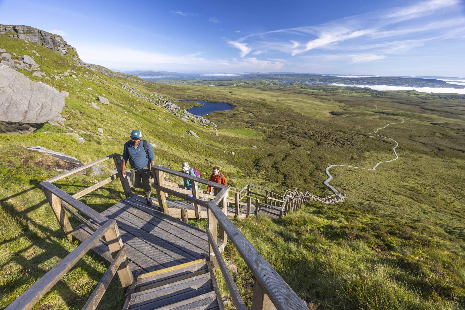
- Glencoaghan Horseshoe – an 8–9 hour, 16 km loop that circles the core massif. It is widely regarded as one of Ireland’s finest ridge walks, offering continuous exposure, dramatic corrie views and the chance to summit Benbaun, Bencorr, Derryclare and several other peaks.
- Owenglin Horseshoe – a longer 19 km, 10–12 hour circuit that adds the western outliers and provides a more remote experience.
- Muckanaght – Benfree – Benbaun Loop – a 5.5 hour, 11 km loop (described on ActiveME) that tackles three classic peaks: Muckanaght (654 m), Benfree (638 m) and Benbaun. The route is moderate‑to‑strenuous and showcases the rugged heart of the range.
- Twelve Bens Challenge – for the truly ambitious, the challenge involves summiting all twelve recognised Bens within a single 24‑hour period.
Rock climbing
The eastern spur of Bencorr in the Gleann Eighneach valley hosts the famed Carrot Ridge (275 m, Diff) and the longer Seventh Heaven (330 m, HS). The large corrie between Derryclare and Bencorr offers multi‑pitch routes such as The Knave (VD, 225 m). Shorter, harder climbs can be found in the smaller corrie of Log an Choire Bhig.
Wildlife & nature
Because the range lies within a SAC, walkers may encounter otters, Atlantic salmon in the Glencoaghan River, and the rare freshwater pearl mussel. Alpine heath and active blanket bogs support a suite of Red Data Book plant species, while the surrounding woodlands still retain remnants of native oak.
Visitor facilities
The Connemara National Park Visitor Centre (wheelchair accessible) provides exhibitions, nature trails and an audio‑visual show on the park’s geology and cultural heritage. In summer, the centre runs guided walks, talks and special events for families and school groups.
Guided walks & tours
Local operators such as Walk Connemara and Climb Connemara run day‑long guided walks, ridge‑walk workshops and mountaineering courses across the Twelve Pins. These guided experiences are a good option for visitors who want expert navigation, safety briefings or a deeper insight into the area’s geology and folklore.
Nearby attractions
If you have extra time, the Abbert River lies a short drive north of the range and offers tranquil fishing spots and a historic abbey ruin. The river valley provides a gentle contrast to the rugged peaks and makes for a pleasant low‑level walk or picnic.
Practical Information
| Item | Details |
|---|---|
| Access | The range is bounded by the N59 (Clifden‑Galway) and the R344. The villages of Letterfrack, Recess and Clifden provide convenient entry points and car‑parking. |
| Parking | Free car parks are available at the trailheads near Lough Inagh and at the Visitor Centre. |
| Admission | Free – the mountains are part of a public national park. |
| Best season | Late spring to early autumn offers the longest daylight; the routes are well‑marked year‑round. |
| Navigation | Detailed OS maps (e.g., OSI Grid Ref. for Benbaun: 1 0 0 0 0) and the ActiveME GPS app are recommended. |
| Safety | While the terrain is generally safe for experienced walkers, some sections involve scrambling and exposure. Carry a map, compass and, where appropriate, a rope for the more technical climbs. |
| Accommodation | Options near the range include The Wilderness (self‑catering home at the foot of the Pins), Roundstone House Hotel (bay views and restaurant), Clifden Campsite & Caravan Park, and Ben Lettery Youth Hostel (backdrop of the Bens). |
Getting there
Travelers can reach Connemara by road from Galway (via the N59) or from the coastal town of Clifden. Public‑transport links include Bus Éireann services to Letterfrack and Recess, though a rental car offers the greatest flexibility for accessing trailheads.
Peak highlights (selected core peaks)
| Irish name | English translation | Height (m) |
|---|---|---|
| Binn Bhán (Benbaun) | White Peak | 729 |
| Binn Chorr (Bencorr) | Pointed Peak | 711 |
| Binn Dubh (Bencollaghduff) | Black Peak | 696 |
| Binn Braoin (Benbreen) | Braon’s Peak | 691 |
| Binn Doire Chláir (Derryclare) | Peak of Derryclare | 677 |
| Binn Gabhar (Bengower) | Goat’s Peak | 664 |
| Muiceanach (Muckanaght) | Hill like a Pig | 654 |
| Binn Fraoigh (Benfree) | Heather Peak | 638 |
| An Chailleach (Bencullagh) | The Hag/Witch | 632 |
| Binn Bhreac (Benbrack) | Speckled Peak | 582 |
These peaks form the backbone of the most popular ridge‑walks and provide numerous photo‑opportunities.
Planning your visit
The Visitor Centre’s wheelchair‑accessible facilities make it an ideal starting point for families and visitors with reduced mobility, though the summit routes themselves require a reasonable level of fitness and sure‑footedness. For those who prefer a guided experience, local operators such as Walk Connemara and Climb Connemara offer day‑long guided walks and mountaineering courses.