Overview
Mangerton (Irish: An Mhangarta, meaning “the long‑haired”) dominates the eastern edge of Killarney National Park at 839 m (2,753 ft), making it the tallest peak in the Mangerton Mountain Group and the 19th‑highest summit in Ireland on the Arderin list. Its broad, bog‑covered summit plateau is punctuated by satellite tops such as Mangerton North Top and Stoompa, while the western slopes lie within the protected confines of Killarney National Park. The mountain is classified as a Marilyn, Arderin, Simm and Hewitt, underscoring its prominence and appeal to hill‑walkers.
The area forms part of Ireland’s oldest national park and a UNESCO Biosphere Reserve, offering a mix of wild‑flower‑filled plateaux, glacial lakes and sweeping views of the Reeks, Kenmare Bay and the Lakes of Killarney.
History
The name Mangerton is thought to derive from the Irish An Mhangarta, possibly translating to “the long‑haired”. An alternative interpretation links the word to mangart – “movement” or “shaking” – a nod to the restless bogs that cloak the southern flanks. The mountain also bears a poignant medieval legacy: on its far‑northern slope lies the Tooreencormick battle site, where in 1262 the forces of the Mac Cárthaigh (Kingdom of Desmond) clashed with the FitzGeralds (Norman). A commemorative stone marks the spot where Cormac MacCarthy Reagh fell, a reminder of the region’s turbulent past. Nearby historic sites such as Aghadoe add further depth to the landscape’s story.
What to See & Do
Devil’s Punchbowl
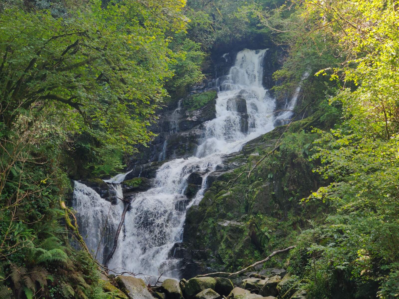
The most celebrated feature is the Devil’s Punchbowl, a deep oval‑shaped corrie on the north‑west face that cradles a tranquil lake at 640 m. Legend tells of a chieftain who punched the Devil, who snapped off the summit and hurled the lake into the valley – a colourful tale that also appears in a variant linking the lake to the Rock of Cashel. From the Punchbowl you can watch water drain into the Owengarriff River and eventually feed the iconic Torc Waterfall.
Glacial Lakes & Wildlife
Beyond the Punchbowl, three glacial lakes spill from the corries into the Horses’ Glen (Glencappul): Lough Garagarry, Lough Mannagh and the hanging Lough Erhogh. Red deer and sika roam the extensive southern plateau, while ravens and kestrels are regular high‑altitude visitors. In summer the plateau bursts with alpine flora such as butterwort (Bog Violet) and other rare wild‑flowers noted by early botanists.
Alternative Loop Routes
The classic ascent from the Upper Torc car park is a 10 km (6.2 mi) loop taking 4–5 hours (≈682 m ascent). For those seeking a longer challenge, the 13.7 km Mangerton Circular Trail (≈979 m gain) follows a wider ridge, passes the same Devil’s Punchbowl and returns via a different descent, typically completed in about 4 h 22 min. Both routes are well‑marked but can become boggy after rain.
Guided Walks & Festivals
The trail forms part of the Killarney Walking Festival each summer, so occasional festival signage appears on the path. Local operators such as Roam Wild run guided hikes (≈€65 per person, minimum two participants) that include a briefing on the mountain’s geology, folklore and wildlife. Guided groups do not allow dogs, although dogs are permitted on the self‑guided routes if kept on a leash.
Summit Views
The summit rewards climbers with sweeping panoramas: the jagged peaks of the MacGillycuddy’s Reeks dominate the horizon, the rolling expanse of Killarney National Park spreads to the west, and on clear days the sea‑kissed coastline of Kenmare Bay is visible to the southwest. Photographers cherish the ever‑changing light on the corrie walls.
Getting There
The most popular ascent begins at the Upper Torc car park, a small free car park off the N71 Killarney‑Kenmare road, about 10 minutes from Killarney town. The trailhead is marked by a concrete slab bridge (grid reference V98034 80782). Directions from Killarney: follow the N71 towards Kenmare, turn left at the first sign for Muckross, then take the right‑hand turn for the Mangerton car park; the trackhead is visible from the road.
There is no direct public‑transport service to the car park; a taxi from Killarney or a private vehicle is the usual option. For those without a car, the nearest bus stop is in Killarney town centre, with regular services to Kenmare; from there a taxi can be hired to the trailhead.
Dogs
Dogs are welcome on the mountain but should be kept on a leash to protect both the animal and the local wildlife. Strong winds and sudden rain are common at altitude, so ensure your dog is suitably equipped and bring enough water for both of you. Dogs are not permitted on guided Roam Wild tours.
Weather & Safety
Conditions can change rapidly. Mist can roll in quickly, reducing visibility on the plateau, and winter winds can be severe. Hikers should carry a waterproof jacket, sturdy boots, a map and compass (or a GPS device) and check the forecast before setting out. The trail is not technical, but the length and exposure make it a moderate‑to‑challenging walk for those with reasonable fitness.
Maps & Apps
The Ordnance Survey Ireland (OSI) map sheet EW‑KNP covers the area. Popular navigation apps such as AllTrails, ViewRanger and the ActiveME app provide downloadable GPX tracks and offline maps – useful where mobile signal is weak.
Flora & Fauna
The plateau’s bogs are home to a variety of alpine plants, including butterwort (Bog Violet) and other wild‑flower species noted by early botanists. The geology consists of green sandstone and purple siltstone (Glenflesk Chloritic Sandstone Formation), giving the cliffs their distinctive colouration. Red deer, sika deer, ravens and kestrels are frequently seen, especially in the early morning.
Practical Information
| Item | Details |
|---|---|
| Height | 839 m (2,753 ft) |
| Elevation gain | ~682 m (classic loop) / ~979 m (circular trail) |
| Distance | 10 km (classic loop) – 13.7 km (circular trail) |
| Estimated time | 4–5 hours (classic) – 4 h 22 min (circular) |
| Starting point | Upper Torc car park / concrete slab bridge |
| Parking | Free (subject to verification) |
| Admission | Free |
| Difficulty | Moderate to challenging |
| Guided tours | Available (≈€65 per person, minimum 2) – dogs not allowed |
| Best season | Late spring to early autumn for wild‑flowers and clearer weather |
The route is well‑marked with a worn track, though the summit plateau can be featureless in mist, so a map or GPS device is advisable. Mangerton’s proximity to Killarney (≈5 km) means that supplies, accommodation and transport links are readily available.
Nearby Attractions
While you’re in the area, consider a short drive to the historic Aghadoe, the stunning Torc Waterfall, or a stroll around the lakes of Killarney National Park. Other worthwhile Kerry destinations within easy reach include Ballybunion, the Black Valley and the Ring of Kerry coastal drive.