Overview
The Devil’s Punch Bowl (often simply called the Punchbowl) is a striking glacial lake set in a deep corrie on the southern slopes of Mangerton Mountain, just outside Killarney in County Kerry. The lake sits at roughly 650 m a.s.l., surrounded by sheer cliffs that frame a crystal‑blue pool reflecting the surrounding peaks – from the MacGillycuddy’s Reeks to the distant Kenmare Bay on a clear day. It is a favourite stop for walkers tackling the Mangerton summit loop, and it can also be enjoyed as a standalone half‑day hike.
History & Legend
Local folklore tells a colourful tale of chieftain O’Donoghue Ross who, after a dinner with the Devil, punched the fiend in the face. In retaliation the Devil snapped off the summit of Mangerton, hurling the chunk that became the Punchbowl lake. Some versions add that the Devil’s missed stone landed in Cashel, forming the famous Rock of Cashel. While the story is mythic, the lake itself is a genuine Ice‑Age relic – a classic example of a corrie (or coom) carved by glacial erosion.
Name Origins
An alternative explanation for the name comes from the Irish Poll an Ifrinn meaning “hole of Hell”. This linguistic root predates the chieftain legend and is recorded in older maps of the area. Both the mythic and linguistic origins contribute to the lake’s eerie reputation.
What to See & Do
- The lake itself – Deep, almost turquoise water framed by sheer rock walls that drop dramatically into the basin. Photographers love the contrast of blue water against the green of the surrounding hills.
- Panoramic vistas – From the rim you can spot Dursey Island, Castlecove, the three Lakes of Killarney, Muckross House, Ross Castle, and on exceptionally clear days the Dingle Peninsula and the Reeks.
- Wildlife – Red deer, mountain hares and occasional peregrine falcons are regular sightings on the higher slopes.
- Extended walks – The Punchbowl sits on the popular Mangerton summit loop (≈10 km, 4–5 h). The route also passes the Horses Glen, Lough Erhogh, and the historic Tooreencormick Battle Field site.
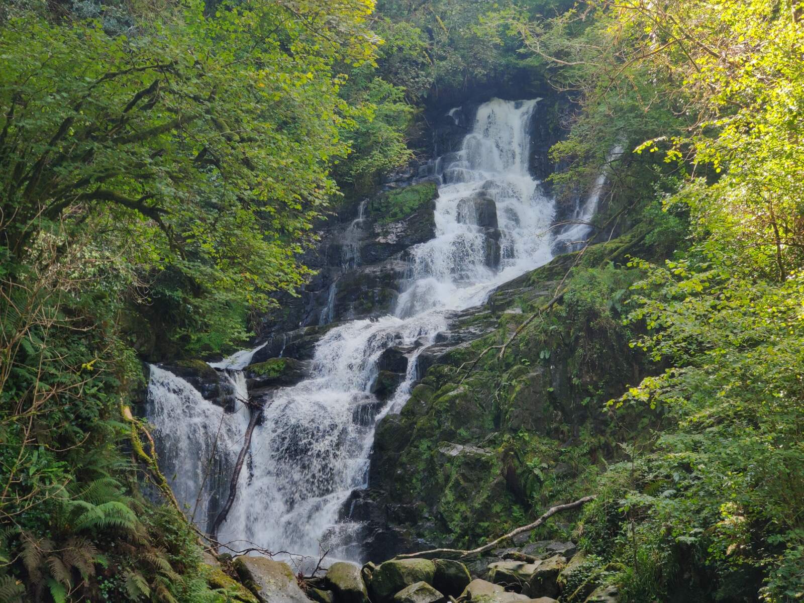
- Source of the Owengarriff River – The lake feeds the Owengarriff River, which cascades over Torc Mountain to create the spectacular Torc Waterfall.
Flora & Fauna
The upland heath around the Punchbowl supports heather, bilberry and dwarf willow. In spring you may spot alpine lady‑fern on the damp scree. Birdwatchers can look for ravens, meadow pipits and, when the weather is calm, the occasional golden eagle soaring above the Reeks.
Dog Friendly
Dogs are welcome on the Mangerton routes. Keep them on a leash to protect ground‑nesting birds and to avoid disturbing the resident red deer. Bring enough water – the mountain streams are often cold and fast‑flowing.
Seasonal Tips
- Early morning or late evening provides the best light for photography and fewer walkers.
- Mist and cloud can turn the lake into an otherworldly mirror; a misty day is perfect for the legend‑filled atmosphere.
- Winter brings snow on the higher sections and stronger winds; sturdy boots and warm layers are essential.
Getting There – Car, Public Transport & Parking
From Killarney take the N71 (Muckross Road) westward and turn left at Molly Darcy’s Pub. The trailhead is sign‑posted just beyond a small concrete bridge. A modest roadside car park sits beside the bridge; parking is free but can fill quickly on busy days.
There is no direct public bus to the trailhead. The most reliable option without a car is a taxi from Killarney (≈15 min). Some visitors also park in the nearby village of Ferta and walk the short 3 km approach road.
The Walk
The ascent begins on a wet, boggy section that can be slippery in winter or after rain; the trail soon climbs alongside the Finoulagh River, gaining altitude steadily to the 650 m contour where the Punchbowl opens into view. After a short rest, the path continues around the north‑east side of the lake, offering successive viewpoints of the surrounding peaks. The final stretch to the Mangerton summit cairn is a gentle ridge walk; from the cairn you can see the full sweep of Killarney National Park.
Practical Information
| Item | Details |
|---|---|
| Opening hours | Open daily, no gate |
| Admission fee | Free of charge |
| Typical route length | 9.5–10 km (loop) |
| Estimated walking time | 3–5 hours (ascent 1.5 h, descent 1.5 h) |
| Elevation gain | ~800 m |
| Difficulty | Moderate – steady climb, some boggy sections |
| Parking | Free roadside parking at the concrete bridge (Molly Darcy’s Pub turn‑off) |
| Public transport | No direct bus; taxi from Killarney or Kenmare recommended |
| Nearest town | Killarney (5 km) |
| GPS coordinates | 52.00682, -9.4803599 (verify) |
Safety Notes
- The first few hundred metres are notoriously boggy; watch your footing.
- Weather can change rapidly – strong winds are common near the summit, especially in winter.
- The descent is where most accidents occur on Irish mountains – keep a steady pace and use any handrails where available.
- The route can be busy on Sundays; start early to avoid crowds.
- For detailed navigation, consult the official Ordnance Survey Ireland Discovery Series sheet 78 or use the ActiveME app’s GPX tracks.
Events & Festivals
The Punchbowl walk is featured in the annual Killarney Walking Festival (www.killarneywalkingfestival.ie), which offers guided walks and talks about the mountain’s geology and folklore.
Resources & Further Reading
- Irish Times walk guide: Take a hearty sup from the Devil’s Punchbowl
- ActiveME route description (includes downloadable GPX): Mangerton Mountain Walking Route
- Hiiker trail listing (maps & user reviews): Devil’s Punchbowl Loop
- Go‑to‑Ireland practical page (hours & fees): Devil’s Punch Bowl
Enjoy the blend of myth, geology and unrivalled Kerry scenery that makes the Devil’s Punch Bowl a highlight on any Killarney adventure.