Overview
The River Greese (sometimes spelled Griese) is a modest but lively river in south‑east Ireland, ultimately joining the River Barrow. Though only about 35 km (22 mi) long, its course cuts a striking line through a patchwork of counties – rising near Dunlavin in County Wicklow at a place called Tober (≈146 m a.s.l.), skirting the Kildare border, and finally slipping into County Carlow before meeting the Barrow at the townland of Jerusalem. Its basin covers roughly 72 km² (28 sq mi) and the Irish name is An Ghrís.
Geography & Course
- Source: Tober, near Dunlavin, Co. Wicklow (≈146 m a.s.l.)
- Length: ~35 km (22 mi)
- Basin size: ~72 km² (28 sq mi)
- Irish name: An Ghrís
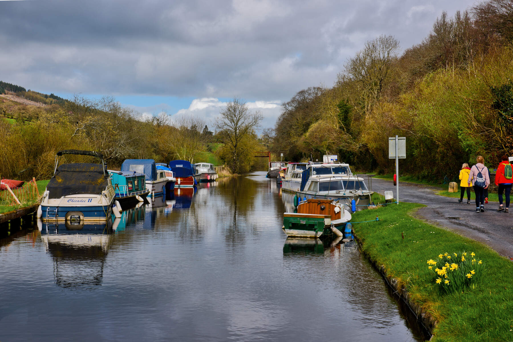
- Course highlights: rises in Wicklow, forms part of the Kildare‑Wicklow border, passes under the R448 at Moyleabbey, the R415, flows through the historic Quaker village of Ballitore, under the M9, through the Kilkea Castle Golf Club estate and finally joins the Barrow at Jerusalem townland.
History & Background
The name “Greese” is rooted in medieval ecclesiastical records. An early 13th‑century register of the Archbishops of Dublin records a capella de Gris at Killeen Cormac – the “Gris Chapel” – from which the river derives its modern spelling. Over the centuries the river has appeared in a variety of forms – rivulus de Grys in a 1533 report, River Greeces on Jacob Nevill’s 1760 map – before the spelling settled on the present‑day Greese.
Legends and Archaeology at Killeen Cormac
Killeen Cormac is an early Christian burial site set beside the Greese. The mound is a gravel esker formed by the river in antiquity and is surrounded by a complex of stone monuments: seven Ogham stones, seven pillar stones, two cross‑slabs and later gravestones. One pillar bears a hound‑paw mark linked to a local legend that King Cormac of Munster was buried here after his funeral procession was forced to cross the Greese; a hound is said to have leapt the river and marked the spot.
Further research shows the site’s name may derive from Cell Fine Cormaic (the church of Cormac’s daughters) or Cell Ingen Cormaic (the church of the daughters of Cormac). 19th‑century landlord records note a dry‑stone wall that was later rebuilt. The rare Drunides Stone bears a bilingual Ogham‑Latin inscription “IV VERE DRVVIDE” – “Four True Druids”.
A colourful version of the legend tells of a bull‑ock team hauling Cormac’s body; when the cattle grew thirsty at “Bullock Hill” a spring burst forth, allowing them to continue. After crossing the Greese the bullocks were swept away, sealing the king’s final resting place. The site is open to the public but has no visitor facilities.
Myth & Legend
Irish river lore often treats waterways as thresholds to the Otherworld. While the Greese does not have a named deity, its association with the burial of a Munster king and the hound‑paw stone reflects the Celtic tradition of rivers as sacred boundaries.
Nature & Wildlife
The Greese supports a healthy range of aquatic life. In addition to the brown trout that make it a favourite angling spot, the river hosts stone loach, Atlantic salmon, European eel, three‑spined stickleback and European river lamprey. The clear, fast‑flowing water creates deep pools that are ideal for both trout and salmon. Aquatic plants line the banks, providing habitat for insect hatches that sustain the fish.
| Species | Typical Size | Notable Spot |
|---|---|---|
| Brown trout | 0.5–2 kg | Ballitore stretch |
| Atlantic salmon | Up to 5 kg | Near Kilkea Castle |
| European eel | 0.3–1 kg | Lower reaches |
Anglers must hold a valid Irish fishing licence, obtainable from Inland Fisheries Ireland. Check the current season dates on the IFI website before you go.
Angling Tips & Recent Reports
Fly‑fishers prize the Greese for its crystal‑clear water and productive hatches. The river’s iron‑blue dun hatch in April‑May creates a chalk‑stream‑like surface, while black gnats dominate June‑July. Autumn can bring salmon runs and parr, especially near Kilkea Castle, and night‑time rises are reported when sedge growth is at its peak.
A 2009 post on the Irish Flyfisher’s blog described a day on the Ballitore stretch: the water was “as clear as the chalk streams of southern England”, iron‑blue duns were rising, black gnats were abundant, and a salmon parr was hooked. The author highlighted a deep weir pool as a reliable spot and suggested trying a night‑rise when the sedges are full. Another recent angler’s note mentions that the river’s fast flow and deep pools make it challenging yet rewarding for both trout and salmon.
Angling Club & Permits
The River Greese is managed by the River Greese Trout and Salmon Anglers Association. Day permits can be bought locally at the Moone Supermarket, the Sportsman Inn in Timolin, or the Shaker Store in Ballitore. For fishing on the Kilkea Castle estate, a licensed ghillie must accompany you and a separate estate permit is required.
Golf & Landscape
One of the river’s most striking modern roles is as a natural hazard on the Kilkea Castle Golf Club course. The 18‑hole parkland championship layout weaves the Greese through several fairways, demanding precise shot‑making from golfers. The water’s meanders are especially prominent around the 9th hole, where the clubhouse windows frame occasional glimpses of the 12th‑century Kilkea Castle.
Kilkea Castle Estate – Lodging & Activities
Beyond golf, the estate offers a range of pursuits set against the river’s backdrop:
- Kilkea Castle Lodges – three‑bedroom luxury lodges adjoining the clubhouse and the Octagon restaurant. They provide modern amenities, Wi‑Fi and private parking.
- Dining – Jays Bistro (Mon‑Fri 09:00‑21:00, Sat‑Sun 08:00‑21:00) and The Octagon (Fri 17:00‑23:00, Sat 13:00‑21:30).
- Equestrian, archery and falconry experiences are available for guests, showcasing Kildare’s “Thoroughbred County” heritage.
- Guided fishing trips with estate ghillies (permit required) – the river is described as a “small but fast‑flowing river with plenty of deep pools”.
- Walking – the 180‑acre Mullaghreelan Wood offers two overlapping 2 km walks through mixed oak, ash and holly, with spring bluebells and a network of connecting paths.
Heritage Walks
The river’s banks are dotted with points of interest. A short walk from the R415 crossing takes you to the historic Kilkea Castle, a 12th‑century stronghold now operating as a luxury hotel and event venue. The castle’s gardens hug the river, and the water’s gentle rush can be heard from the terrace. Further downstream, the old High Cross of Moone and a domed christening well lie within easy walking distance, providing a glimpse into the spiritual life of the surrounding communities.
Walking & Cycling
The Greese corridor offers several pleasant routes. The estate’s Mullaghreelan Wood features two overlapping 2 km walks through mixed oak, ash and holly, with spring bluebells and a network of connecting paths. The Barrow Way long‑distance trail follows the River Barrow and passes the Greese’s confluence at Jerusalem townland, making it easy to incorporate a short side‑loop along the Greese into a longer hike or bike ride.
Accommodation & Base‑camps
For those wishing to stay close to the river, Greese View House offers a family‑run, relaxed base just off the N9. The property sits on former Aldborough estate grounds, with spacious gardens that open onto the river’s edge. Guests can enjoy on‑site fishing, and the house’s proximity to both the golf club and historic sites makes it an ideal hub for exploring the Greese corridor.
Kilkea Castle also provides upscale lodging. The newly renovated Kilkea Castle Lodges sit beside the club house and the Octagon restaurant, giving guests direct access to the river, the golf course and estate‑wide walking trails such as Mullaghreelan Wood.
Nearby Attractions
The River Greese lies within Ireland’s Ancient East, a short drive from several notable sites:
- Irish National Stud – world‑renowned thoroughbred breeding centre (link)
- Curragh Military Museum – military history displays in the heart of the Curragh plains (link)
- Athy – historic market town on the Barrow, with heritage centre and riverside walks (link)
- Barrow Way – long‑distance trail that follows the Barrow and connects with the Greese’s lower reaches.
- Carbury – village and historic hill with castle ruins, a short drive north of the Greese (see Carbury).
Practical Information
The River Greese is freely accessible along most of its length; there are no entry fees or formal opening hours. Parking is available at several points, notably:
- Kilkea Castle Golf Club car park
- Public lay‑by at the R415 bridge near Ballitore
- Lay‑by at the R448 crossing at Moyleabbey
The river is crossed by the M9 motorway, the R448 and R415 roads, making it easy to reach by car from Dublin (≈1 hour) or from the nearby towns of Carlow and Athy. The nearest train station is Carlow, on the Dublin–Waterford line, about 10 km north of the Greese’s lower reaches. Regular Bus Éireann services run to Carlow and Athy; local taxis can reach the river’s key access points.
Angling requires a valid Irish fishing licence; local tackle shops in Carlow and Kildare sell day permits. The Kilkea Castle Golf Club welcomes visitors for a round of golf, a meal, or simply to admire the river’s role in the course design – bookings can be made through the club’s website.
For heritage enthusiasts, the Killeen Cormac site is publicly viewable, though there are no visitor facilities on site. The High Cross of Moone and the christening well are located within the village of Moone, a short drive from the river’s lower reaches.
Getting There
- By Car: Take the M9 southbound, exit at the Kilkea/Kilcullen junction, then follow the R415 to the river’s crossing points.
- By Public Transport: Regular Bus Éireann services run to Carlow and Athy; from there, local taxis can reach the river’s key access points. The nearest train station is Carlow.
Seasonal Notes
The river’s flow is strongest in the winter months, offering excellent conditions for experienced anglers seeking larger salmon runs. Summer brings calmer waters, ideal for family picnics along the banks or a relaxed round of golf with the river’s gentle backdrop.
All information is drawn from publicly available sources as of 2026. Visitors are encouraged to verify any specific activity requirements (such as fishing licences or seasonal dates) before arrival.