Overview
Lough Navar Forest is a jewel of the Marble Arch Caves UNESCO Global Geopark, covering roughly 2,600 ha of blanket bog, heath, open water, native oak‑ash woodland and extensive Sitka‑spruce plantations. The forest lies about 5 km north‑west of the village of Derrygonnelly (postal code BT93 6AQ) and is accessed via the main car park on Glennasheever Road (BT93 3BW). A 10 km (7‑mile) scenic, mostly single‑track drive winds through the site, punctuated by several designated viewpoints, picnic areas and interpretive panels that explain the geology, flora and fauna of this trans‑border landscape.
The forest forms part of a larger continuous woodland block that includes Carrigan, Big Dog, Conagher and Ballintempo forests, together creating the largest forested area in Northern Ireland (over 8,500 ha). Whether you are a walker, angler, bird‑watcher or simply a lover of dramatic scenery, Lough Navar offers a compact yet varied outdoor experience.
History & Heritage
Human activity in the Lough Navar area stretches back to the Late Bronze Age. From the Carrick Lough Viewpoint you can see the remains of an ancient crannog – a timber‑built island farmstead that likely served both domestic and defensive purposes during the Bronze Age and early Christian periods. The name derives from the Irish crann (tree), reflecting the wooden foundations of the structure.
The landscape also records the legacy of the last glaciation. Drumlin hills, limestone outcrops and the spectacular Magho Cliffs (a 5.5 mi limestone escarpment) dominate the southern edge of the forest. The Old Man’s Head, a sandstone outcrop shaped by wind and rain, supports a specialised upland flora and attracts butterflies such as the red admiral, speckled wood and peacock.
War History & Memorials
Near the Magho Viewpoint car park stand two memorial tablets commemorating aircrew who lost their lives over Lough Erne during World War II. One marks the crash of a Sunderland aircraft of 201 Squadron (November 1943) and the other a Catalina (November 1944). The tablets honour the crew members of both crashes, linking the forest to the wartime history of nearby Castle Archdale and Killadeas air‑bases. These quiet memorials are a poignant reminder of the area’s role in the aerial war effort.
Geology & Landscape
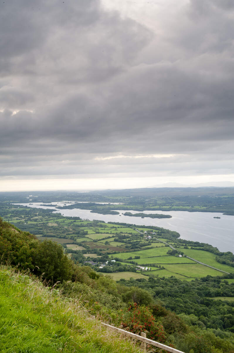
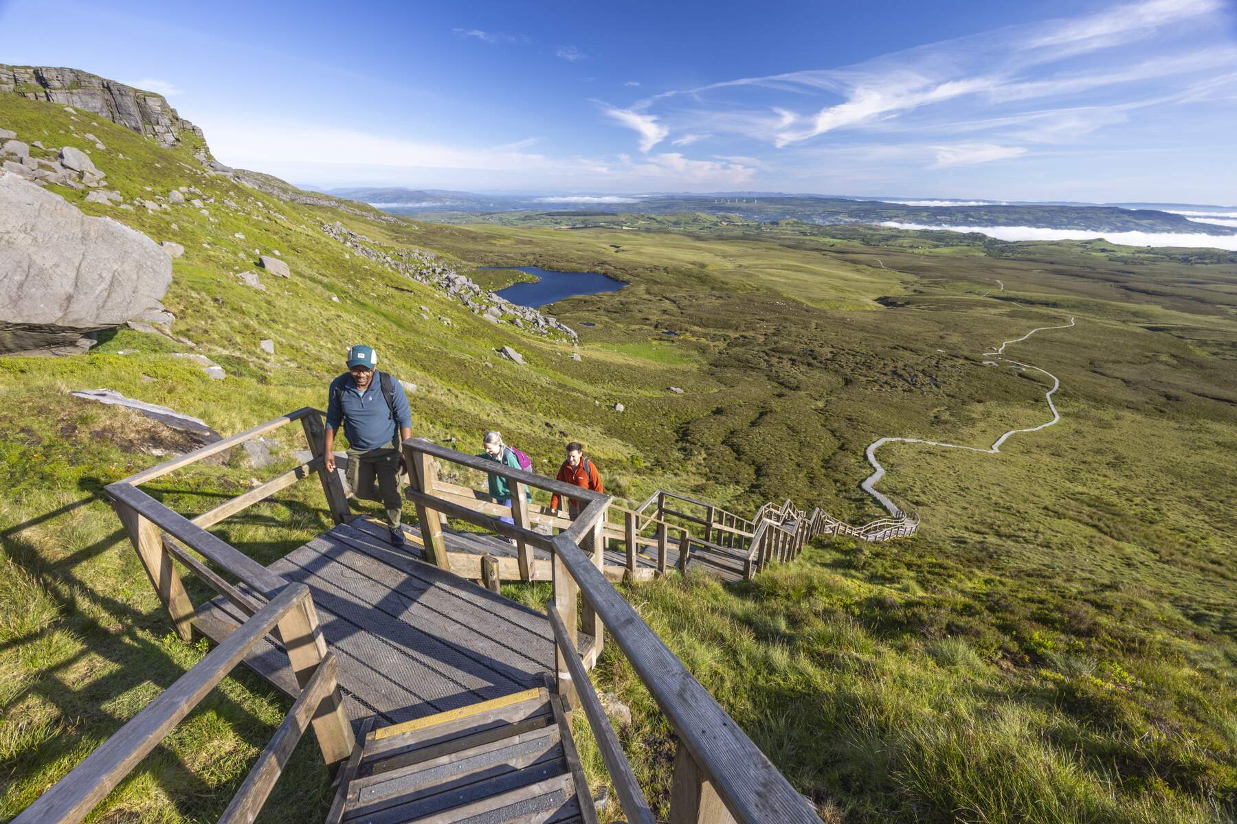
Lough Navar sits atop a Carboniferous limestone plateau that has been sculpted by successive glacial advances and melt‑water erosion. The resulting drumlin field and the sheer limestone cliffs of Magho provide classic examples of post‑glacial geomorphology celebrated by the UNESCO Global Geopark. The cliffs rise to about 300 m, offering panoramic views across Lower Lough Erne, Donegal Bay, the Blue Stack and Sperrin Mountains. The area is designated an Area of Special Scientific Interest (ASSI) because of its rare orchid species – the bird’s‑nest orchid and early‑purple orchid – and its diverse upland plant community.
What to See & Do
Viewpoints
- Carrick Lough Viewpoint – a short walk from the car park leads to a platform overlooking Carrick Lough and the crannog remains.
- Aghameelan Viewpoint – offers sweeping panoramas across County Fermanagh, County Cavan and the limestone‑capped Knockmore cliffs.
- Magho Cliffs Viewpoint – perched 300 m above Lower Lough Erne, this spot provides one of the most dramatic vistas on the island, extending to counties Sligo, Tyrone, Donegal and even the Wild Atlantic Way.
Walking Trails
| Trail | Distance | Approx. Time | Ascent | Grade | Wheelchair accessible |
|---|---|---|---|---|---|
| Blackslee Waterfall Walk | 2.5 mi / 4.5 km | ½ hour | 60 m | Moderate | No |
| Lough Achork Walk | 1.5 mi / 2.5 km | 30 min | – | Moderate | No |
| Lakes Walk | 7 mi / 11 km | 1 h 30 min | – | Moderate | No |
| Magho Cliffs Walk | 1.5 mi / 2.5 km | 45 min | – | Difficult | No |
| Whiterocks Trail | 0.5 mi / 0.8 km | 15 min | – | Easy | No |
| Lough Slawn Trail | 0.5 mi / 0.8 km | 15 min | – | Easy | No |
Blackslee Waterfall Walk takes you deep into the conifer‑dominated Blackslee Forest, where a small sandstone waterfall tumbles over rock. The route passes open glades scented with wood sorrel, wild garlic and spring‑time bluebells, and offers good chances to spot red deer, foxes and a variety of birdlife.
Lough Achork Walk circles a tranquil lake that feeds the Sillees River. The lake’s sheltered fringe supports otters, ducks, swans and a healthy brown‑trout fishery (angling permits required). Along the route you will find 3‑D information panels, a forest‑bathing spot and interpretive signs that recount the legend of St Faber.
Lakes Walk is the longest circuit, linking Lough Meenameen, Lough Navar and the raised‑bog Lough Naman (an Area of Special Scientific Interest). Here you can glimpse sundews, bog cotton and a host of sedges, while occasional sightings of red deer and wild goats add excitement.
Magho Cliffs Walk is a linear, challenging trek that climbs the 300 m limestone escarpment. The summit offers a bird’s‑eye view across Lower Lough Erne and far beyond, making it a favourite of photographers and painters. The cliff is an ASSI, supporting rare orchids such as the bird’s‑nest orchid and early‑purple orchid.
Whiterocks and Lough Slawn Trails are short, family‑friendly loops that start from the Magho Viewpoint car park. Both provide superb views of Lower Lough Erne and the surrounding hills of west Fermanagh and Leitrim.
Correl Glen Nature Trail – located on the opposite side of the road from the forest entrance – runs through part of the extensive Largalinny National Nature Reserve. The reserve hosts rare plants and almost all native Irish butterfly species, making it a prime spot for lepidopterists.
Cycling & Outdoor Activities
The forest’s wide, low‑gradient roads are popular with cyclists. Both casual riders and mountain‑bike enthusiasts can enjoy the 7‑mile Forest Drive or venture onto the more technical forest tracks that link to the Ulster Way, a long‑distance walking and cycling route that reaches a height of 735 ft within the forest.
Fishing & Wildlife
Both Lough Achork and Lough Meenameen are stocked with brown trout and are open to anglers holding a valid permit (available from the visitor centre or local angling clubs). The mixed habitats support red deer, red squirrels, a variety of waders and raptors, and in summer a carpet of bluebells and wild garlic. Birdwatchers can look out for buzzards, sparrowhawks, crossbills and the occasional golden eagle.
Visitor Experience & Amenities
The main car park on Glennasheever Road provides level access and accessible toilets, and the visitor centre offers maps, guidebooks and a small reading area that includes information about St Faber and the local folklore. Throughout the forest you will find interpretive panels, 3‑D information displays and an interactive scavenger‑hunt that encourages families to explore the geology and biodiversity of the area.
A short walk off the main path at the forest entrance leads to a sweat house – a stone‑room once used to ease rheumatism by heating stones and placing rushes on top, an early form of sauna. The site is sign‑posted and explained on an interpretive panel near the exit of the Forest Drive.
The forest‑bathing area near Lough Achork offers a quiet spot to sit, listen to the sounds of water and birds, and enjoy the therapeutic benefits of the woodland atmosphere.
Seasonal Highlights & Events
- Butterfly season (late spring to early summer) – the upland flora around Old Man’s Head attracts red admiral, speckled wood and peacock butterflies.
- Bluebell carpet (April–May) – the forest floor in the lower tracks is blanketed with native bluebells, a favourite photo‑op for families.
- Historic Sweat House – near the exit of the Forest Drive a sign‑posted ‘sweat house’ recalls a traditional stone‑room once used to ease rheumatism; a short interpretive panel explains its history.
- Guided walks – school groups and larger parties can arrange guided walks through the Geopark’s education team; teacher and student information sheets are downloadable from the Geopark website.
Practical Information
- Opening hours: Daily 10:00 am until sunset.
- Admission: Free (parking charges may apply at the main car park – spaces are limited during peak season).
- Facilities: Visitor centre with maps and guides, picnic area, public toilets (available at the Magho Cliffs car park), and marked way‑markers (black arrows on a white background) throughout the network of trails.
- Parking: Main car park on Glennasheever Road (BT93 3BW) – free, with limited spaces during peak season.
- Getting there: From Enniskillen take the A46 to Derrygonnelly, then follow signs for the “Forest Drive”. The site is also reachable via the B81 from Derrygonnelly. Public transport is limited; most visitors arrive by car. Nearest airports are Belfast International and City of Derry.
- Safety: Some sections, particularly around the waterfall and the Magho Cliffs, can be damp or steep. Follow all safety signage and be aware of temporary diversions for forestry work.
- Dog policy: Dogs are permitted but must be kept under control and waste disposed of in provided bins.
- Fishing permits: Required for angling on Lough Achork and Lough Meenameen; permits can be purchased at the visitor centre or from local angling clubs.
- Accessibility: The main car park and visitor centre have level access and accessible toilets. Walking trails are not wheelchair‑accessible.
- Guided experiences: School groups and larger parties can arrange guided walks through the Geopark’s education team; teacher and student information sheets are downloadable from the Geopark website.
Nearby Attractions
- Ballintempo Forest – adjoining forest with the Aghanaglack Dual Court Tomb walk.
- Belmore Forest – another extensive woodland area offering additional trails and wildlife spotting opportunities.
- Cliffs of Magho – the dramatic limestone escarpment that forms the southern edge of the forest.
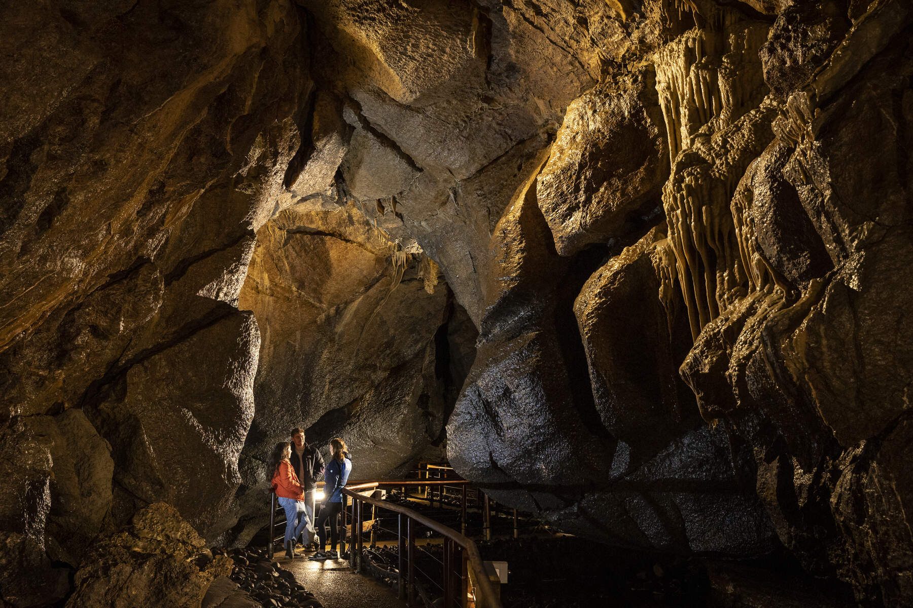
- Marble Arch Caves – world‑renowned showcaves just a short drive away.